Disclosure: This content may contain affiliate links. Read my disclosure policy.
This route follows the woods roads up Friday to the rim trail. This is the most pleasant and interesting route.
Trailhead info at bottom of this post.
Hiking Trail Description
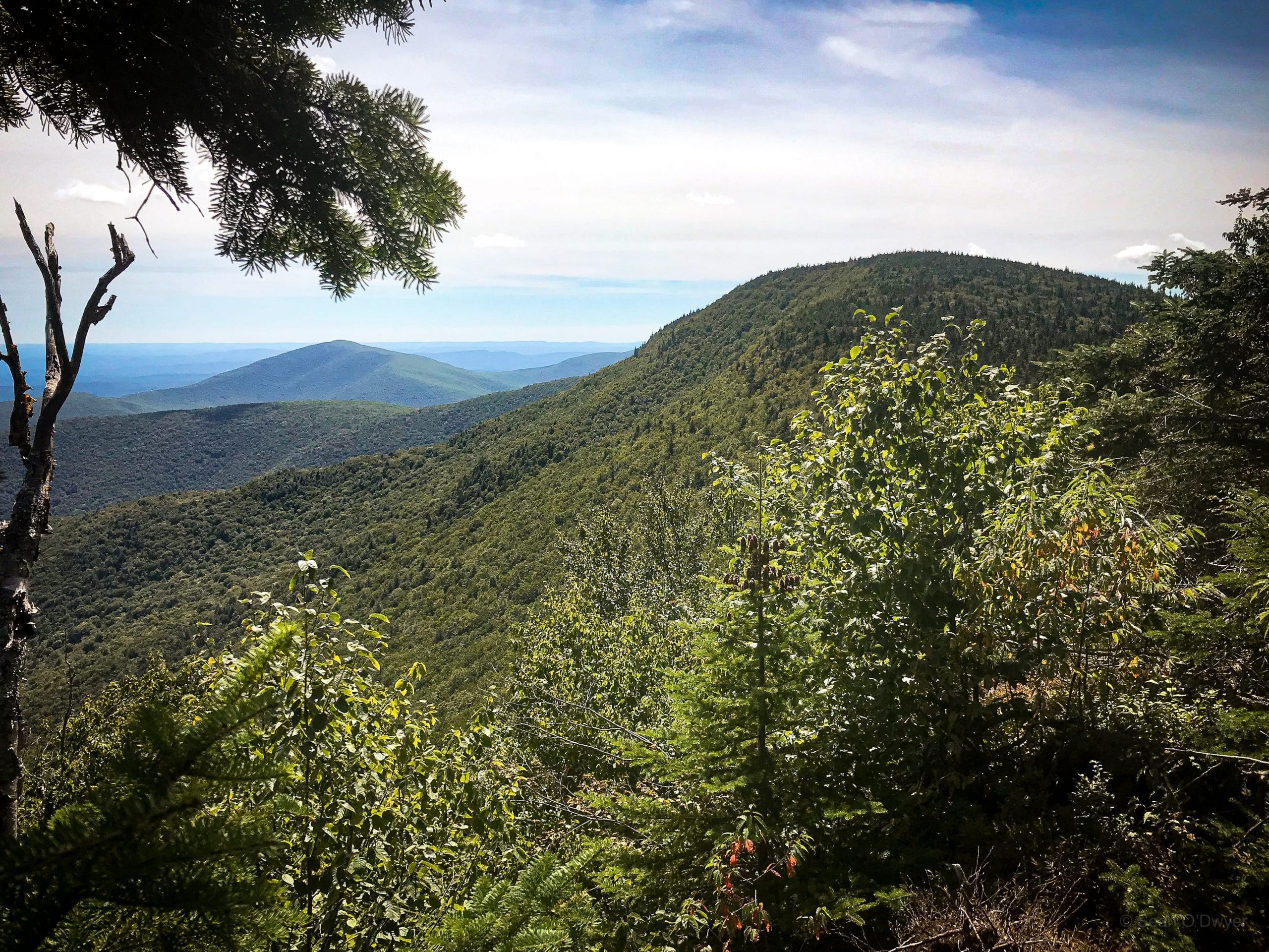
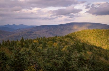
If you want a long, rewarding untrailed hike, this is it: some of the toughest miles you can do in the Catskills. This track shows my preferred route up Friday Mountain.
Bushwhack Description
Take a minute to review the main Friday Mountain page which describes the two main approaches: straight up the ridge-line or via the woods roads route. On this day, I was accompanying a small group of Friday first-timers who wanted to be with someone who knew the way. After discussing the pros and cons of each route, we chose the latter which is an easier and far more interesting ascent.
There are old woods roads all over Friday—and all over the Catskills—remnants of the logging and tanning industry from the 1800’s. These roads split and branch regularly; some are in better shape than others. After hiking up away from the parking area, use your GPS/Avenza/NYNJTC trail map, or an AllTrails track, to guide you to the first major turn uphill. Basically: keep to your left.
Our group was chatting and getting to know one another and we missed this first turn. You can see at the beginning of the Gaia track how we veered over the public boundary into private property, and had to bushwhack our way back to the correct woods road. Strong start!
At about 2000’, after a steep incline, the route leaves the woods road. Turn abruptly left (south) and make your way across a talus field. After that, you’ll head uphill again, to the right, and you’ll pass some enormous rock outcroppings, also on your right (see below).
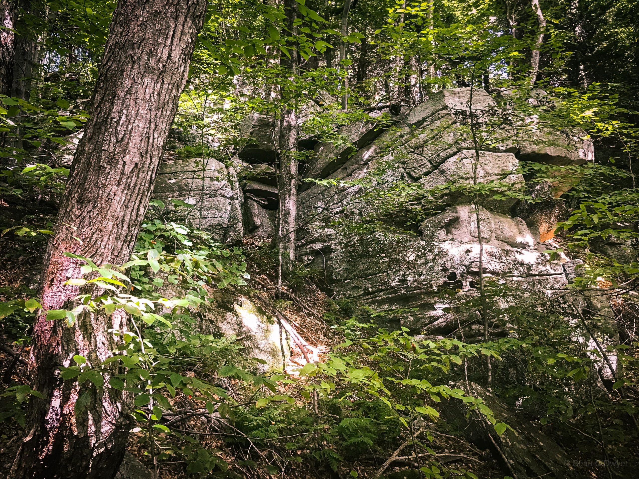
Above these are some open woods in a flat area, a natural spot for a rest break.
From here, we made our way to The C-Shaped Tree and then to The Rim Trail and The Pregnant Tree, as described on the main Friday Mountain page.
We stopped at the lookout above The Ramp, discussed whether we’d attempt a new, untested route up to the summit. In the end, to avoid adding unnecessary drama to the day, we chose to go the way I’d been twice before.
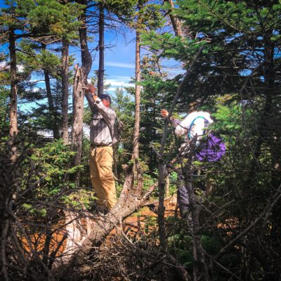
From here, the group did great with way-finding and climbing the steep summit. They located the canister on the first try.
Friday to Balsam Cap
After lunch, we made our way back down to The Pregnant Tree and turned right to make our way over to Balsam Cap.
This was all very straightforward and an extremely pleasant part of the hike.
Details for the route can be found on the main Balsam Cap page.
B-25 Military Bomber Wreck
After Balsam Cap, we descended to 2700’ on The Rim Trail. There’s no marker or sign here to signify where you might begin your bushwhack. Just look for an opening you feel comfortable entering and start to make your way across.
Using your GPS, keep an eye on your elevation. Try not to gain or lose too much.
There is no developed herd path and the terrain is real ankle-twister territory: duff collapses underfoot to reveal dangerous traps between rocks and boulders. On top of this, at times, the brush is quite thick.
There are three or four large, rocky drainages to cross. Take your time.
Aim to reach the stream you see on maps, though it’s not quite that far.
After a pretty intense 30 minutes, you’ll reach an even larger gully and the wreckage will be plainly visible. You do not have to worry that you’ll somehow miss it. It extends at least 200’ vertical feet up and down the drainage.
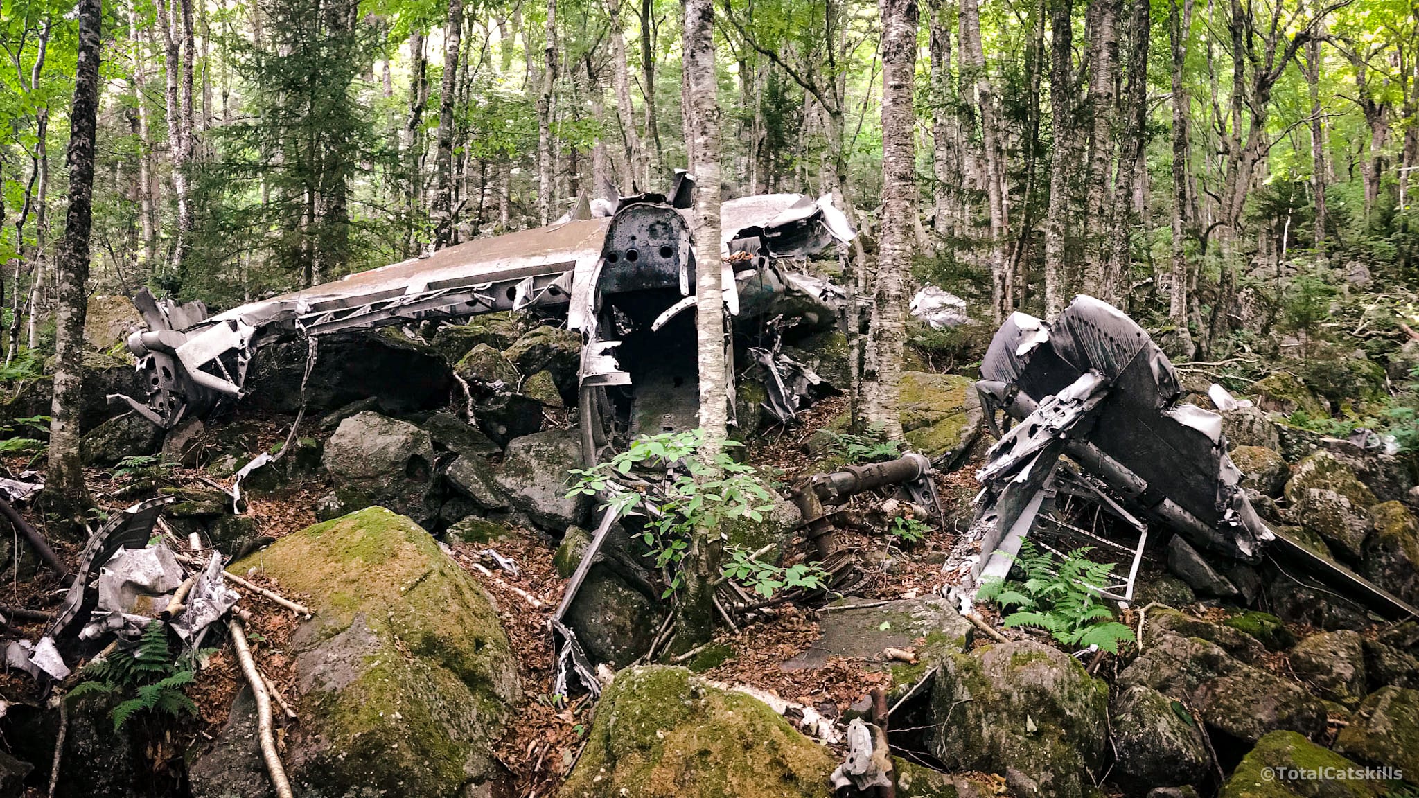
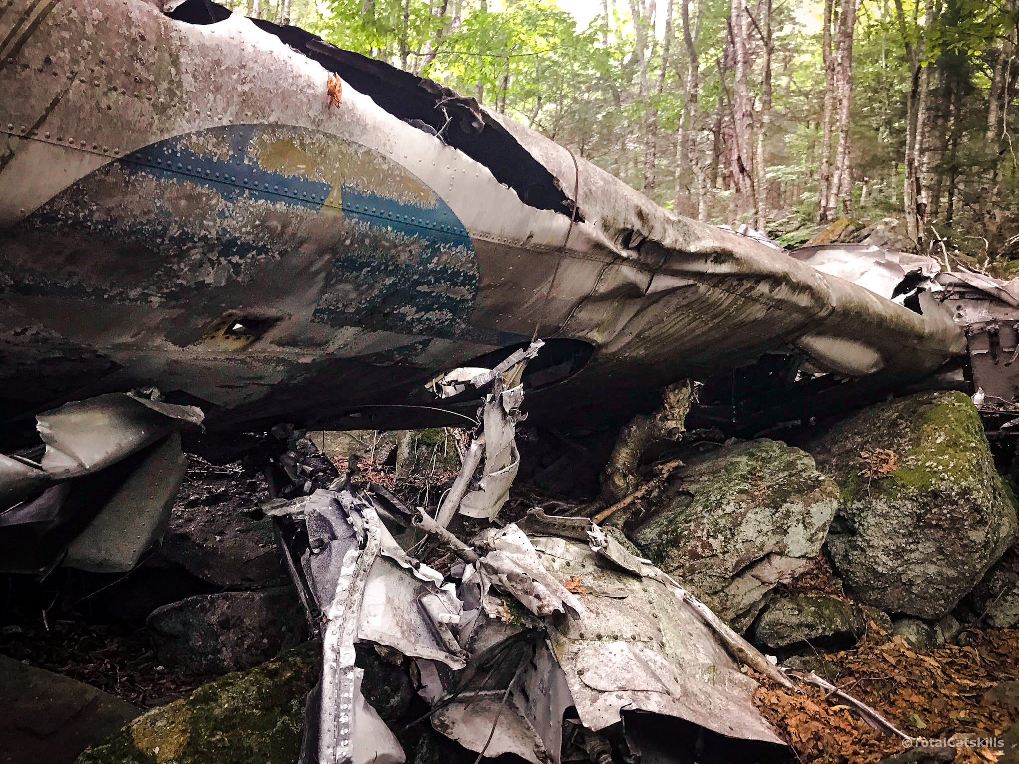
This North American B-25 Mitchell bomber flew missions in France during WWII. But in 1948, on home territory, a navigation error led to this crash: the pilots, flying at night in poor conditions, thought they were following the Hudson River, but they were actually over the Ashokan Reservoir and struck the wall of mountains on its western rim. After 70+ years many large chunks remain largely intact.
Bear in mind, this is the site of a tragedy. Please be respectful.
Return & Descent
To descend, make your way carefully back to The Rim Trail and begin hiking down to Moonhaw Road.
My Gaia track is pretty solid until around 2000’ when I started to veer too far away from the green line. I was trying to come directly down the ridge to save time, while staying well away from the private property in that area. But it was a mistake to head so far north. Our group had to navigate some very steep and extremely sketchy terrain, with loose rocks and dirt sliding under our feet as we made our way down a very steep slope. I dropped a red pin on my Avenza map as a reminder to avoid this area on future hikes.
The land here is very tough. Even on a subsequent hike to Balsam Cap, I did not manage to navigate the lower part of the descent to my satisfaction.
You may prefer to follow your own track back down through the talus field to reconnect with the woods road that leads down to the parking area.
More Tough Hikes
If you love tough hikes, try pairing Wittenberg and Cornell, which are both trailed, but that’s a solid 10 mile day-hike with some very rewarding views.
North Dome and Sherrill is another classic double-bill if you want a bushwhack to remember.
The ultimate bushwhack, though, is doing Rocky and Lone together — as tough a hike as you can get in the Catskills.

Friday, Balsam Cap & B-25 Crash Site Trailhead
Smallish lot. Park alongside the road if it’s full.
Google Maps Location: 41.983823, -74.327326
The map below shows the exact topographic location of the trailhead
Cell Service
Patchy all over. Service comes and goes. My network is Verizon. YMMV.
3 responses to “Friday, Balsam Cap & B-25 Crash Site”
Your comments are welcome here…
The parent mountain for this hike is Friday.

Have you ever been to the plane crash on West Kill ?
Not yet. I’ll probably head up there this summer. I have a good fix on its location.
That’s what I’m looking for. I know a hunters trail up from Shandaken to West Kill and trying to find area of crash site. Do you happen to know approx where, that you’d share? I do not share w others nor take groups !!