Disclosure: This content may contain affiliate links. Read my disclosure policy.
An easy hike up to the ridge-line and then a moderate hike back and forth along it before returning to your car
Trailhead info at bottom of this post.
Hiking Trail Description
The parking area for this hike — which is the same lot as for hikes to Blackhead and Black Dome — is at the very end of Big Hollow Road, the last mile of which switches from asphalt to dirt.
Windham High Peak, Acra Point, Burnt Knob
Trailhead Parking Warning: when it snows, the dirt section is never plowed, and you have to park roadside, at the end of the asphalt section, and hike in. This adds a mile to each side of your hike, which can make a big difference during the shorter days.
Start as early as you can, and always make sure you’re prepared to hike safely.
BTW, you might also enjoy…
- UPDATED › Best Bug Spray & Bug Repellent for Hikers
- CATSKILLS › Peakbagging The Catskills High Peaks (Ultimate Guide)
- STAY › Find Your Perfect Catskills Stay
- ADIRONDACKS › Wright, Algonquin & Iroquois Peaks
- LEARN › Teach Yourself How to Use a Compass
- ENTERTAINMENT › Best & Worst Hiking Movies
- Follow › My Instagram @TotalCatskills
- Follow › My Substack @TotalCatskills
- Follow › My writing for Times Union
Batavia Kill
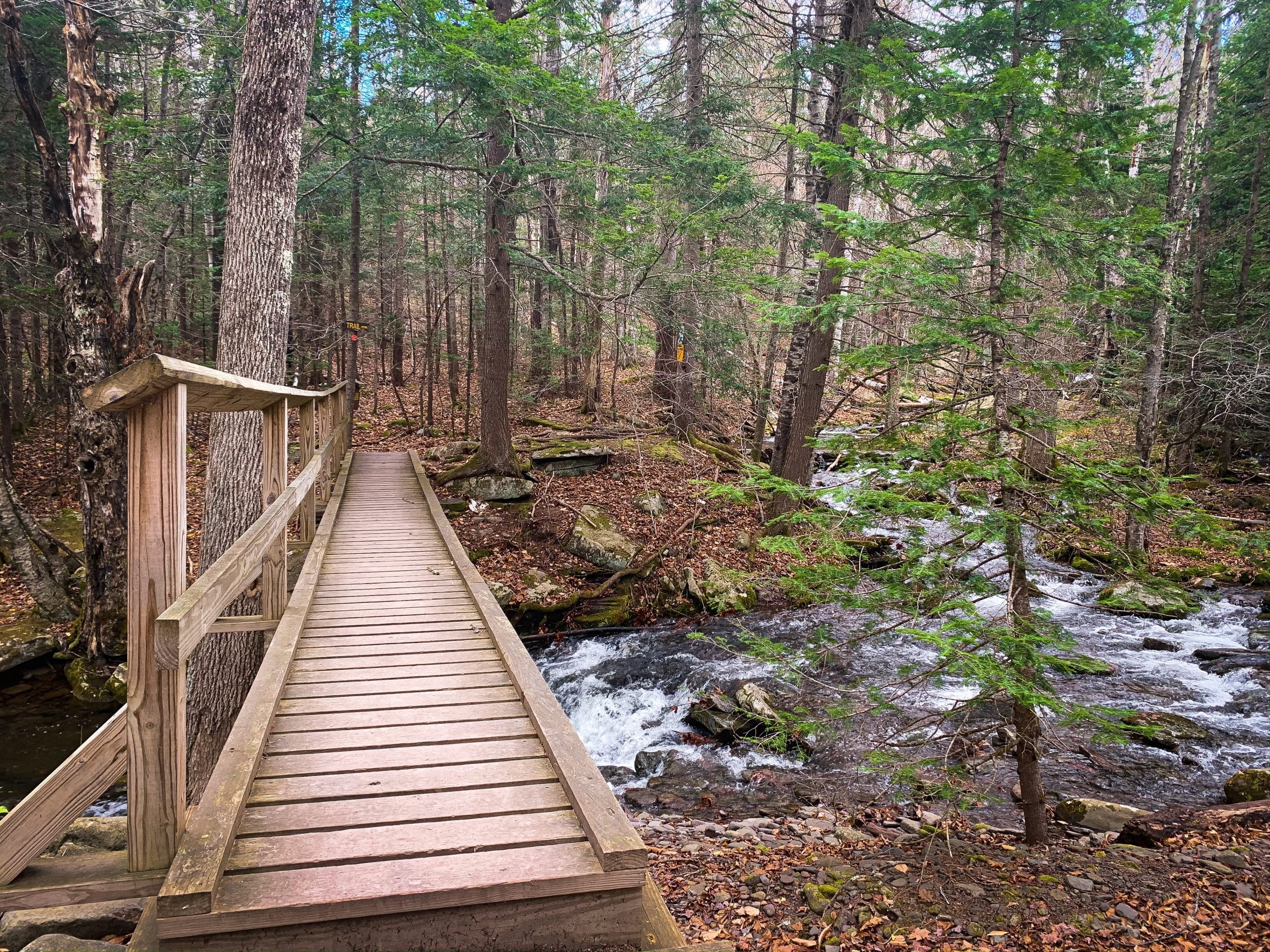
From the parking area, the trail goes immediately into the woods toward a footbridge that passes over Batavia Kill. The register is on the far side of the footbridge.
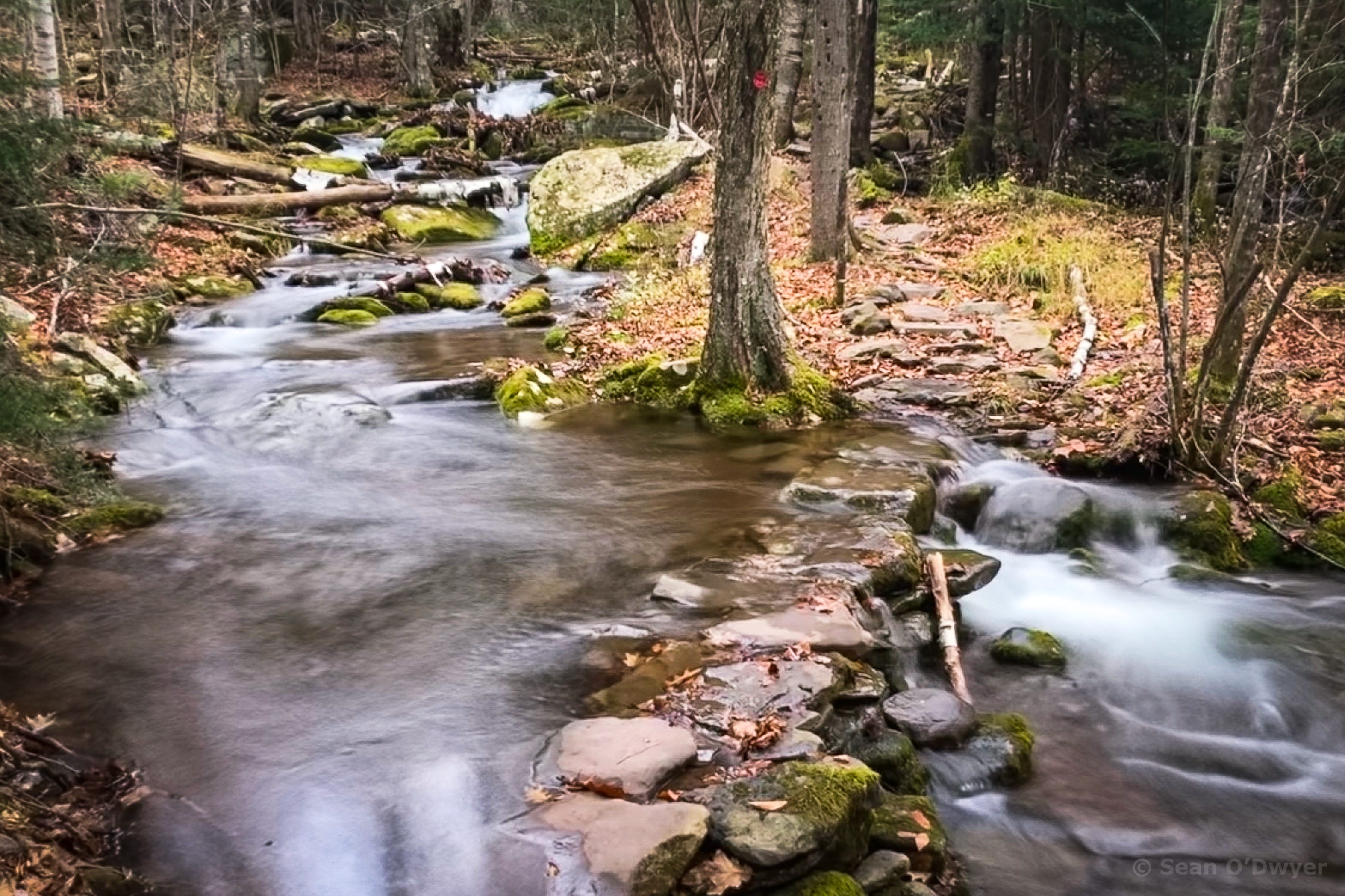
The first ¼ mile of this hike, which crosses the riparian corridor, is really lovely. There are several fun stream crossings.
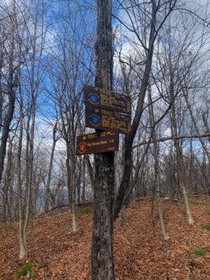
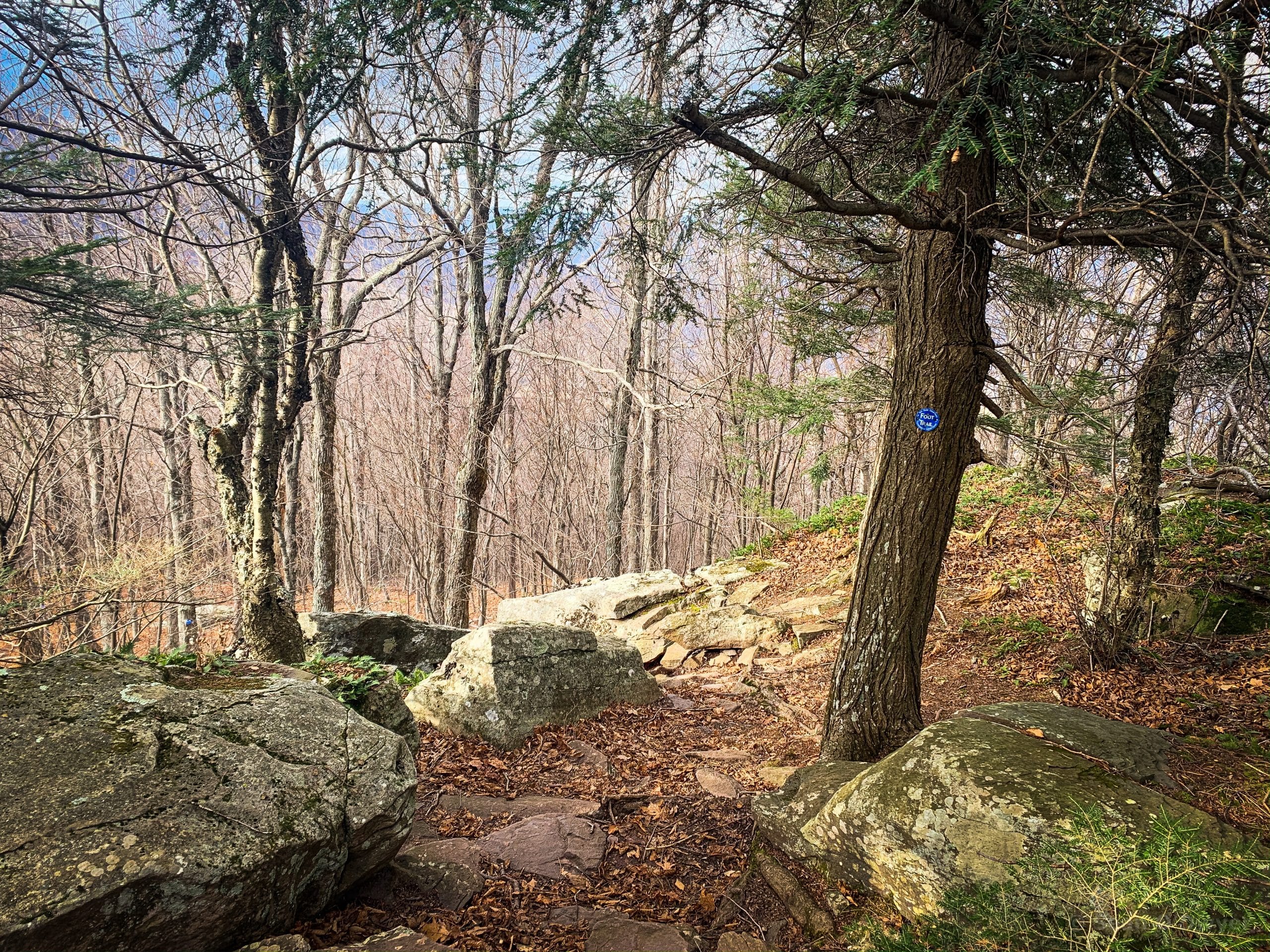
The remaining ¾ mile up to the col is an easy ascent following the red blazes. At the junction, you’ll see signs for the blue-blazed trail pointing right to Acra Point and left to Burnt Knob and Windham High Peak.
Side Quest: Acra Point
The trek to Acra Point, through open woods and over a few rocky outcroppings, is short and uneventful.
There are two lookouts, both on the right side of the trail. Skip the first one: the view from it is obscured and it would be better to let this spur return to nature.
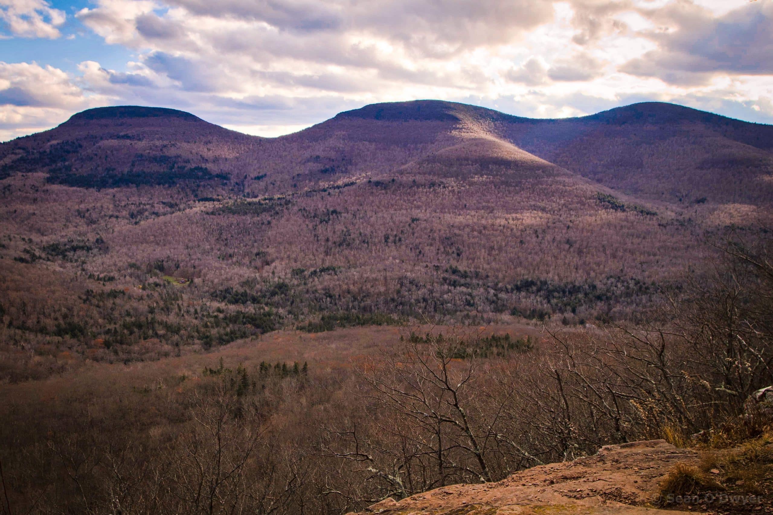
The second lookout is really great. From an open ledge, the view of the Blackhead range is majestic. You can also see Arizona Mountain peeking out from behind Blackhead’s eastern flank.
To your right is Burnt Knob, obscuring Windham High Peak.
Return to the junction and begin hiking toward Burnt Knob.
Burnt Knob Lookout
At about ¼ mile from the junction there’s an acute switchback. Winding past some very steep terrain, the trail turns sharply to the right before a hairpin turn to the left.
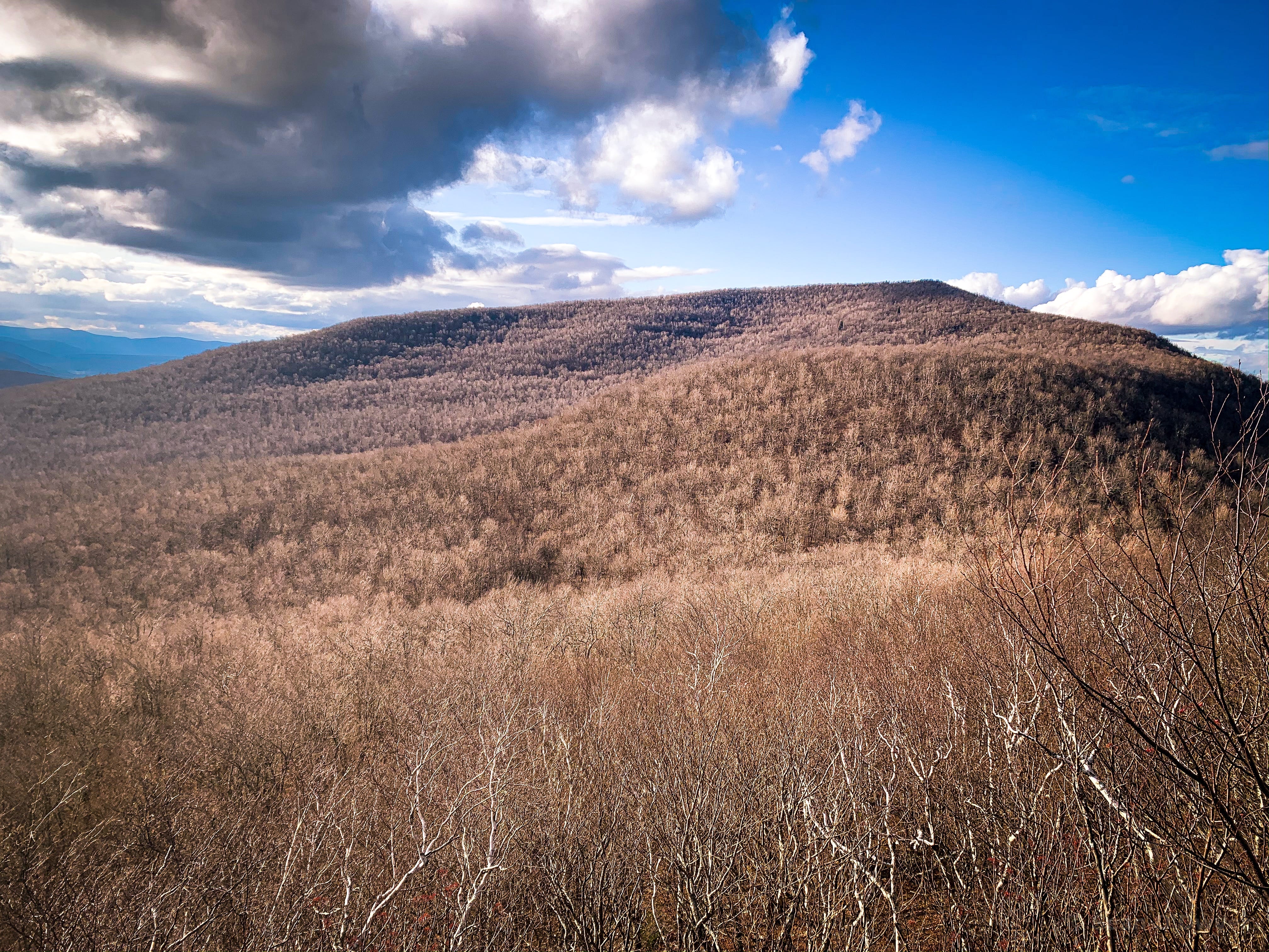
Not long after this, down a short herd trail to your left, is an epic ledge that offers a panoramic view of the entire Blackhead range across the valley: Blackhead, Black Dome and Thomas Cole and Camel’s Hump are laid out in a line.
Return to the trail and turn left, heading west along the side of Burnt Knob.
Burnt Knob
Burnt Knob got its name from one of the many forest fires that have ravaged this part of the Catskills over the centuries.
The trail does not pass directly over the summit. Instead it follows the contour and stays pretty even. However, in November it was muddy.
On this day, with daylight fading, I chose not to bushwhack to the summit. It looks straightforward enough.
On the far side of Burnt Knob is another scenic view, this time on the right side of the the trail. An open area looks north to a classic escarpment scene: the flatlands around Albany and the beginnings of the Adirondacks.
Further along the trail, back on the left, you’ll come to two small ledges that look southwest, out the mouth of the Maplecrest Valley.
You also get a great view of Windham High Peak. From here, the summit is about 45 minutes.
Windham High Peak
Descend to the col, down through one slightly tricky rock ledge.
The hike along the flats, here, reminded me a lot of the very quiet section between Camel’s Hump and Thomas Cole. It’s easy going.
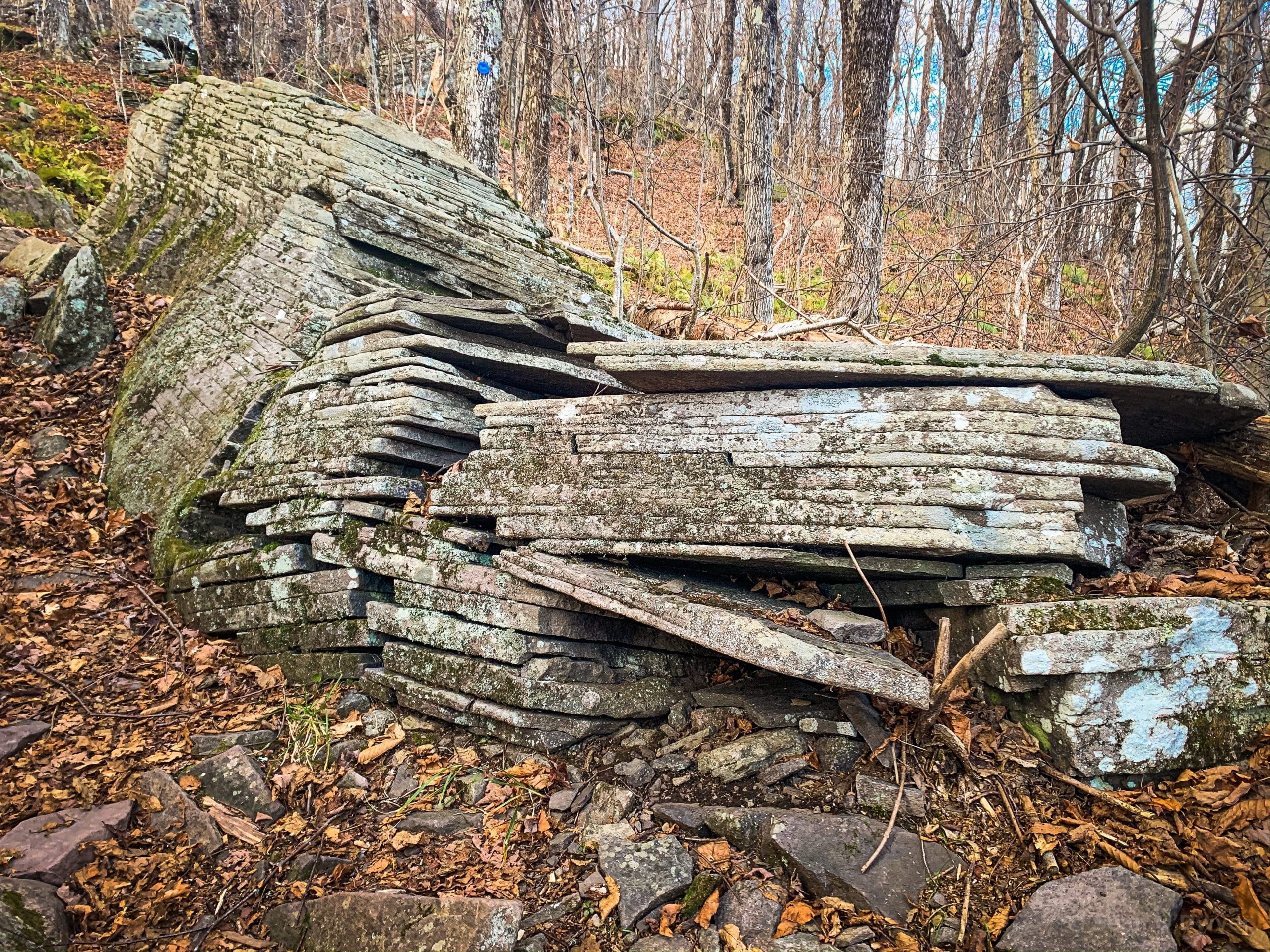
As you ascend Windham, at about 3150’, you pass this wonderful sandstone boulder which has cleaved into perfectly parallel layers.
The hiking here is all moderate, with a few steepish pitches, but no tricky business.
Windham High Peak Ledges & Lookouts
You’ll come to a small ledge which marks the eastern end of the summit. Climb up onto the flat section. On your right is an excellent escarpment lookout, and a good place to rest with a large boulder to lean on.
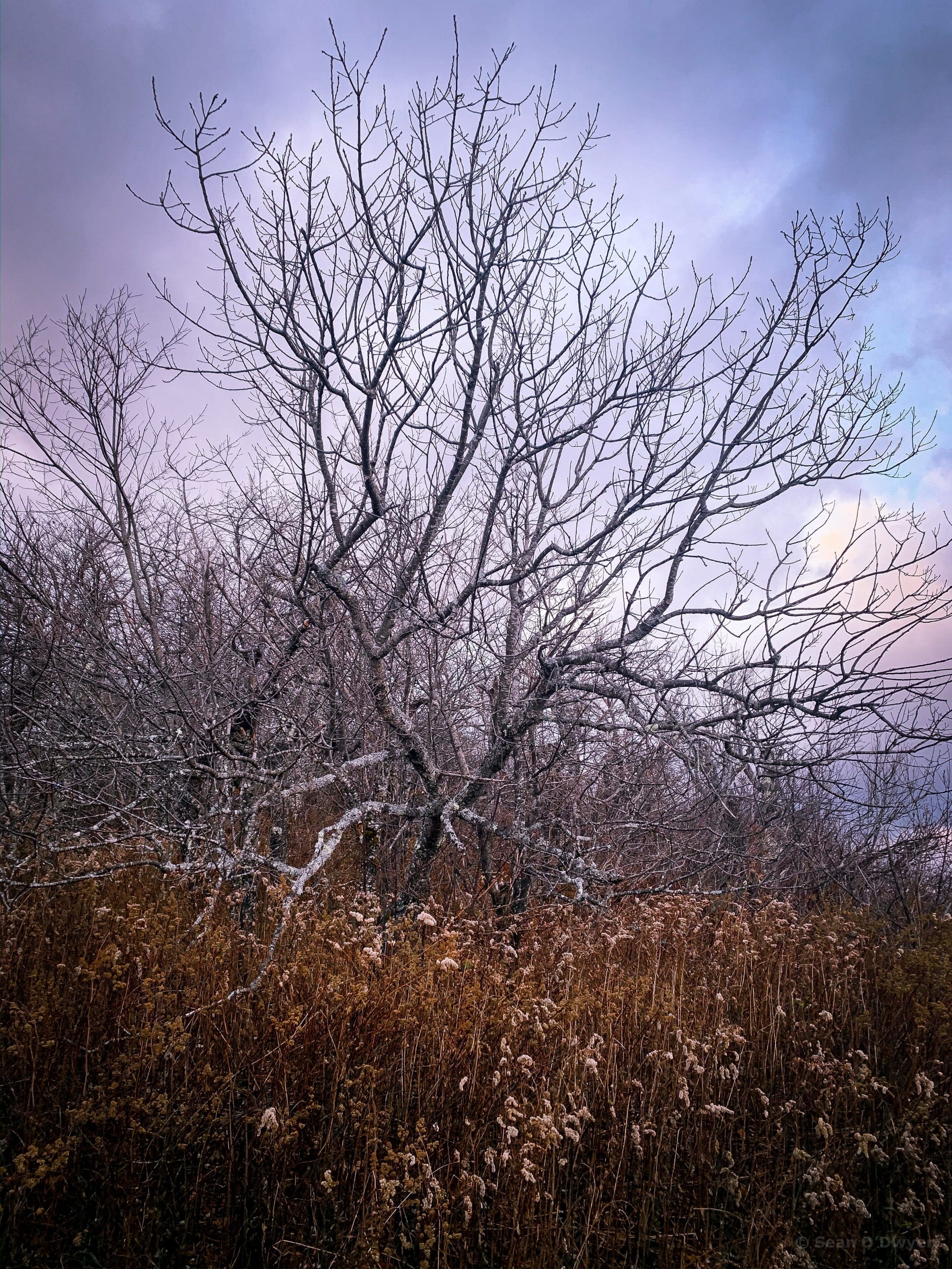
Beside the boulder is a wonderful gnarly tree. I can’t believe I’m developing relationships with individual trees but I love this crazy tree on this lovely summit.
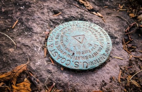
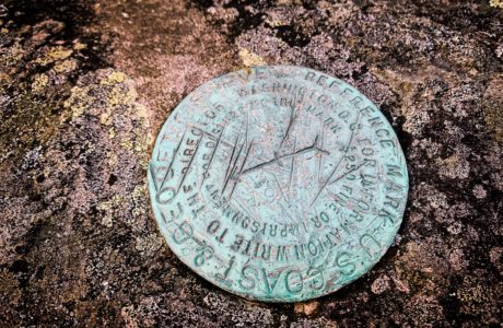
A little farther down the trail is the actual summit, marked by a geodetic survey marker. The last time I was up here was in the snow, and I couldn’t find the survey marker. This time, I found two. From this direction, you find the secondary marker first: it’s on a rock that protrudes onto the right side of the trail. On it you’ll see an arrow which points to the primary marker just a few feet away.
Return to Car
From here, the hike back to the parking area took two hours. Most of it was done by headlamp.
As I was coming down the east side of Burnt Knob, I met one other person coming up. He was also navigating by headlamp. He’d begun a through-hike of the escarpment trail early that morning, starting at the horseshoe turn near Kaaterskill Falls. Amazing!
Similar Hikes
If this length and intensity of hike appeals to you, check out the list of moderate Catskill hikes.
And here’s the list of moderate Catskill peaks.
Get full access…
Get instant access to the full version of this site and enjoy great supporter benefits: full galleries, full trail notes, early access to the latest content, and more.
Hot on the website right now…
Follow for more…
Follow my @TotalCatskills content on Instagram for regular hiking inspo and safe, inclusive community.

Windham High Peak via Burnt Knob (with Acra Point) Trailhead
There’s a lot at the end of the road but, for this trail, you can street park right by the signposts. The last section of Big Hollow Rd is unplowed in winter, so leave a little extra time to hike in.
Google Maps Location: 42.289288, -74.116144
The map below shows the exact topographic location of the trailhead
Cell Service
No service at the trailhead but some service up high. Patchy. I was able to send out a final text from the last junction, before heading down the last stretch to the trailhead. My network is Verizon. YMMV.
The parent mountain for this hike is Windham High Peak.
