Disclosure: This content may contain affiliate links. Read my disclosure policy.
A long, tough, rugged, technical out-and-back.
Trailhead info at bottom of this post.
Hiking Trail Description
I’ve previously hiked this route in reverse — as a thru-hike from Wittenberg › Cornell › Slide in winter. That was a truly spectacular hike.
Since then, I’ve been planning to hike this magical terrain from the Slide side, and to camp out overnight in the col between Slide and Cornell. That’s exactly what I did.
I’ll tackle the campout experience in a separate post. This article describes everything you can expect on the route itself.
After a long hike, you might really enjoy tapping the 10 Best Post-Hike Hacks.
“Here the works of man dwindle, in the heart of the southern Catskills.“
— John Burroughs
Parking
Slide is “the tallest Catskill” and is fairly easy to climb, so it attracts a lot of attention. The parking lot on Route 47 (aka Oliverea Road) is quite large but this is a very busy destination. There is a Porta-Potty at this location — are you brave enough to use it?
Hiking Trail
Very soon after the trail register, you must cross the Neversink. On this day, it was bone dry; a nice piece of luck.
The name “Neversink” comes from an Algonquian phrase meaning “mad river”. The river is sometimes dry, sometimes a brook, sometimes a stream, sometimes an uncrossable river, and sometimes a raging 6’ torrent. It changes from day to day, and can change from morning to afternoon. There is no footbridge. You should be ready to deal with whatever you find, or have a Plan B Location if you feel the water is impassable.
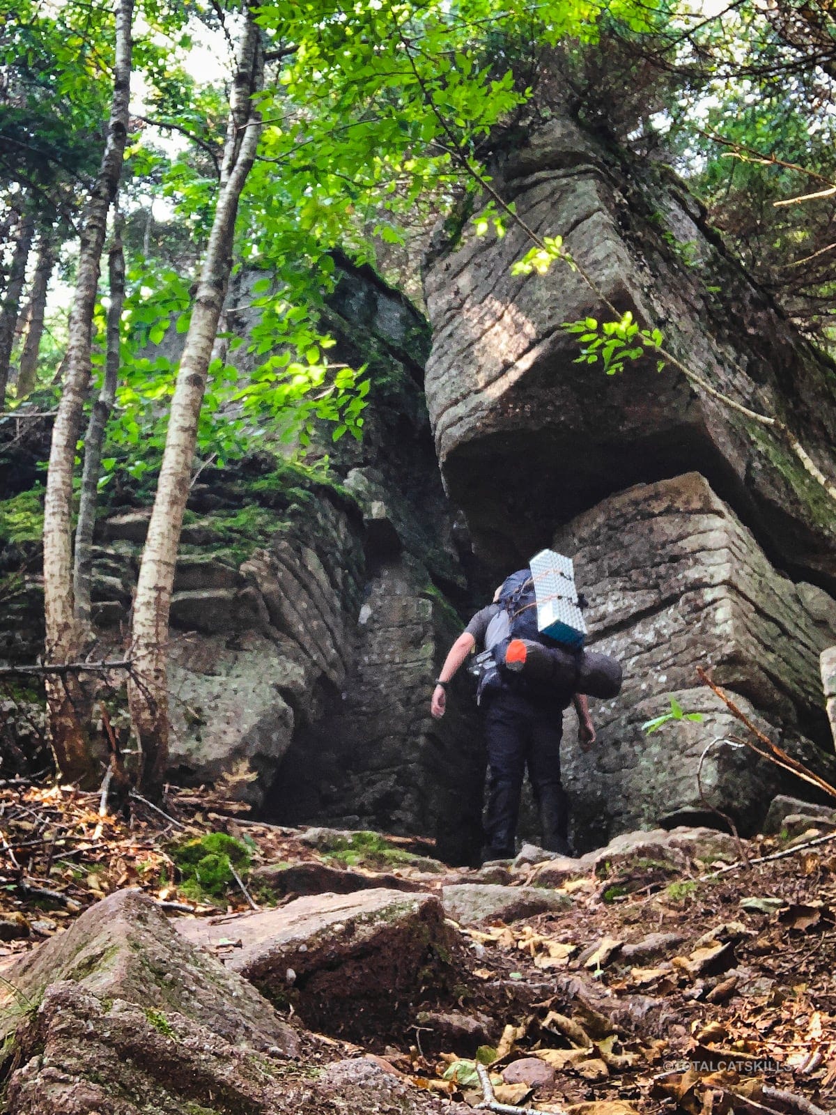
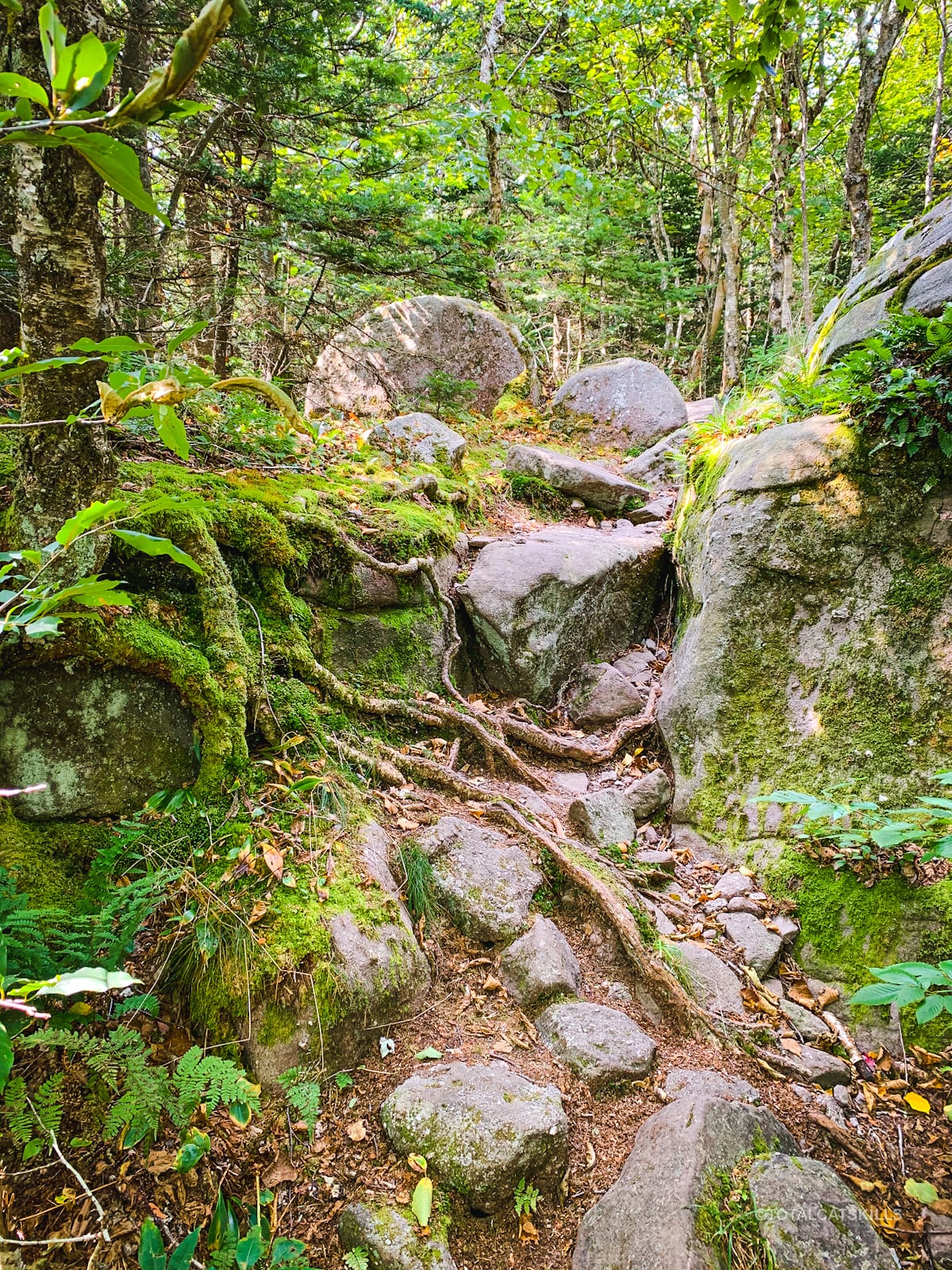
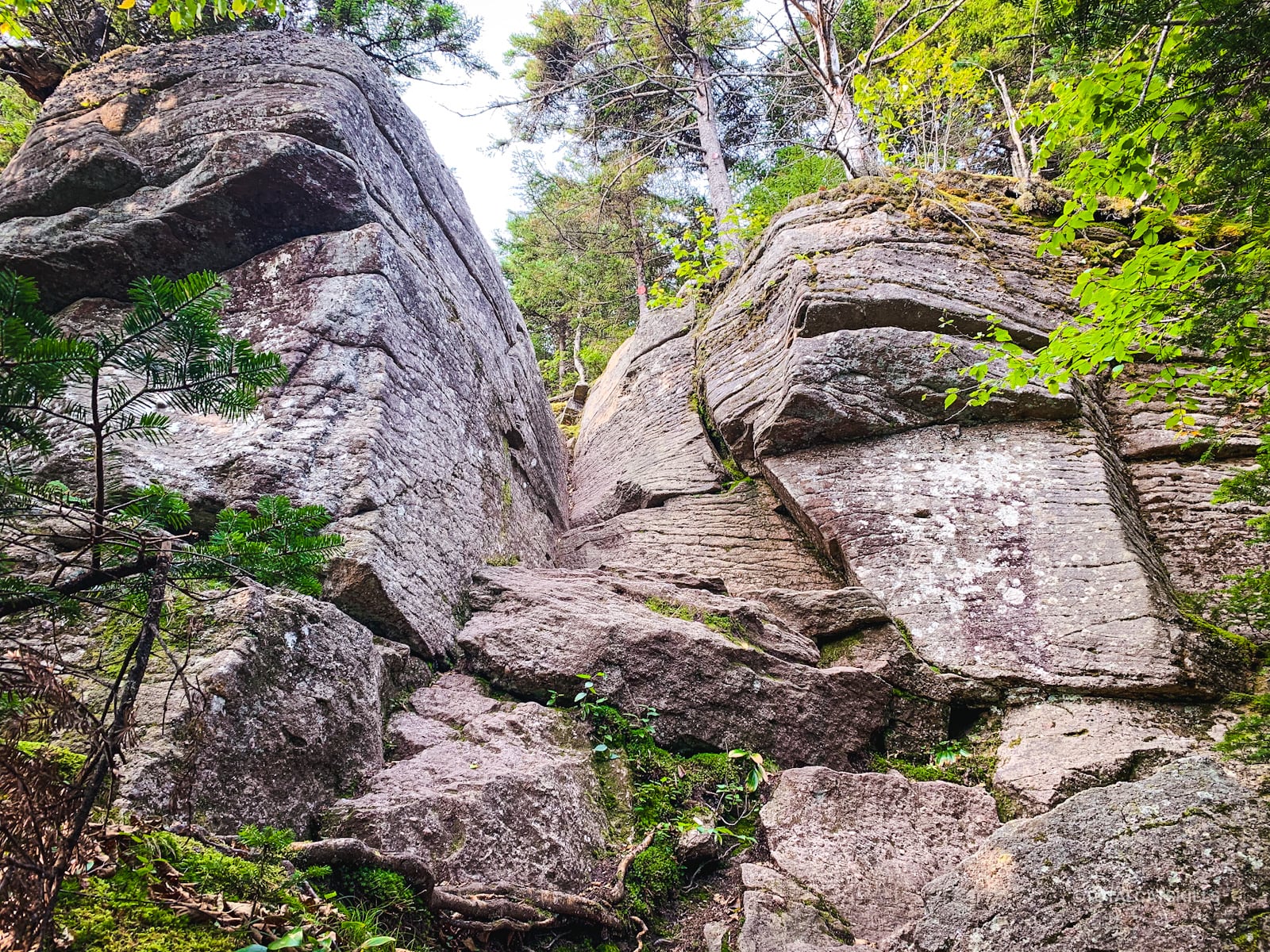
Follow the yellow blazes. I really love the first short section when climbing Slide. It’s rugged and beautiful and you pass some dramatic boulders.
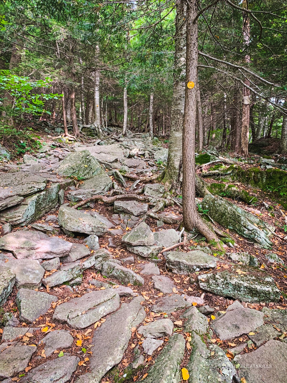
Once you ascend a final set of stone steps, the trail levels out for a little bit before arriving at the first junction.
Turn east/left and head up the 1.4 mile section, now following the red blazes. This next section, I really hate. It’s so boring. I think it’s the most boring 1.4 miles in the Catskills. It used to be known as The Truck Trail when it was used to supply the fire tower for fire observations (after 1911). Before that, in the late 1800’s, it was used for wagons.
You do at least pass a primitive campsite on the way. Something to think about.
If you have the time and energy, I recommend you hike Slide Mountain via the Curtis Ormsbee trail which is “the scenic route” — far more interesting.
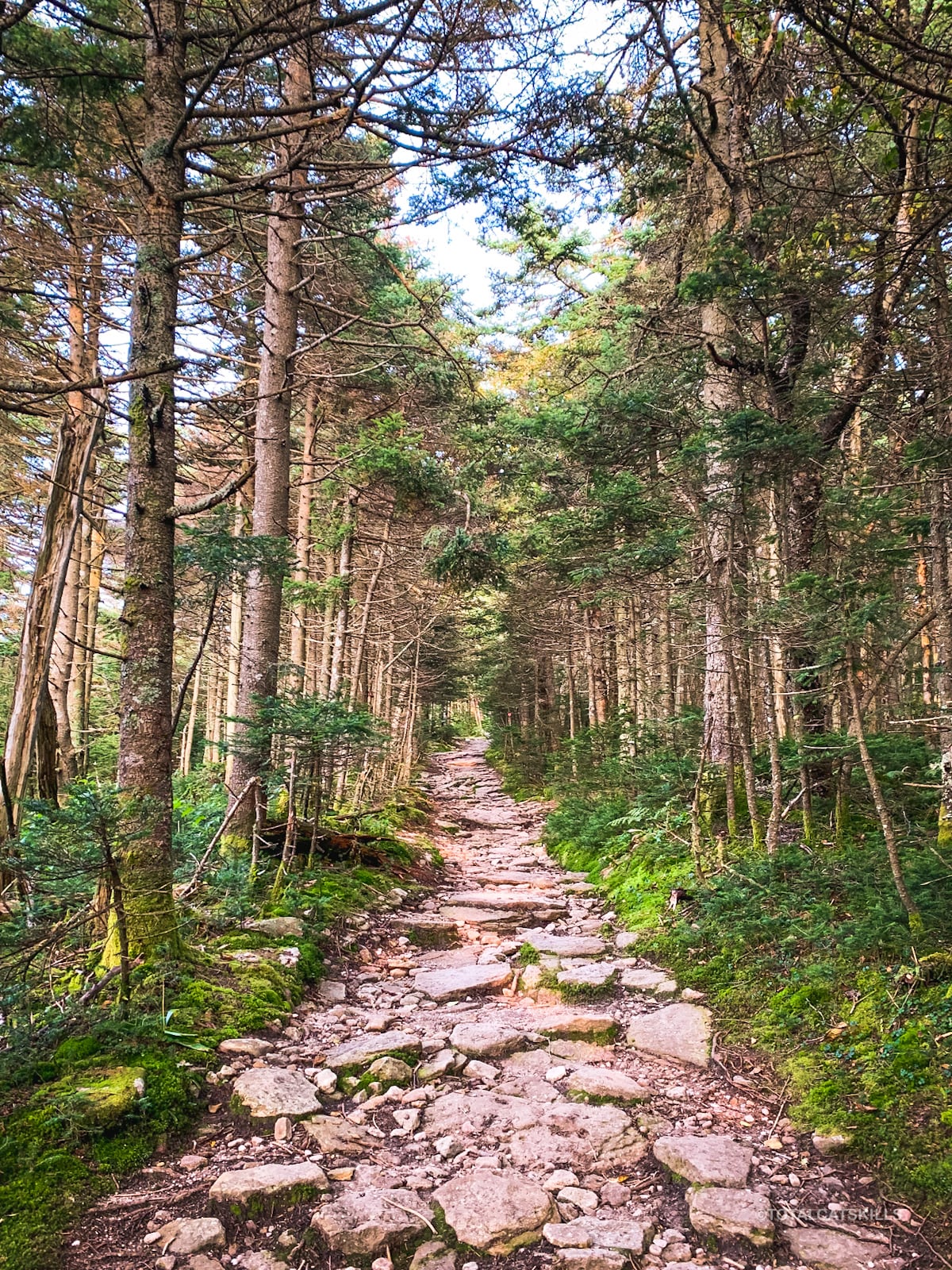
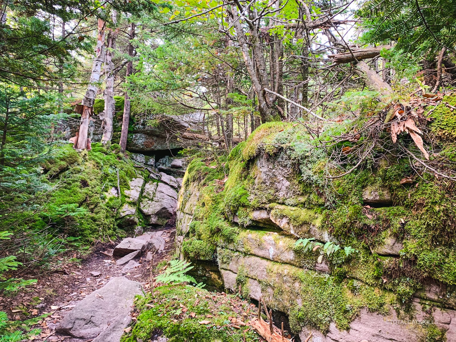
Eventually, you’ll hit the switchback and, from that point on, the rest of this route is really spectacular.
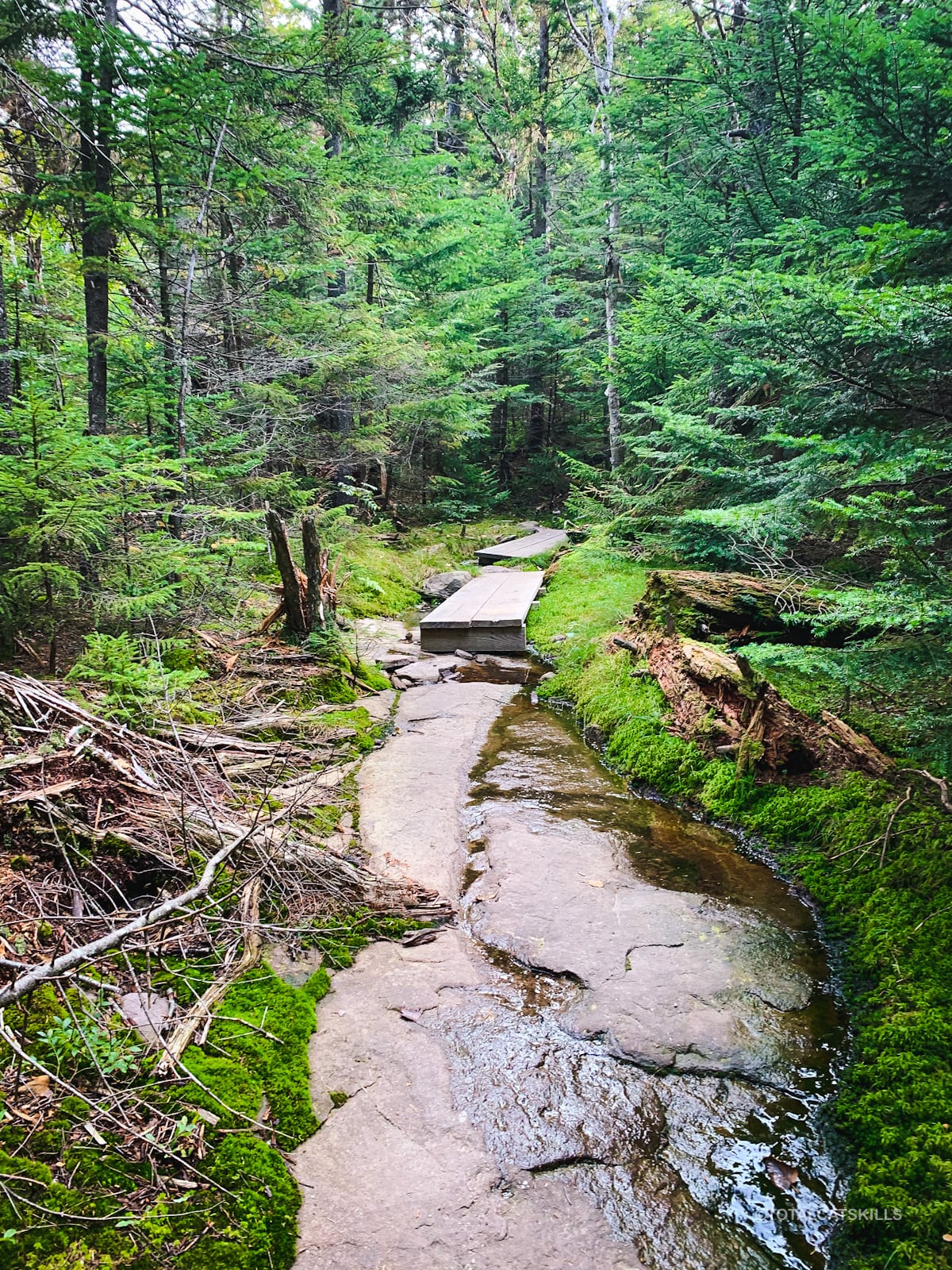
From the switchback to the summit is mostly a series of long, straight stretches through beautiful dense spruce woods.
From the junction you’ll pass (on your right) on the way up, the DEC’s trails and the Long Path converge. You can get a very detailed description of the following mile sections from this page on the NYNJTC’s Long Path Guide.
Two Great Views
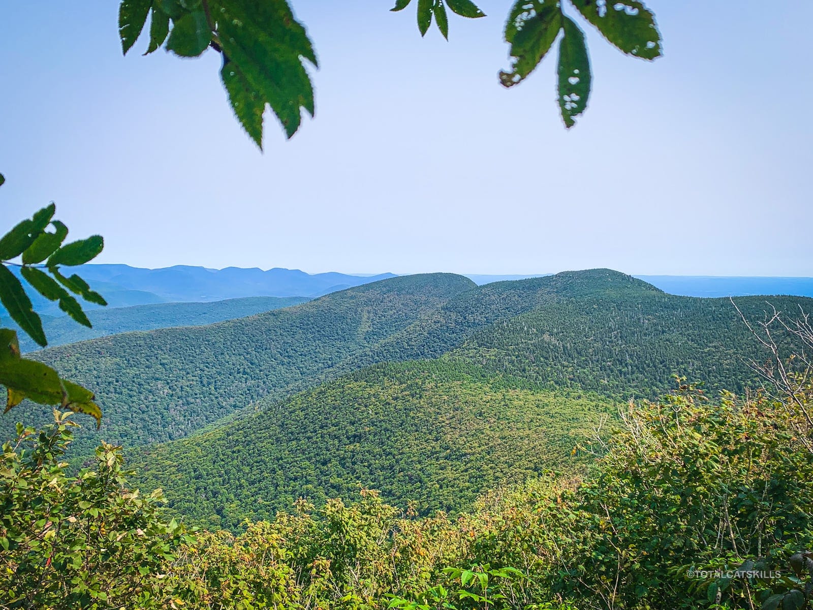
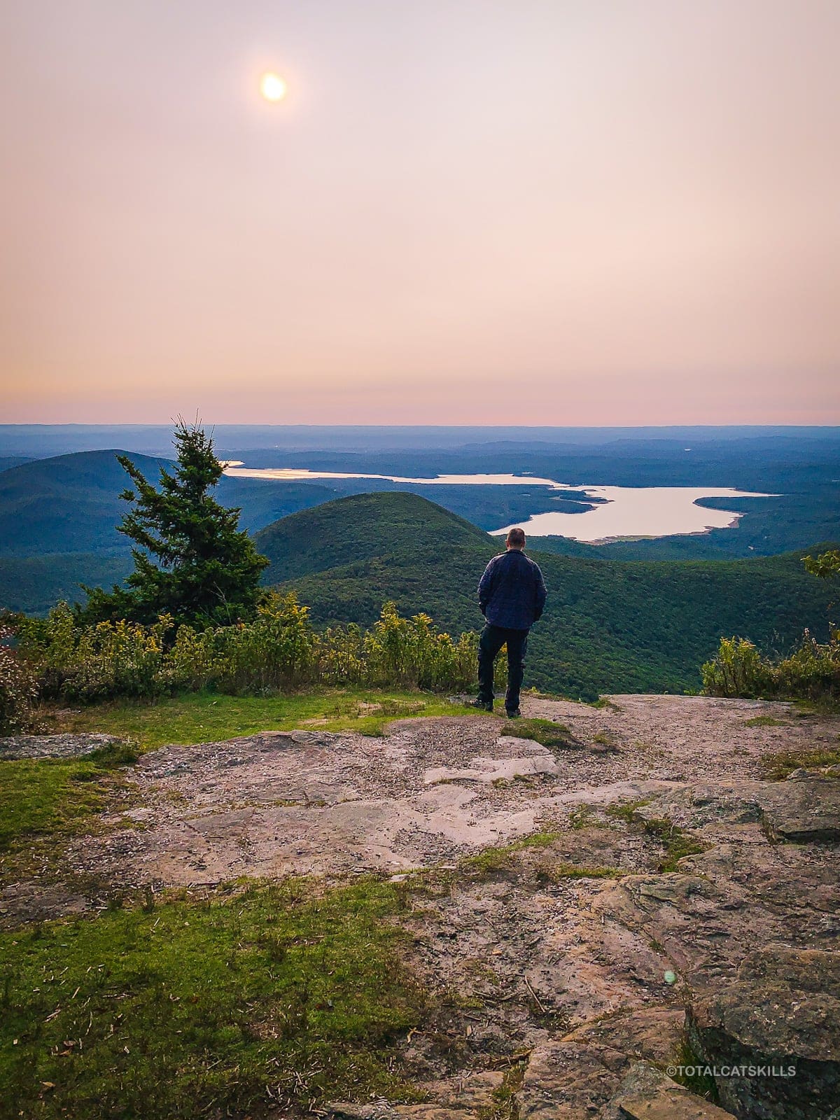
Just below the summit, around 4100’ or so, there are two small ledge openings on the left side of the trail. Both give wonderful views.
The lower one gives a better view of the long, elegant slopes coming down off Wittenberg and Cornell’s west sides. In the distance, you can see the Devil’s Path mountains. Even Black Dome makes an appearance.
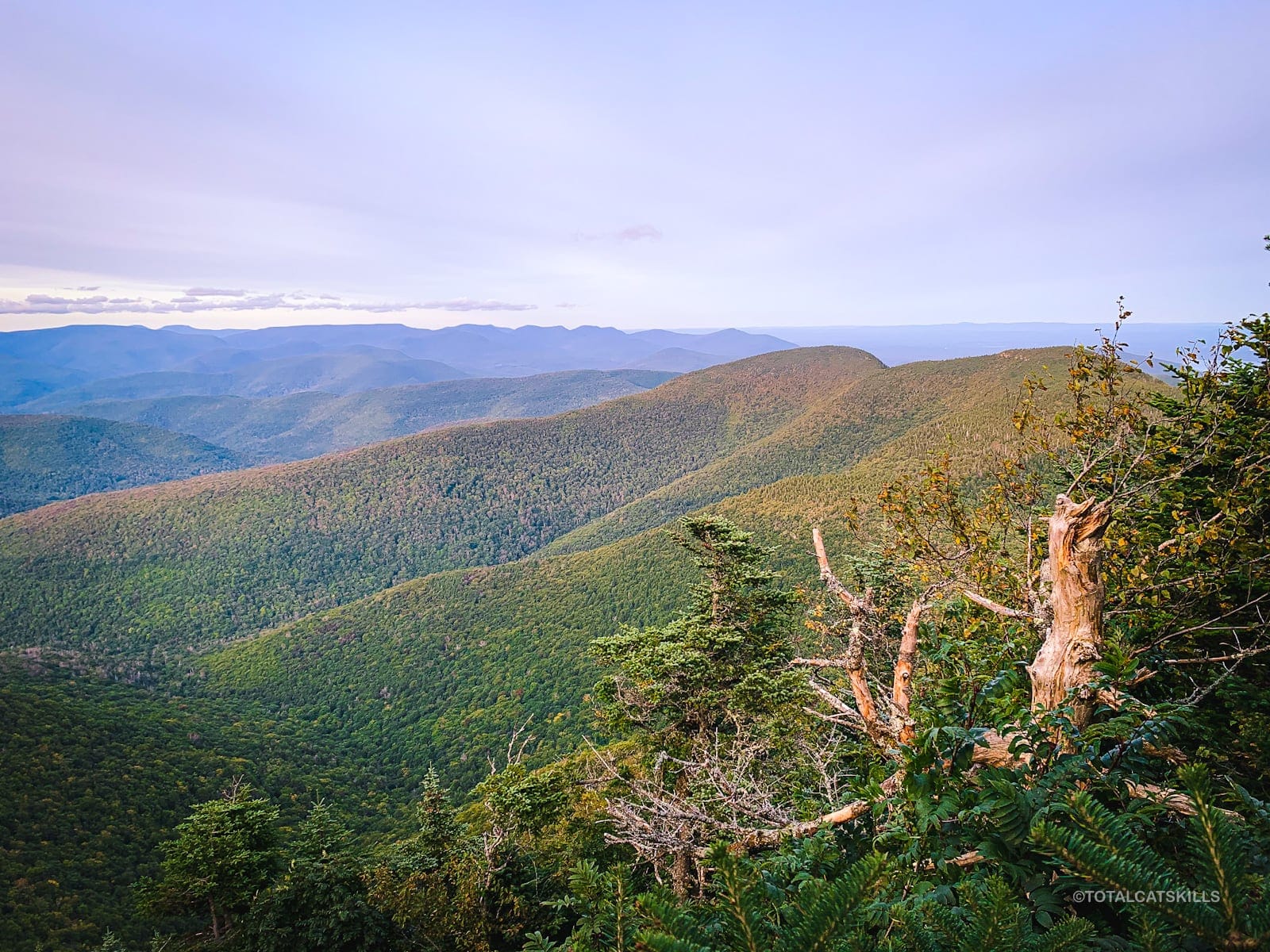
About a minute later, the second ledge gives a better view of Giant Ledge and Panther Mountain.
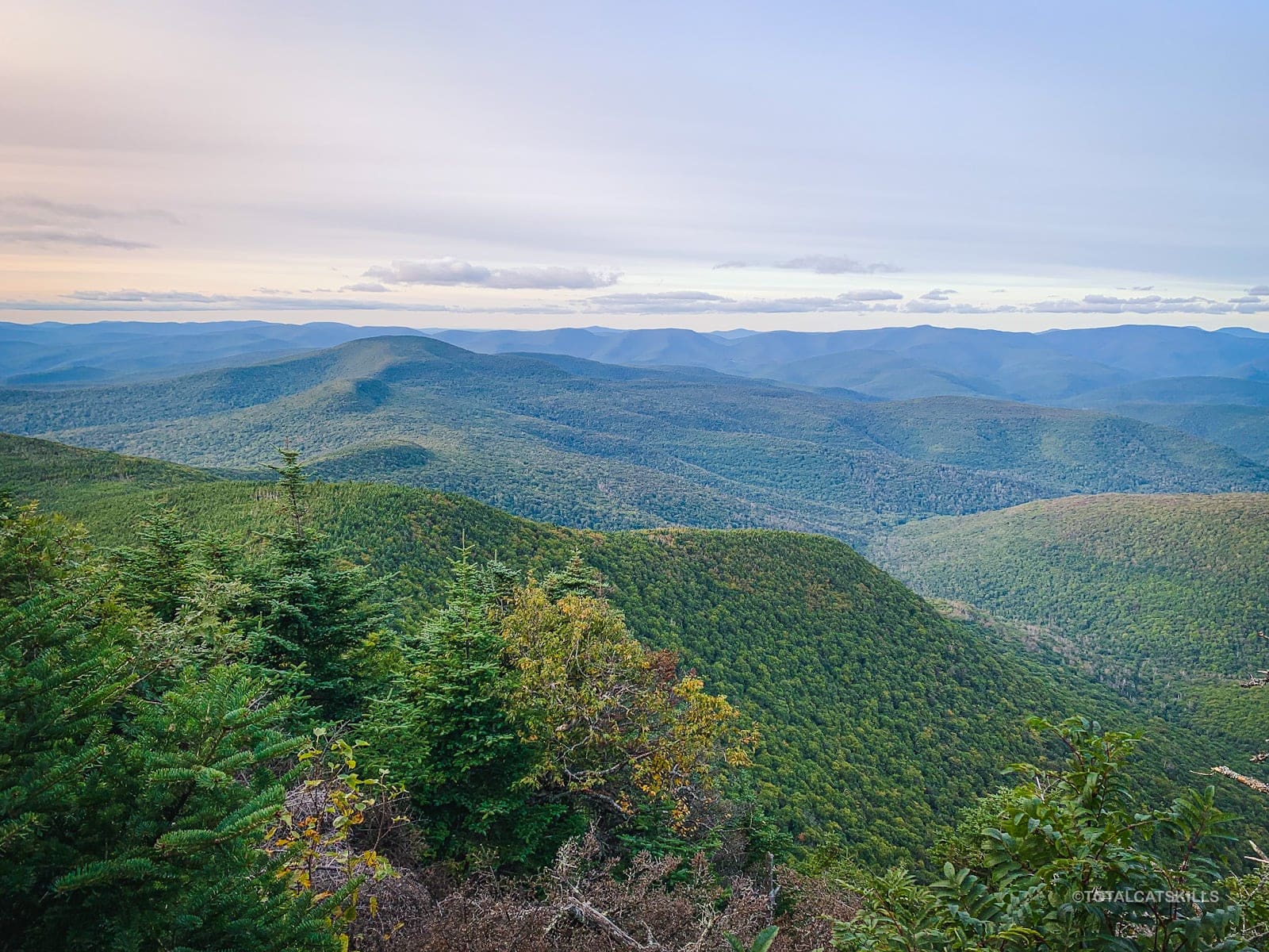
The two pale and pointy mountains in the far distance — visible over Panther’s southern ridge and behind the western Devil’s Path — are Huntersfield and Richmond.
Cell Coverage Ends Here
These two open views are the last spots where, on Verizon’s network at least, you’ll have a steady cell signal.
I expected to get a better signal from the summit, which is very close, but was confounded by the lack of service at the highest point in the Catskills.
From here on, cell service is lousy to non-existent until after Cornell Crack.
Slide Mountain Summit
Slide’s summit is marked with a single remnant of a fire tower that used to stand here. A single concrete footing sits right on the trail. This was the first time I’d seen it. Previously, I’d only been up Slide in snowy months, when the footing is covered under at least a foot of snow.
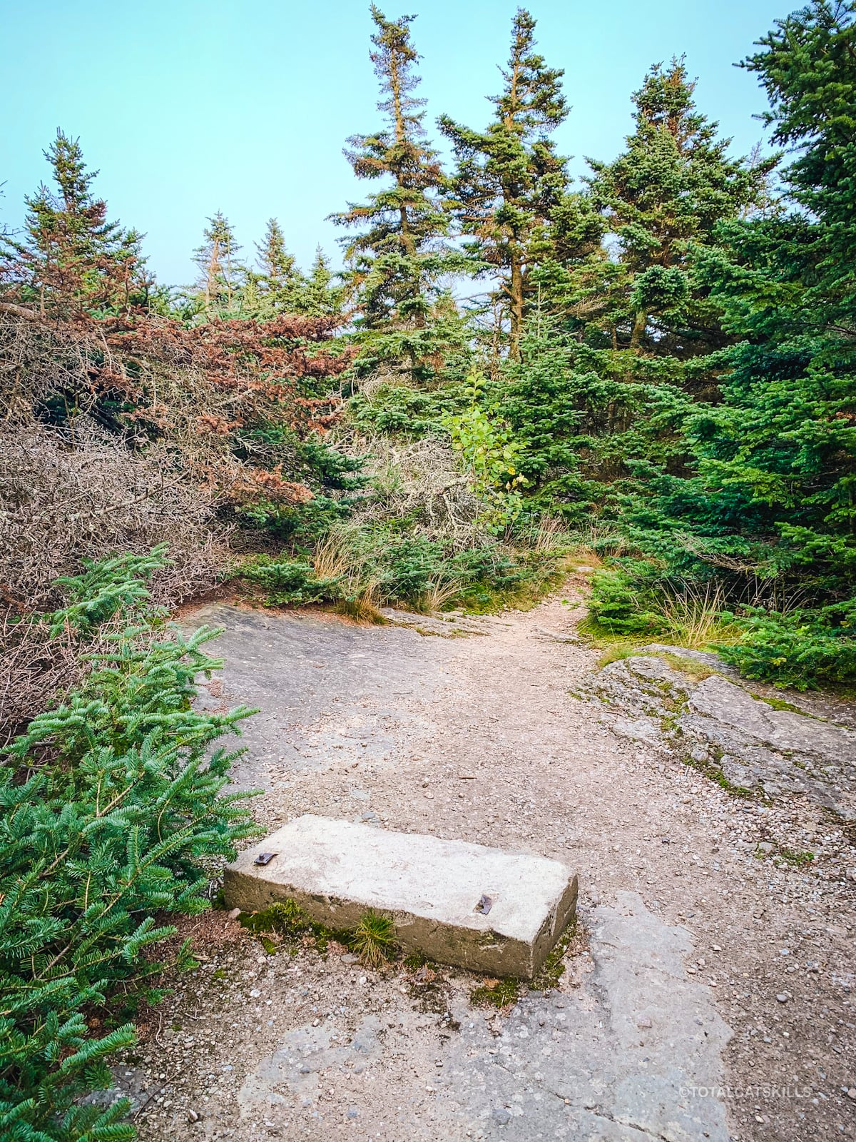
As is common in the Catskills, there’s no view from Slide’s summit.
However, just a few hundred feet past the concrete block, a large, level, open, rocky outcrop makes for a great place to picnic. The views there are mostly grown in, but far below you can see the Ashokan Reservoir, and some Catskill peaks are visible in the distance.
At this point, most people turn around, happy with their day’s hike. But, on this multi-peak hike, the real fun is truly only just beginning…
Descent from Slide
Go around the right side of the rocky outcrop, and make your way down to the Burroughs Plaque embedded on the far side of the ledge.
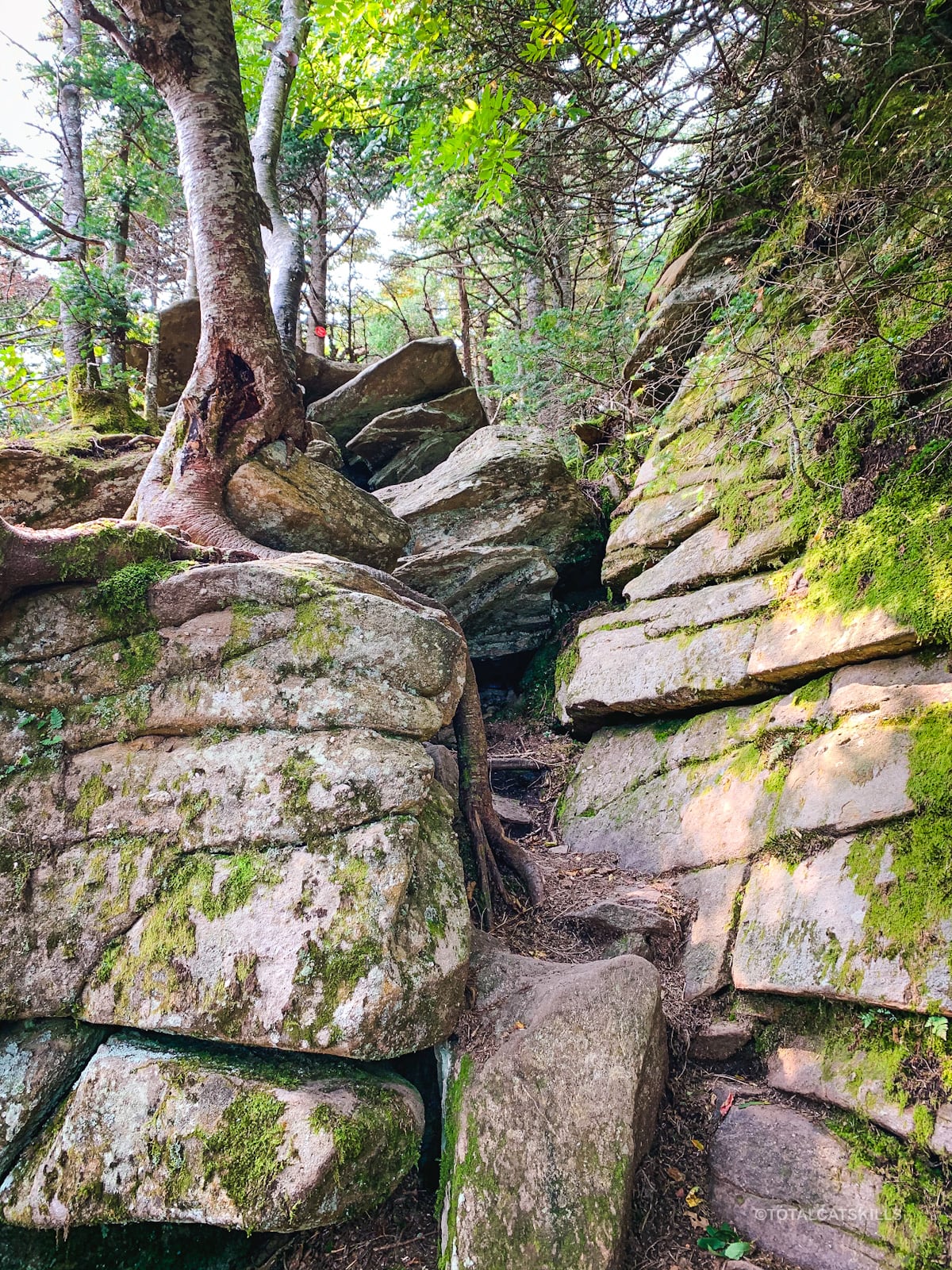
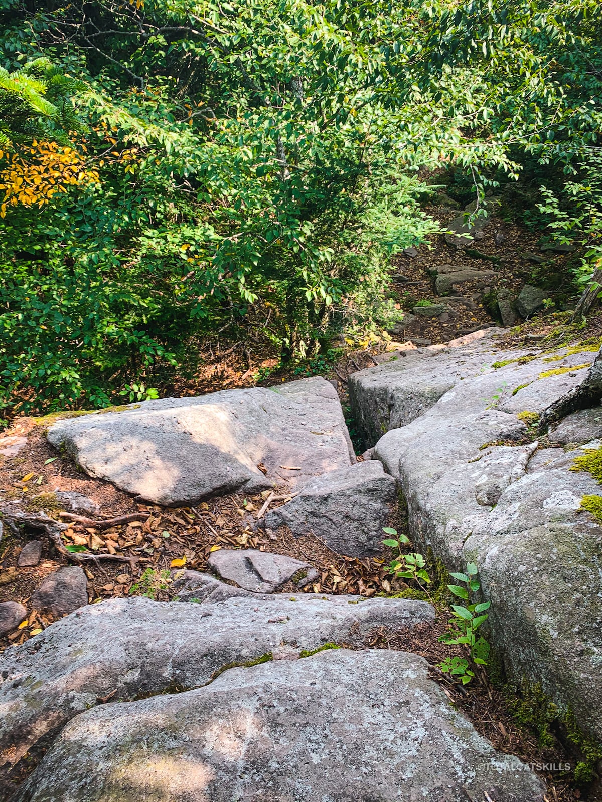
From here, the trail continues down through the balsam/spruce woods, descending rapidly and ruggedly — and very steeply — into the col between Slide and Cornell.
Micheal Kudish states that the trail between Slide and Wittenberg has been in use, in one form or other, since at least 1903 when the first survey quadrangles of the area were produced.
Warning! From this point on, you need to be experienced with and very comfortable hiking rugged, steep, cliffy terrain. There are several difficult descents and subsequent re-ascents. The risk of serious injury is greatly increased. Turn around if anything feels sketchy.
At the bottom of some steep wooden stairs, you’ll come to an excellent view of Wittenberg and Cornell.
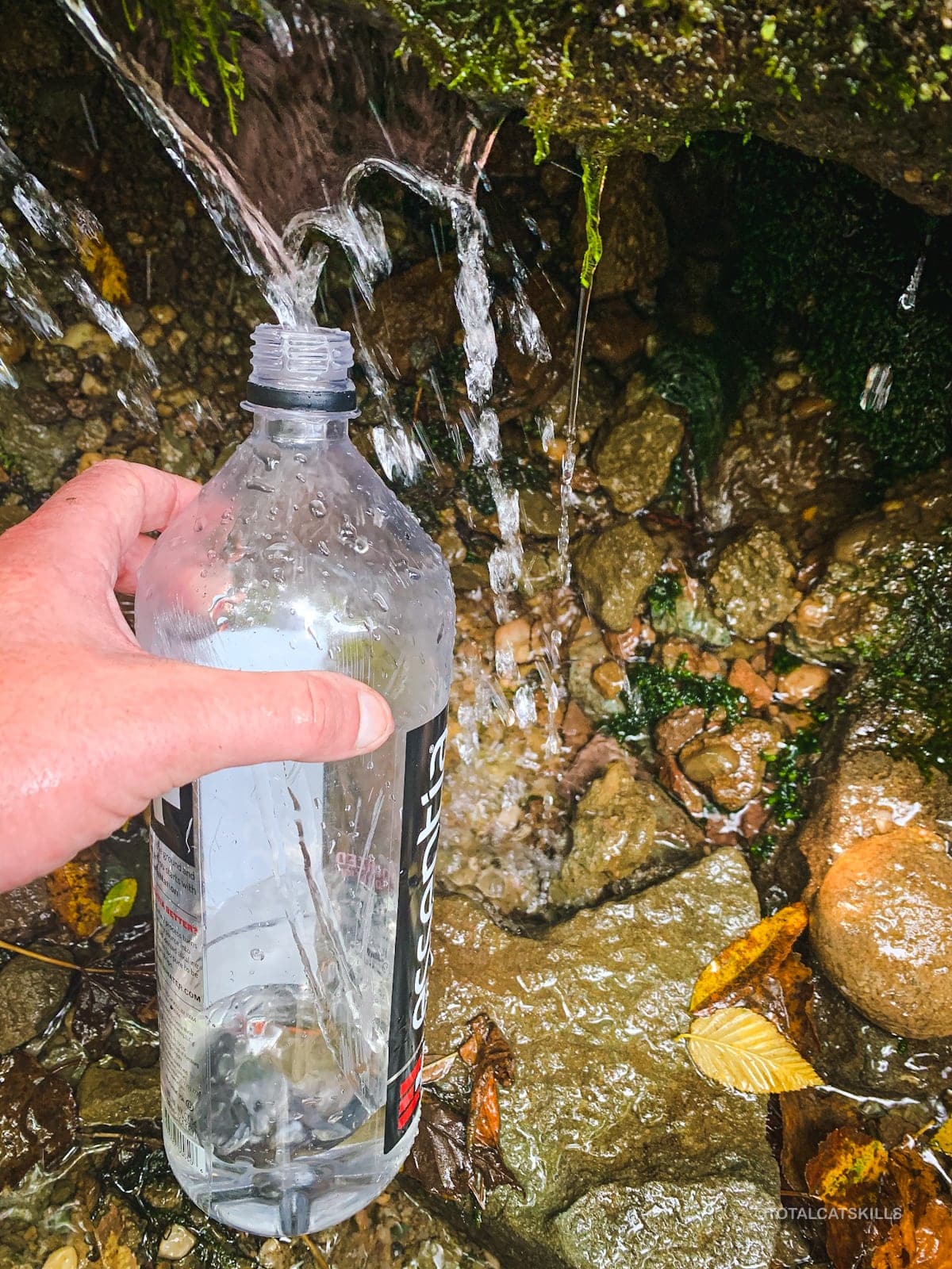
Spring
To the left of this spot, a steady spring is a great place to re-up your water supply. Always filter and treat any water you collect in the Catskills.
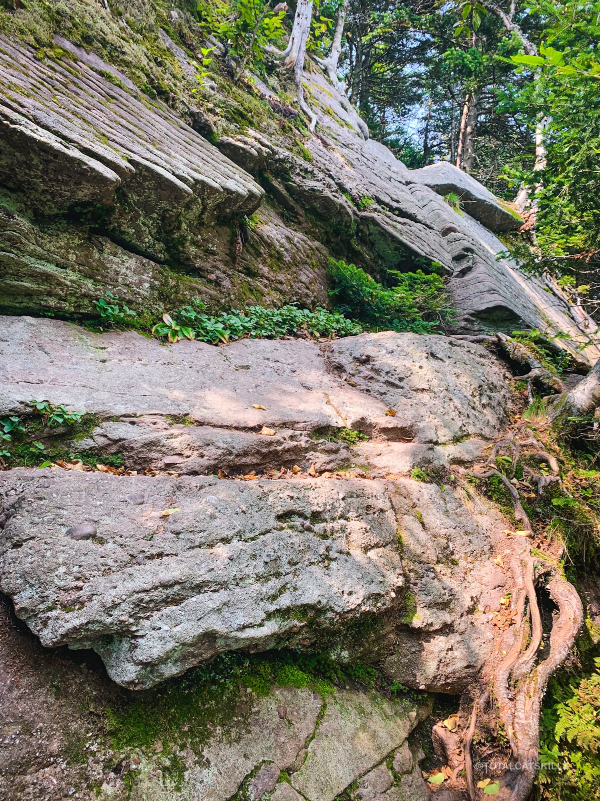
Epic Rocks
Not far below the spring, at 3750’, you’ll pass this epic outcrop. It must be at least 30’ tall.
Slide Crack
Next, you’ll have to deal with three rocky ledges, each of which presents a challenge. The first and third ledges need some care.
The middle ledge is known as Slide Crack. I think it’s maybe only 20’ high but I find it far more intimidating than Cornell Crack. This is the view looking down from the top of Slide Crack…
The crack itself is just about wide enough to get a foothold inside — but it also looks like it would snap your leg in half if you made a mistake. Not something you want to have happen. (Definitely not on a solo hike, right before sundown…)
Here’s the view from the bottom, looking up. The crack is on the right…
There are bushwhack routes around both sides of ledge. To re-climb the crack on my way back out, I used one of them. To climb down, I pulled out my stash of webbing.
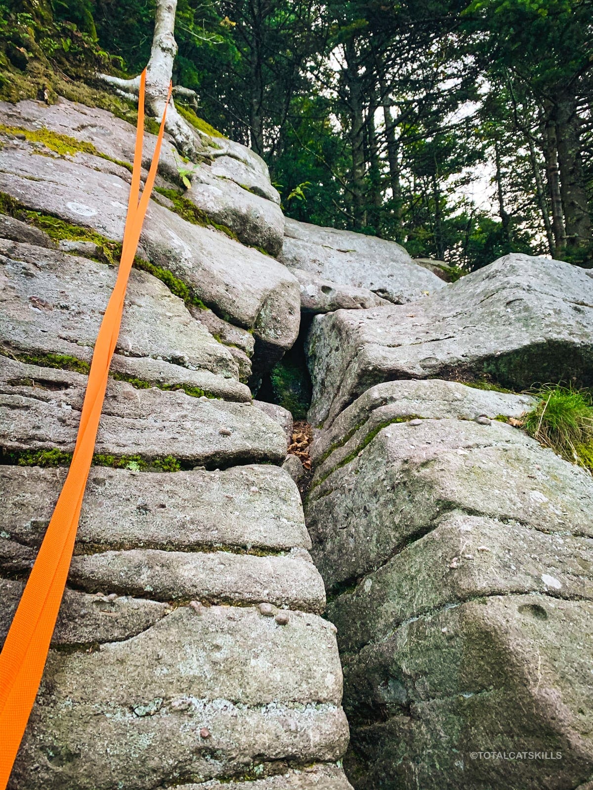
I’ve been carrying around 40 ft of orange 1″ webbing in my backpack for two years, and never felt the need to pull it out before this day. This was the first and only time I felt an assist was necessary for my safety in the Catskills. I was very glad I had it with me.
As always, assess all your options — and only proceed at your own risk.
The final third ledge is about 300’ after Slide Crack. It’s not nearly as sketchy, but still demands your full care and attention.
An injury anywhere down here is a long way from help.
Slide/Cornell Col
The trail descends another 250’ and then begins to flatten out.
In the middle of the col are at least five primitive campsites. On this hike, I camped out overnight in one. (Report coming soon.) Some of the campsites are small, but some are quite large.
I was really happy to see that each was pristine and had clearly been used with leave no trace in mind. I found only a few tiny scraps of plastic wrapping in one, and packed them out.
This is one of my favorite places in the Catskills. It’s so remote and difficult to get to, and the terrain and forests are so beautiful, particularly on the Cornell side.
Cornell
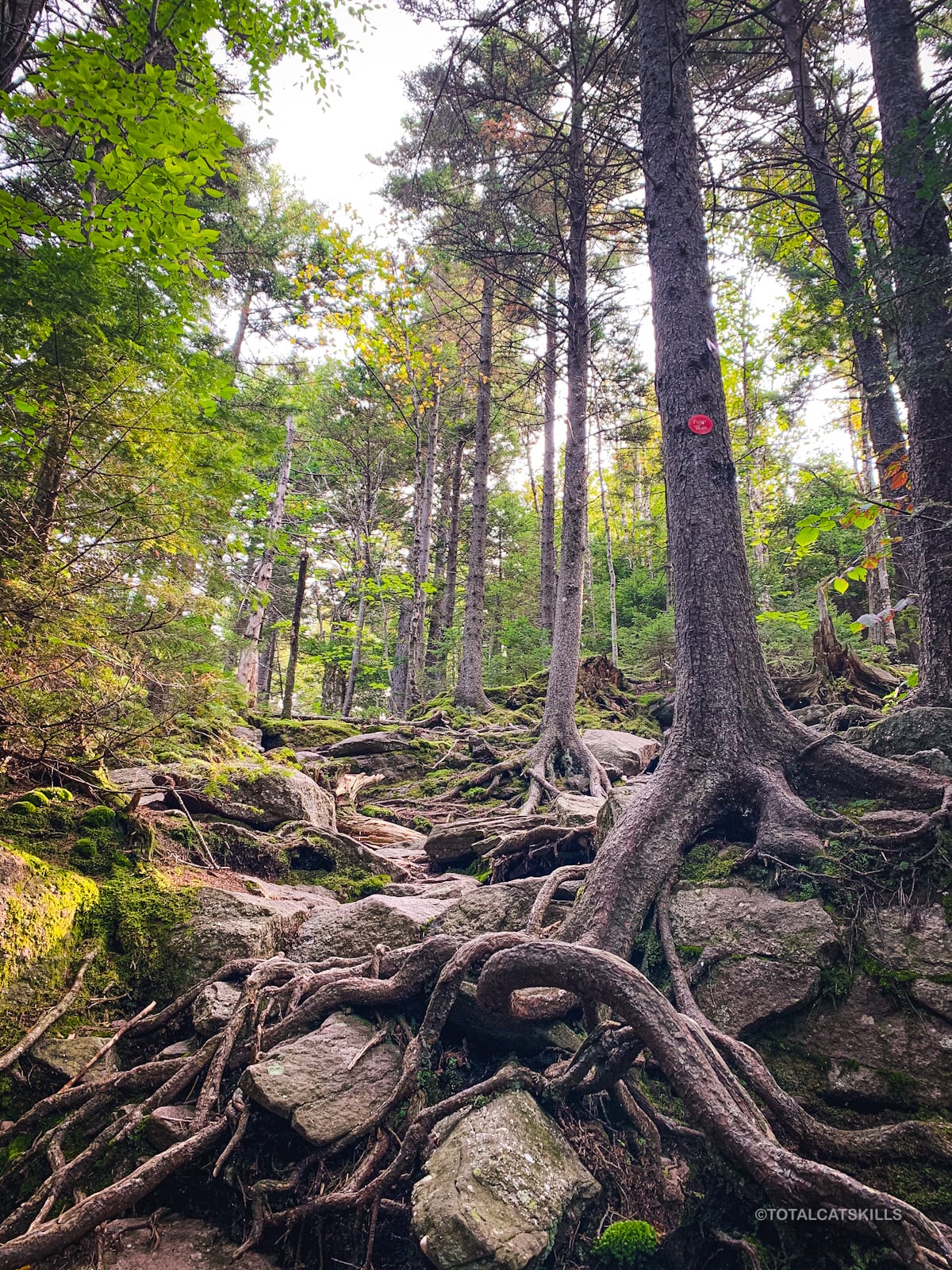
The climb up Cornell‘s western slope is delightful. The trail winds, there are rocky sections, mossy sections, footbridges, and weird rock formations to contend with. I think Cornell might give Twin Mountain a run for its money in terms of sheer fun — except Cornell’s terrain is even more beautiful.
At 3750’ you’ll hit a lemon squeeze rock formation. It took me a minute to climb it. I had to take off my pack. (Climbing back down was easier.)
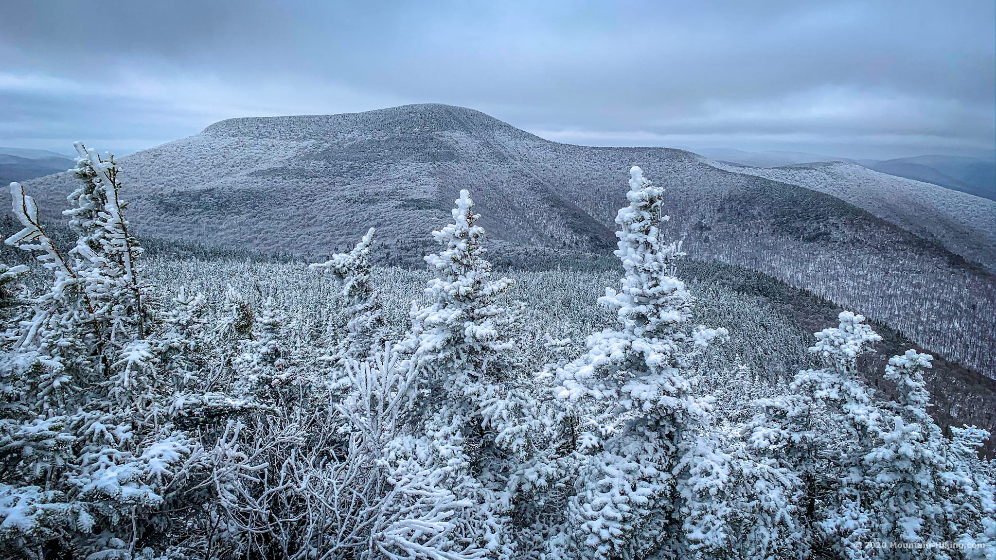
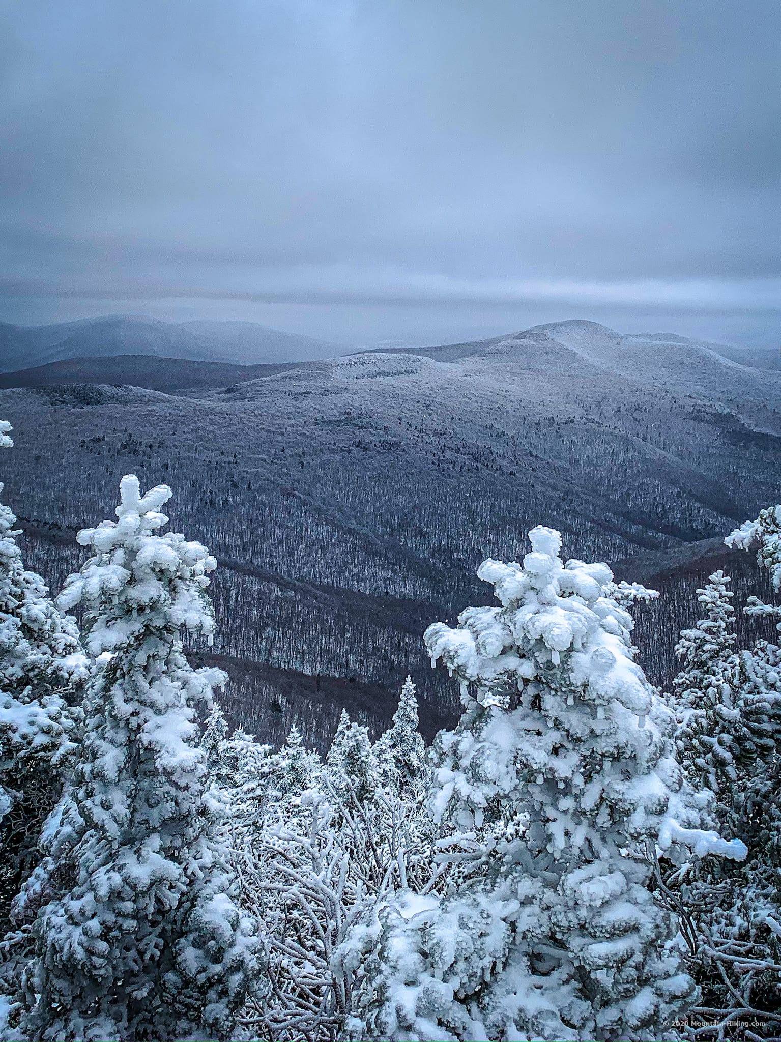
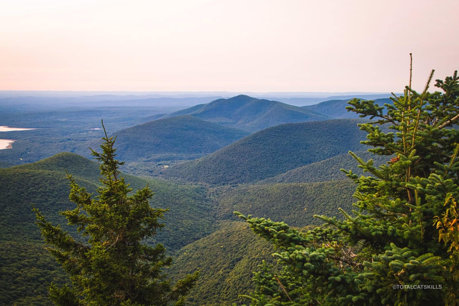
Right above the lemon squeeze, you’ll find an opening on the left with a large boulder. This spot offers the very best view of Slide Mountain in the Catskills. The scale of the mountain you have just climbed over is awe-inspiring.
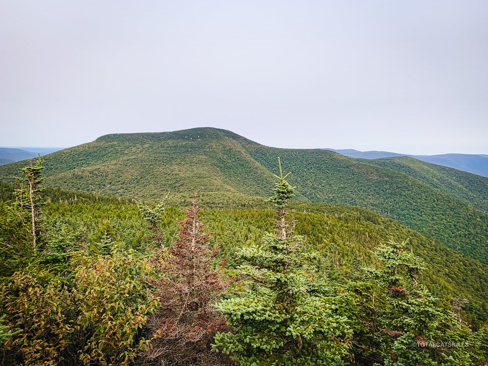
For kicks, here’s what that same view looks like in January…
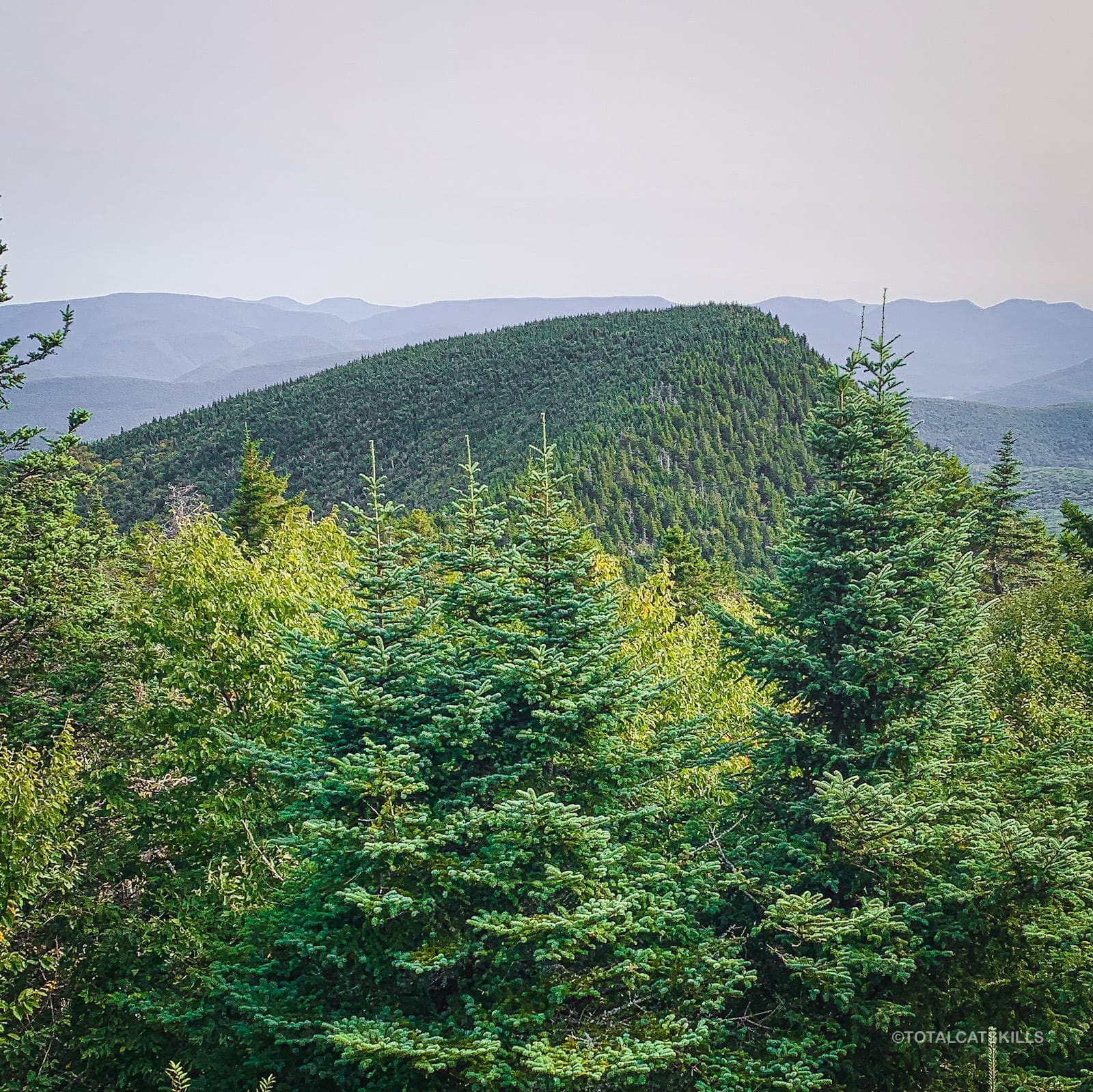
Looking north/to your right, you can also now once again see Giant Ledge and Panther mountains — this time from a very different angle than from the earlier lookout back on Slide Mountain.
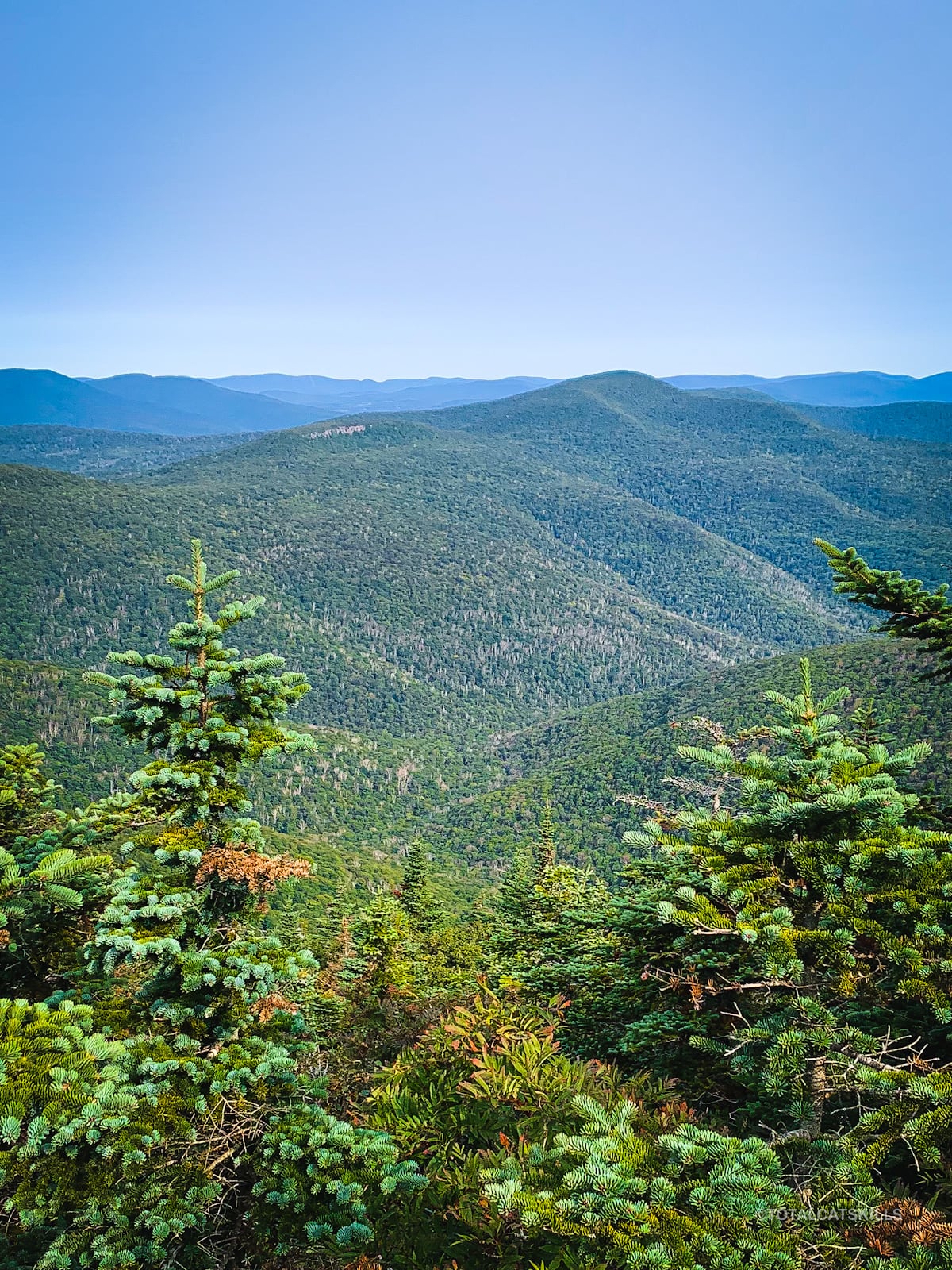
And here’s what that same scene looks like in January…
Cornell’s Summit
Not far from here, Cornell’s summit is just off trail. It’s up a very short unmarked spur. It’s pretty obvious. Just keep an eye on the right side of the trail. A small round opening marks the spot.
A partial view through an opening in the trees is a sweet teaser for what’s coming soon.
Return to the trail and turn right, once again following the red blazes and heading toward Wittenberg.
Cornell Crack
Cornell Crack is one of the very top highlights of hiking in the Catskills: a giant rock formation in the shape of a sharp v-shaped crevice you must climb through to pass.
Before you climb down, look for a small ledge above the crack, on the right side. From there, you get this amazing view of Wittenberg, behind which you can also see the eastern Devil’s Path and the Blackhead range.
Climbing Cornell Crack is difficult for most people. You will have to asses your options and find a safe way down for yourself. Take your time to figure out whatever works for you.
On this day, the rock was bone dry and so its surface was quite grippy. I was able to navigate the Crack easily in both directions, even with my backpack on.
If it had been wet? Whole other story. I might well have pulled out my webbing again. Snow and ice present a slew of additional safety concerns.
But in the warm months, when it’s dry, the Crack is quite doable. Just take your time, work out a method for yourself, and proceed slowly with caution.
After the Crack, plenty more beautiful hiking…
Tricky Spot / Return of Cell
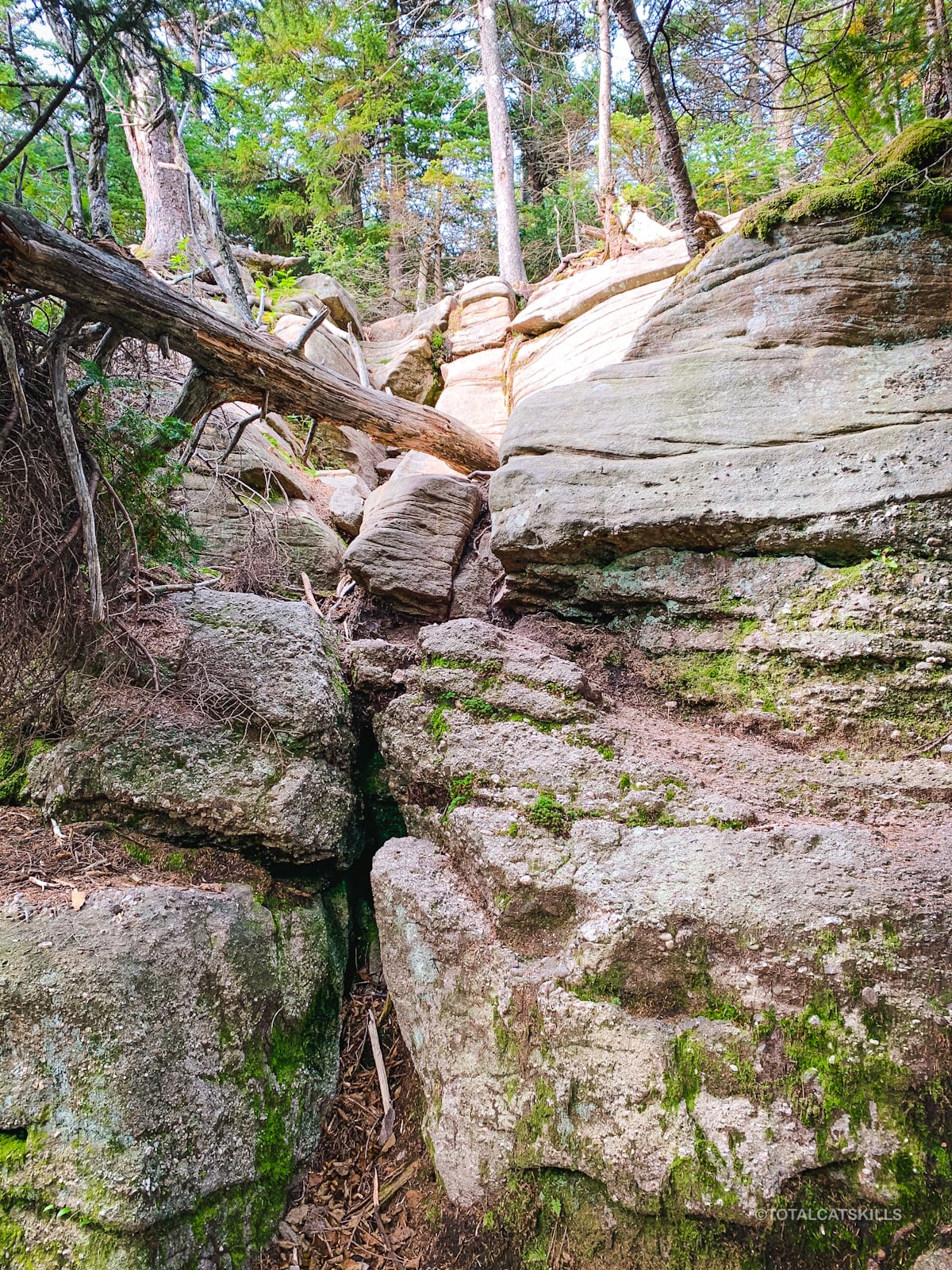
About 900’ after Cornell Crack, you’ll come to another tricky spot, a very rugged rock chimney. Currently, there is an old bare blowdown in the chimney.
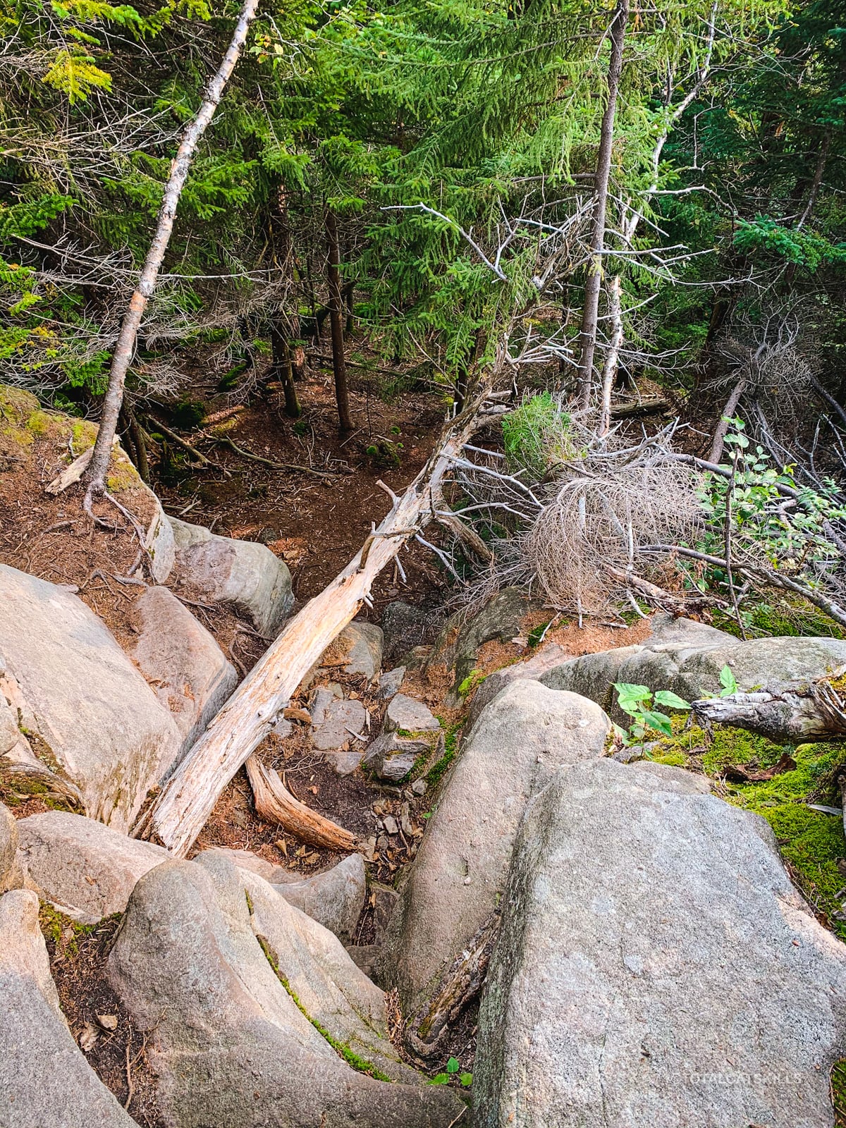
There are several ways down, depending on your preference. I found a way down on the left side of the above photo.
Note: from the top of this chimney, you can get a pretty good LTE signal, and cell coverage continues to be semi-decent between this spot and Wittenberg‘s summit.
Here’s the view from below. It doesn’t look too bad but this angle is deceptive. This spot definitely needs care.
Bruin’s Causeway
Continue down into the col between Cornell and Wittenberg.
At the half-way point, looks for safe spots to step off trail. There are some nice views to be had. But be careful…
This is one of the highest cols in the Catskills and it’s known as the Bruin’s Causeway for the bears that are said that traverse it regularly. The drop-off on either side is so precipitous it’s almost an arete.
The trail right here really is on a knife-edge.
Somewhere around here, too — according to the NYNJTC Long Path note — a very old, steep and gnarly, unmarked trail descends to Moonhaw Road. I plan to explore that route soon.
Between here and Wittenberg’s summit, you’ll pass through a sweet little rock channel. Directly after exiting the channel, look for a small-but-lovely view to the Ashokan reservoir.
Wittenberg
Somehow, the climb from the col to Wittenberg’s famous summit ledge never feels as steep as it looks from the top of Cornell Crack. It’s just so pleasant.
You arrive at the summit from the southwest. The view immediately opens up to the north and east to take in the Devil’s Path, Samuels Point, the Ashokan Reservoir, Ashokan High Point, and even Friday and Balsam Cap are visible directly south.
It’s a solid 180° panorama, so rare in the Catskills.
Below, you can see Ashokan High Point which is 3086 ft high. Wittenberg is 3782 ft high. So this is what 700 ft of elevation difference looks like — at a distance of 6½ miles.
This marks your turn-around spot, unless you’ve staged a car in Woodland Valley which is four miles down the other (very steep) side of Wittenberg.
To return to Route 47, turn around, head back toward Cornell, and begin your long, beautiful walk out.
Final Advice
I made a mistake on the last leg of my hike out: I did not descend the west side of Slide Mountain via the Curtis Ormsbee trail.
I thought I’d save some time, and my legs, by shooting straight back down the boring old truck trail. But it was so tough, I was so tired, and that trail is so steep and lumpy, it really wore me down.
I don’t think I’ll ever hike that section again!
Similar Hikes
- IMO, this route can only be beaten by doing it in winter. That hike is the best hike in the Catskills, absolutely spectacular in the snow.
- A shorter, safer and much less taxing hike is a day hike over Indian Head and Twin. That route has a similar mix of untouched terrain, tricky scrambles, and epic scenery.
- A much tougher through-hike challenge would be doing the classic eastern half of the Devil’s Path.

Hike Slide, Cornell & Wittenberg Trailhead
Large, busy, popular lot.
Google Maps Location: 42.007986, -74.428461
The map below shows the exact topographic location of the trailhead
Cell Service
Service from the lookouts below Slide’s summit but, weirdly, not at the summit itself. Forget about service until you get to Cornell. Service between Cornell and Wittenberg is patchy surprisingly okay. Nothing in the col between Cornell & Slide. You’re very much on your own down there. My network is Verizon. YMMV.
4 responses to “Hike Slide, Cornell & Wittenberg”
Your comments are welcome here…
The parent mountain for this hike is Slide.

I just did this hike yesterday. My first three peaks of the Catskills! It was very challenging, I was in tears of fear coming down the Crack! Luckily we met the trail steward at the beginning of our hike so he came on the journey with us!
Oh wow, you really jumped in at the deep end! Well done!
Great article.
I just started hiking my 35, and this triple is certainly on my list. Great description of the route. Something to think about before heading there.
Thank you.
It’s definitely one of the highlights of the Park. A little sketchy in spots but such a rewarding hike.