Disclosure: This content may contain affiliate links. Read my disclosure policy.
Out and back bushwhack route. The steep sections are very steep.
Trailhead info at bottom of this post.
Hiking Trail Description
This is a fun and challenging short hike, through extremely varied terrain. Strong backcountry navigations skills are required. Waterproof boots are highly recommended.
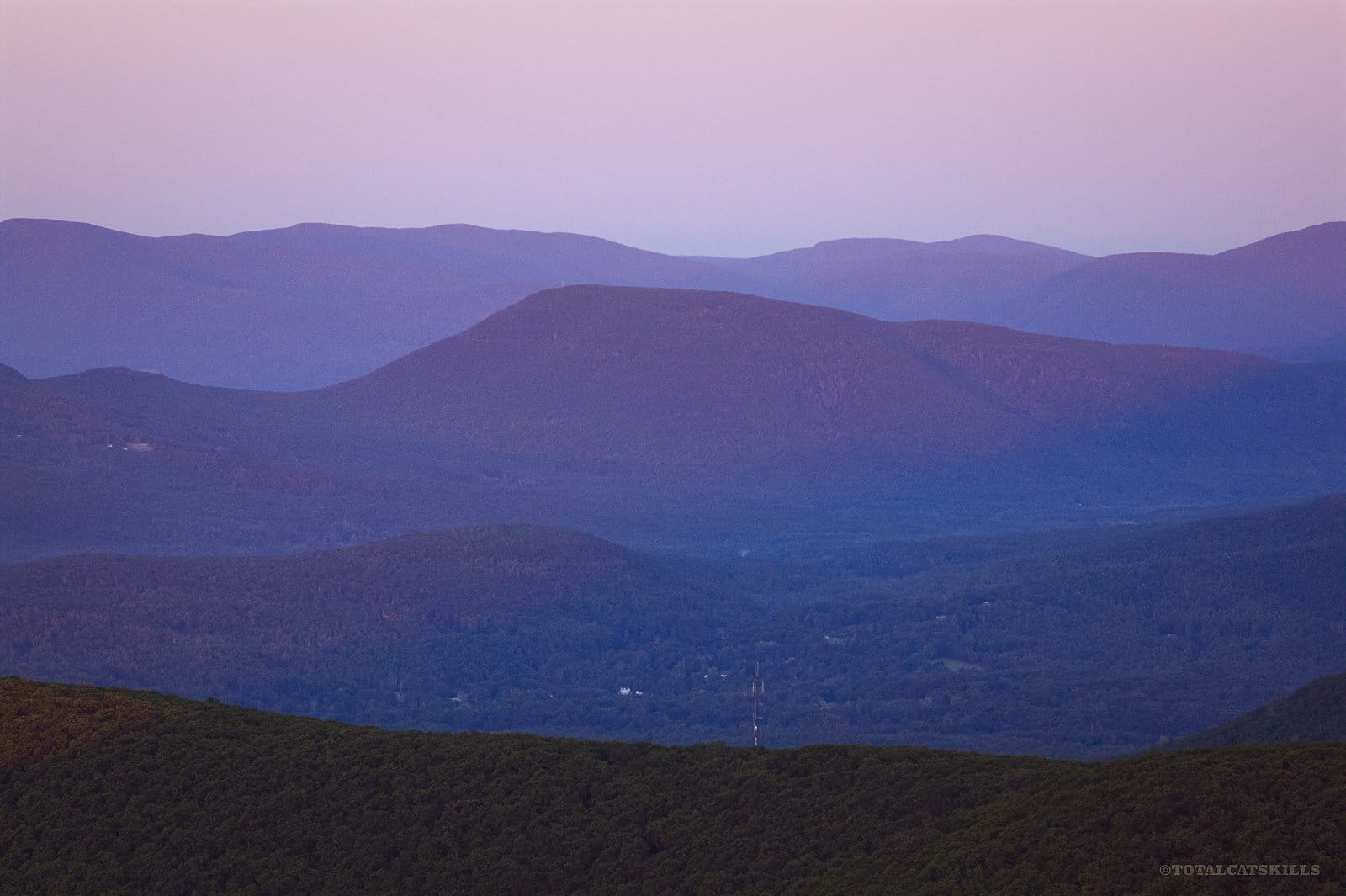
Ticetonyk Mountain is a lower Catskill peak in the Phoenicia/Mt. Tobias Wild Forest near the town of Mount Tremper.
This route uses a well-blazed trail to get started, and then plots a bushwhack route to some old woods roads which soon connect with a herd path that runs directly up the ridge to the summit.
This mountain is steep; every ascent is a huffer. Bring your best legs.
BTW, you might also enjoy…
- UPDATED › Best Bug Spray & Bug Repellent for Hikers
- CATSKILLS › Peakbagging The Catskills High Peaks (Ultimate Guide)
- STAY › Find Your Perfect Catskills Stay
- ADIRONDACKS › Wright, Algonquin & Iroquois Peaks
- LEARN › Teach Yourself How to Use a Compass
- ENTERTAINMENT › Best & Worst Hiking Movies
- Follow › My Instagram @TotalCatskills
- Follow › My Substack @TotalCatskills
- Follow › My writing for Times Union
Ticetonyk Eastern Bushwhack Route
This Ticetonyk hiking route includes…
- A weird start
- Lots of stone fences
- A small marsh
- Open woods
- Old woods roads
- A very sweet ridge walk
- Great views of the Ashokan Reservoir
- A celebrity connection
- A unique view of Samuels Point and the Burroughs Range
A full breakdown is provided in the hike notes below, with 17 valuable photos.
Ticetonyk Bushwhack Hike Time
Allow apx 2 hours for this hike.
Ticetonyk Elevation Gain
The elevation gain for this hike is 1300 feet (apx 400 meters).
Trail Notes & Gallery
The access road to this lot is short but severely washed-out (as of December 2023). Your car should have plenty of clearance; my Elantra barely made it up the heavily rutted incline.
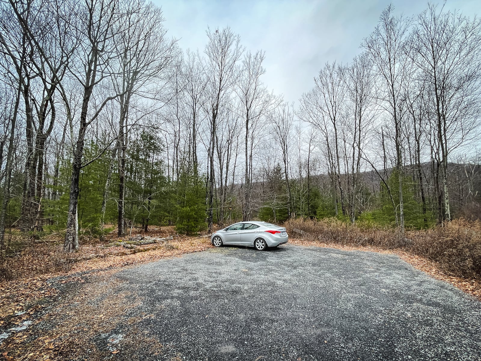
But the lot itself is generous—much bigger than the western lot just two minutes away, if you want to hike the relatively new Ticetonyk Trail to a great scenic view.
Although this route contains true bushwhacking, it begins with what must be the strangest section of public land in the entire Catskills…
 You’ve got the basic details, but there’s so much more…
Unlock this site now to get complete intel on every route, including my full photo galleries, personal insights and tips. Elevate your next hike with deep trail beta. Experience hundreds of amazing routes at their absolute finest. With Mountain-Hiking.com, you’re not just skimming the surface.
Sean


Similar Hikes
Parts of this hike are true bushwhack, meaning there is no trail to follow. Most of it, though, is blazed trails and herd paths. Still, you should be an experienced backcountry hiker before attempting this off-trail route.
Untrailed hikes are great when you want some solitude, and this one comes with two great scenic views. The cost? It’s quite steep.
Read More
Get full access…
Get instant access to the full version of this site and enjoy great supporter benefits: full galleries, full trail notes, early access to the latest content, and more.
Hot on the website right now…
Follow for more…
Follow my @TotalCatskills content on Instagram for regular hiking inspo and safe, inclusive community.
Bushwhack Ticetonyk South Ridge Trailhead
Small lot. Washed-out access road. Your car should have good clearance.
Google Maps Location: 41.990480, -74.214373
The map below shows the exact topographic location of the trailhead
Cell Service
Patchy all over, but better than most Catskills hikes! My network is Verizon. YMMV.
2 responses to “Bushwhack Ticetonyk South Ridge”
Your comments are welcome here…
The parent mountain for this hike is Ticetonyk.
I can’t wait to try this!
Did you ever get to try this route? I just re-hiked and loved it!