
Disclosure: This content may contain affiliate links. Read my disclosure policy.
A long out-and-back with a very steep first and last mile.
Trailhead info at bottom of this post.
Hiking Trail Description
This northern route to Panther Mountain from Fox Hollow — a quiet and wild place — offers ever-changing terrain and lots of wildlife.
Most hikers climb Panther Mountain from the south via Giant Ledge. That classic route is super fun but much shorter and, if you want a workout, it offers far less elevation gain.
This longer, steeper route to Panther is dotted with dramatic terrain and epic views of the Western Devil’s Path that most hikers never see.
There’s nothing technically tricky about this route. Even the dramatic rock scrambles near the summit don’t require anything more than thoughtful footing. But I’ve marked it difficult because it’s long, and because the first mile is so steep.
In terms of effort, this single-peak hike is equivalent to hiking Wittenberg & Cornell from Woodland Valley. This is a great hike if you seek solitude.
Get access to hyper-detailed trail guides, insider tips, and expert advice. Join a vibrant community of like-minded hikers, receive exclusive content, and embark on unforgettable outdoor adventures. Whether you’re a seasoned outdoor enthusiast or just starting out on your hiking journey, this website provides invaluable resources to help you explore the best trails in the Catskills, Adirondacks, Hudson Highlands, Berkshires, and beyond. Get access now to all content on this website instantly and enjoy unique supporter benefits.
BTW, you might also enjoy…
- UPDATED › Best Bug Spray & Bug Repellent for Hikers
- CATSKILLS › Peakbagging The Catskills High Peaks (Ultimate Guide)
- STAY › Find Your Perfect Catskills Stay
- ADIRONDACKS › Wright, Algonquin & Iroquois Peaks
- LEARN › Teach Yourself How to Use a Compass
- ENTERTAINMENT › Best & Worst Hiking Movies
- Follow › My Instagram @TotalCatskills
- Follow › My Substack @TotalCatskills
- Follow › My writing for Times Union
Fox Hollow Parking Area
The parking area for Fox Hollow is a good size. The lot is used by locals who walk here regularly, and for accessing the nearby brooks, but this trail is comparatively little-used by hikers and you’ll likely always be able to grab a spot.
Panther Mountain from Fox Hollow Trail
After a very easy 500ft of flat trail, turn left and begin your ascent.
The trail is immediately steep and gets steeper.
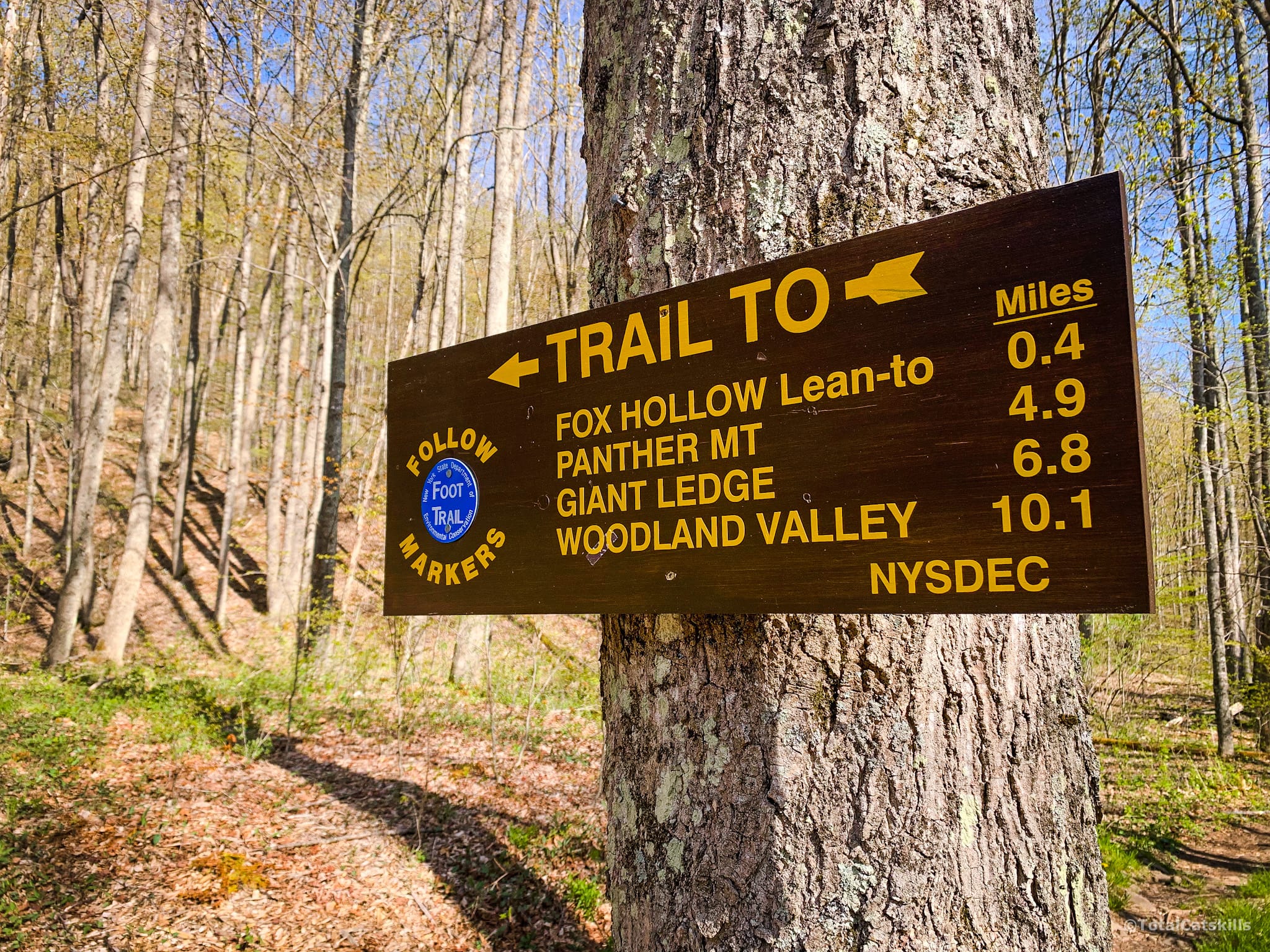
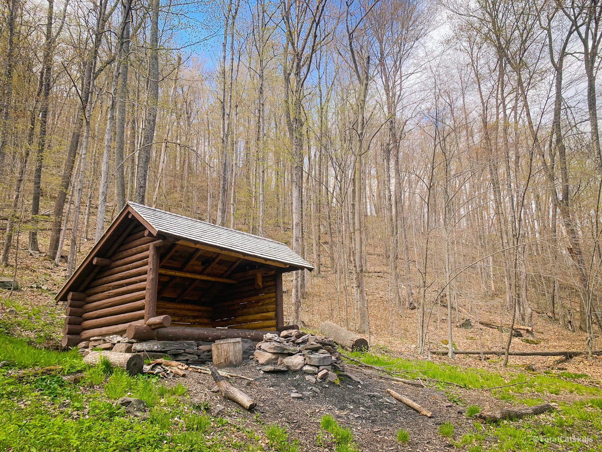
After ¼ mile or so, you’ll come to a sign pointing right, to a spur trail which leads quickly to the Fox Hollow lean-to and a spring.
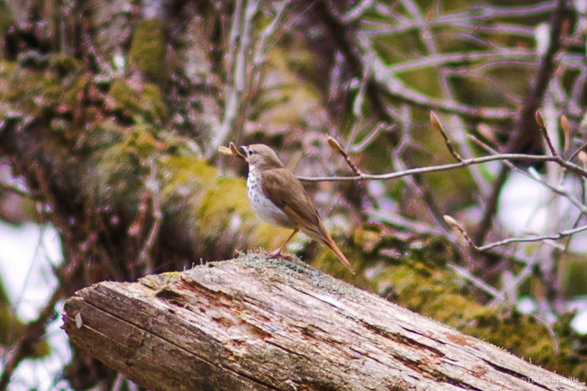
Return to the trail, and continue uphill. It’s a bit of a slog. On the other hand, by May, the woods are alive with birdsong. You’ll hear plenty of thrushes and woodpeckers. You can hear both in this video…
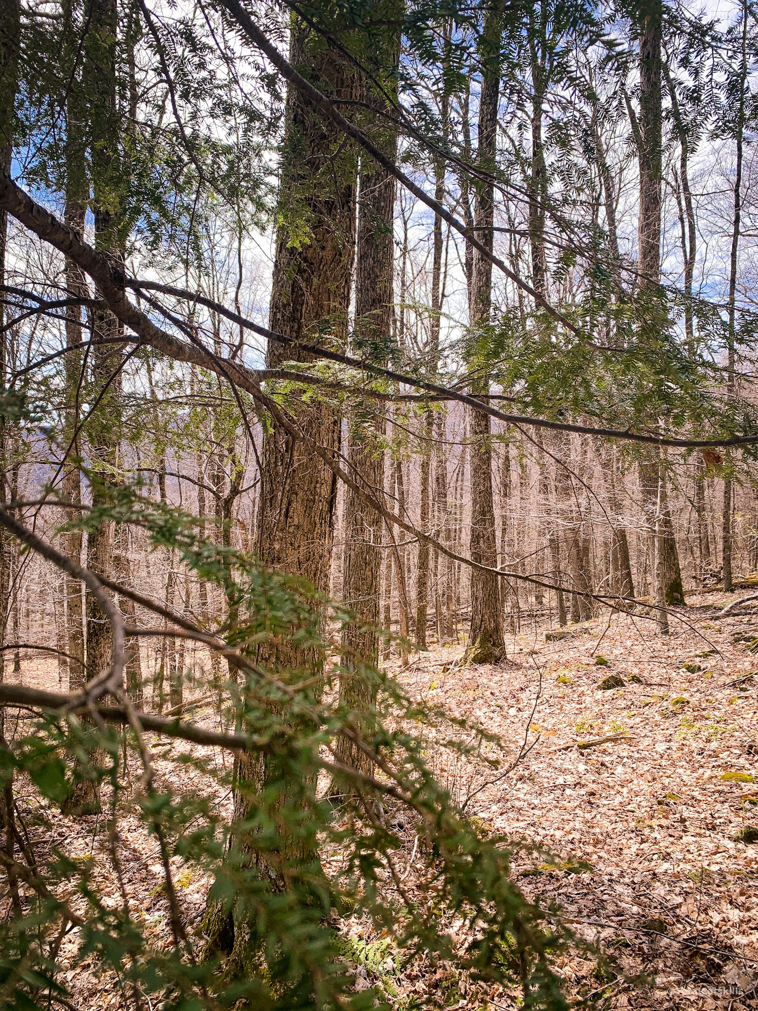
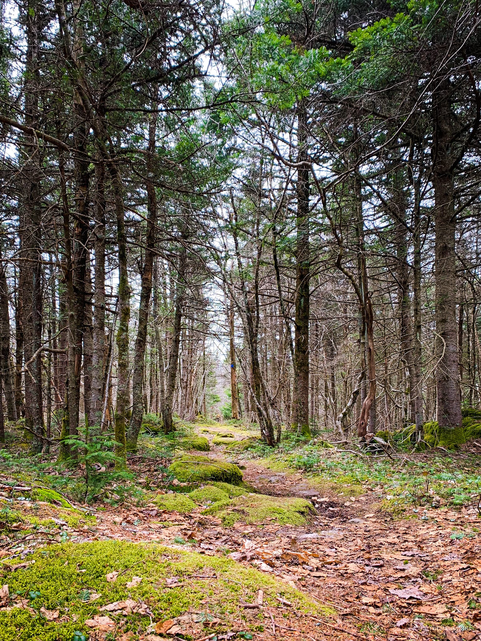
The forest is mostly open deciduous with the odd hemlock tree mixed in.
If you look over your shoulder, the large mountain rising up behind you is Garfield.
There are a few rugged patches and lots of blowdown but, mostly, it’s just a lot of work to gain the ridge.
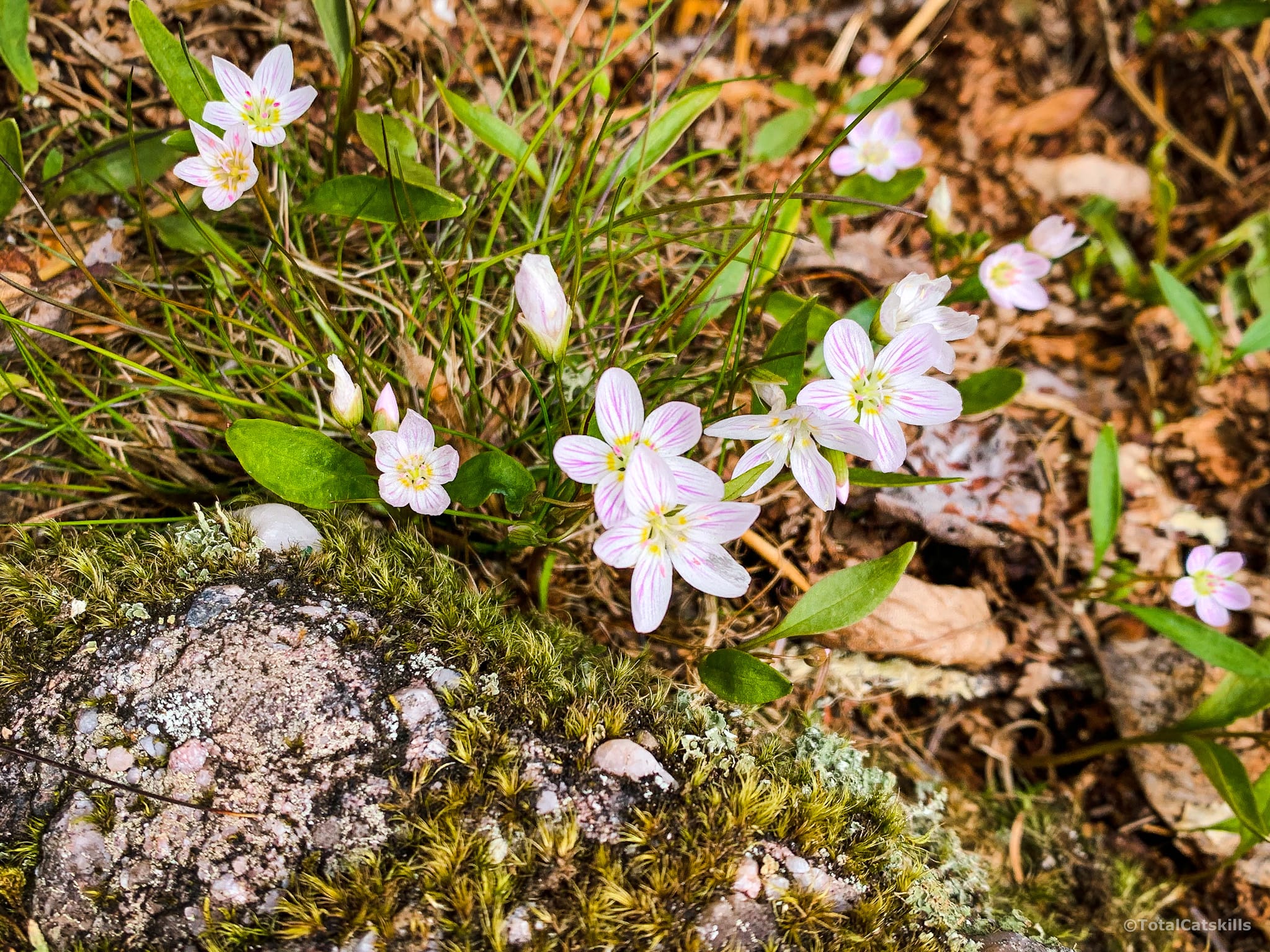
But there is some fun nature stuff along the way…
I noticed very few scratches in the rocks in Fox Hollow. Compared with the southern route, it’s just one more clue that very few hikers climb Panther this way, at least not in microspikes or snowshoes — crucial winter gear!
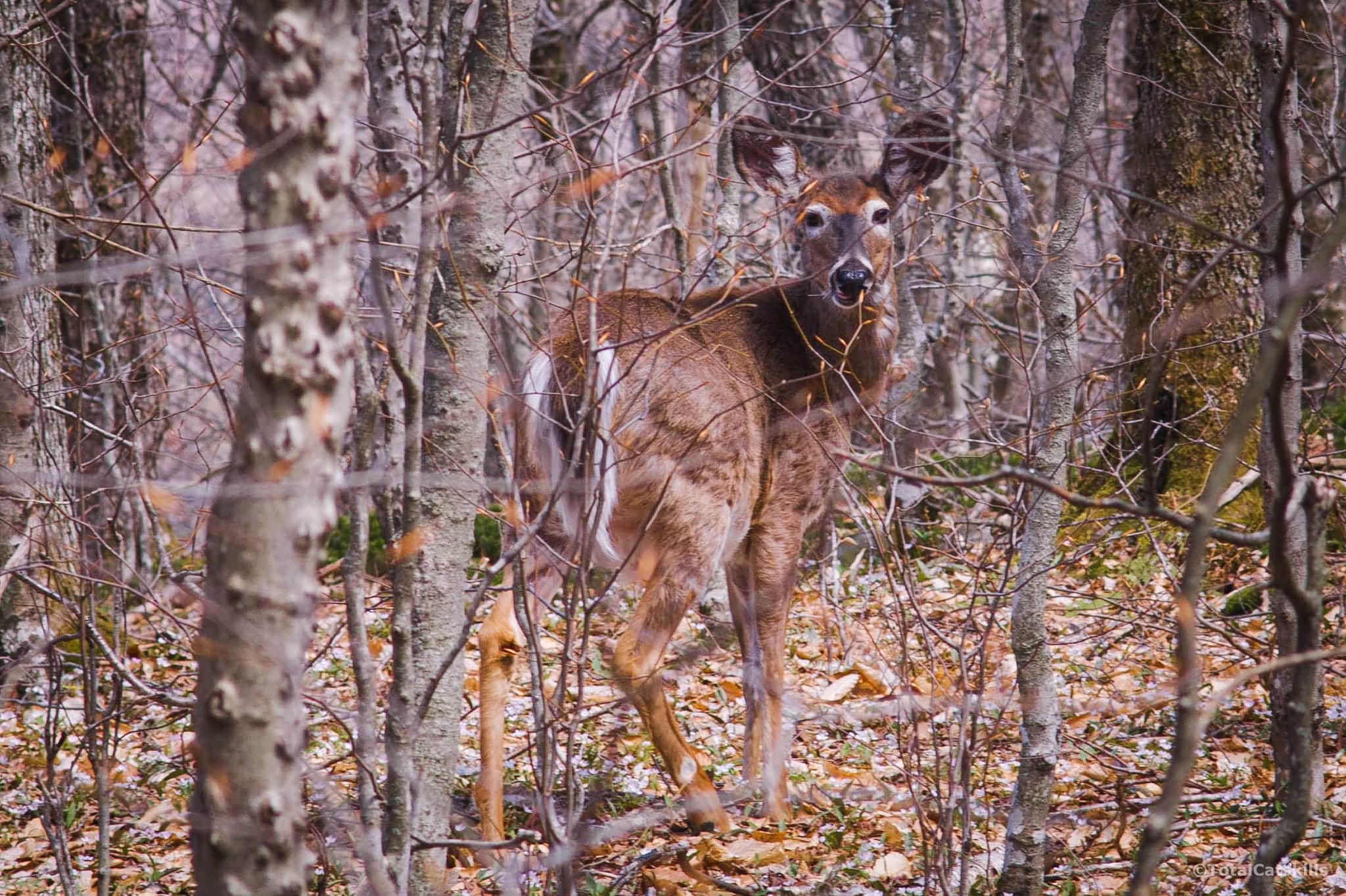
Fox Hollow Flora & Fauna
I never saw so many chipmunks and birds. On my way out, I came very close to two young deer, just minutes apart from each other.

At first, this deer and I spooked each other pretty badly but we ended up exchanging extremely meaningful eye contact. I think… we became… friends?
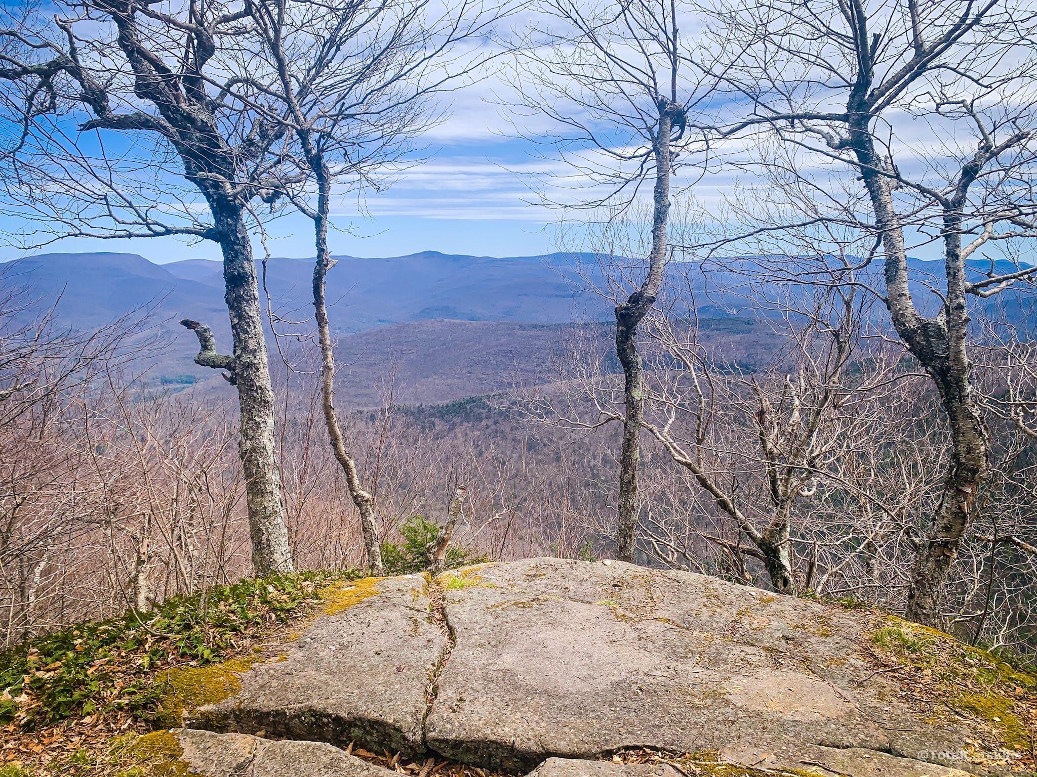
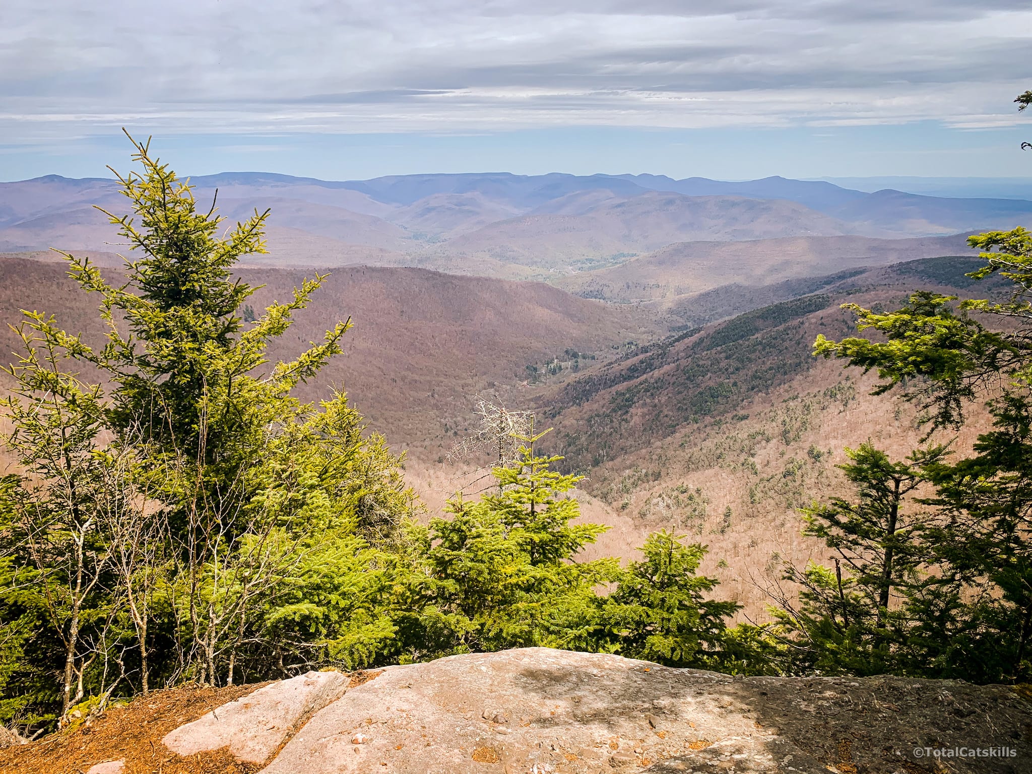
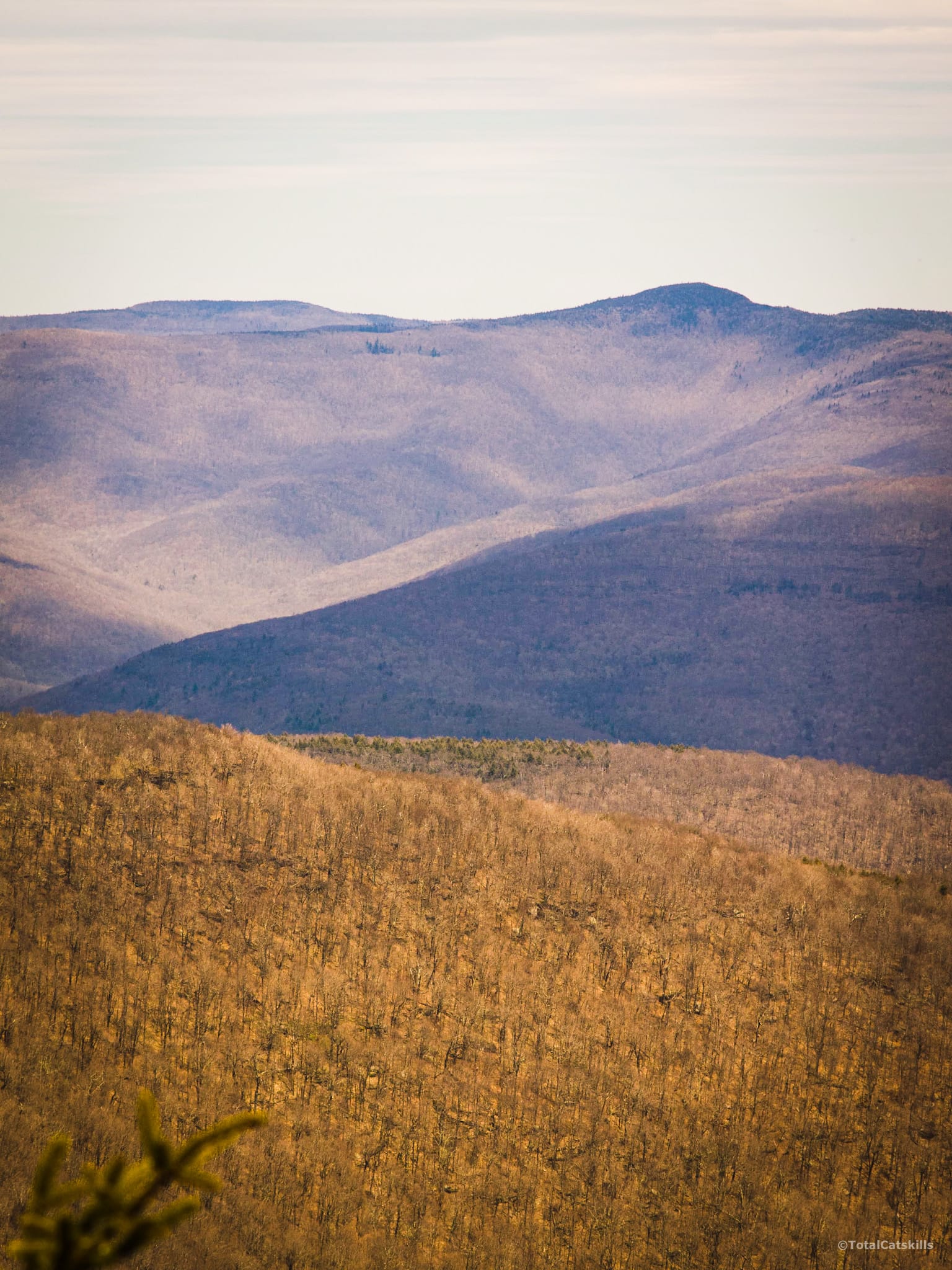
Grand Northern Ledge View
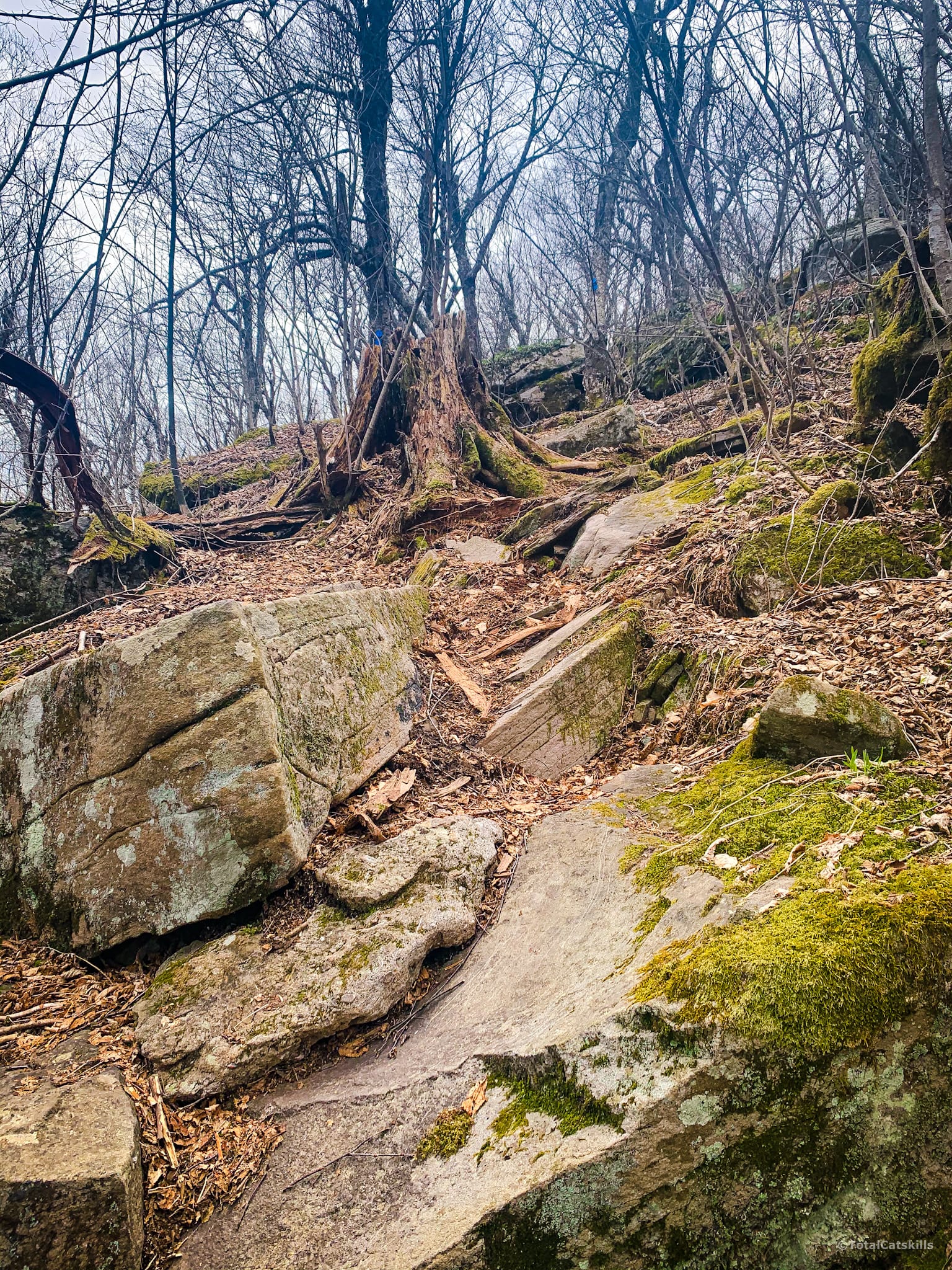
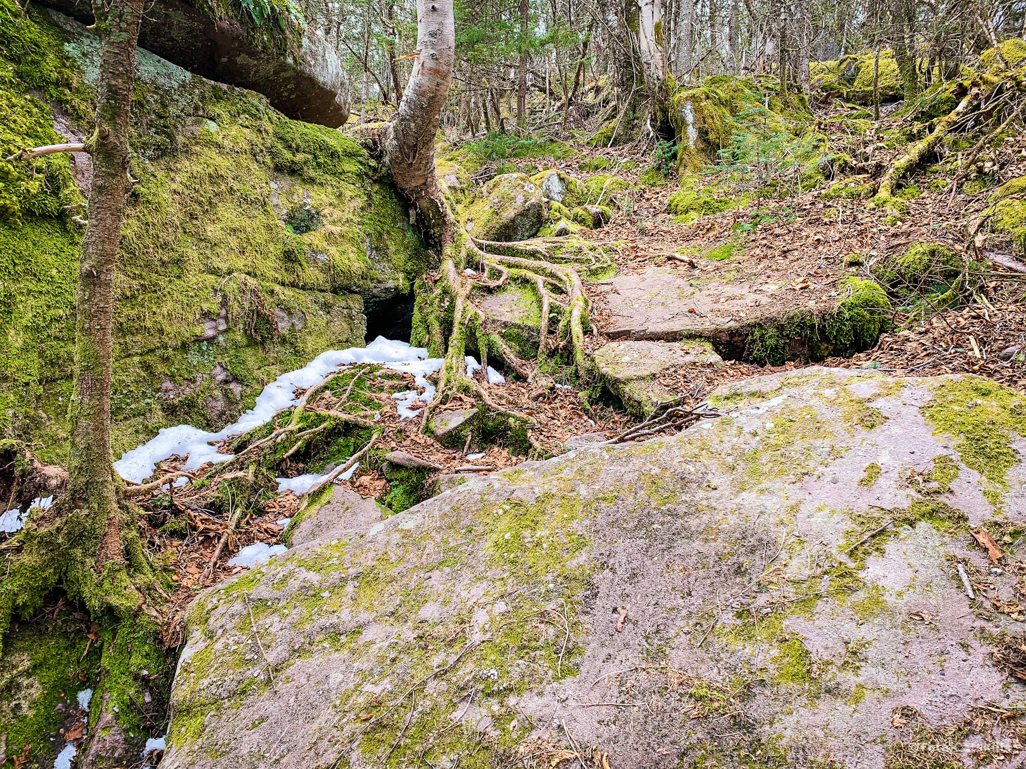
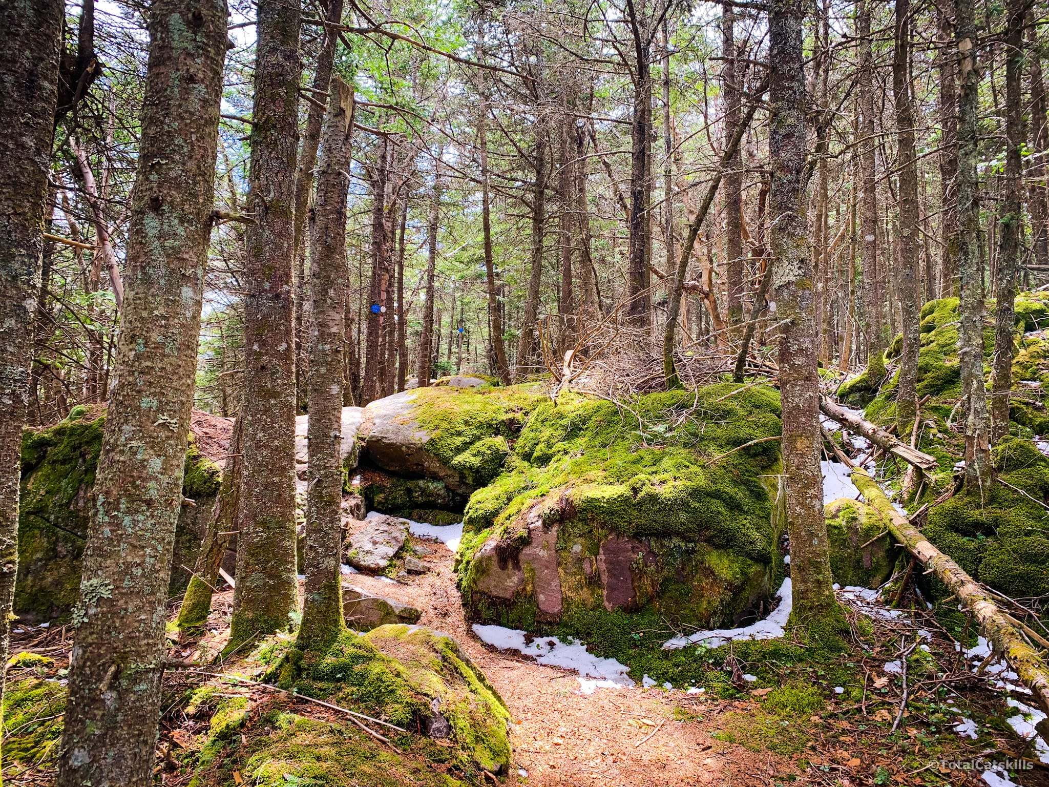
Above 3000’ the trail becomes increasingly rugged and delightful.
At 3200’ or just above, you’ll come to this ledge on the left side of the trail. The view is excellent: a great close-up view of Mount Sherrill and North Dome, St. Anne’s Peak and West Kill.
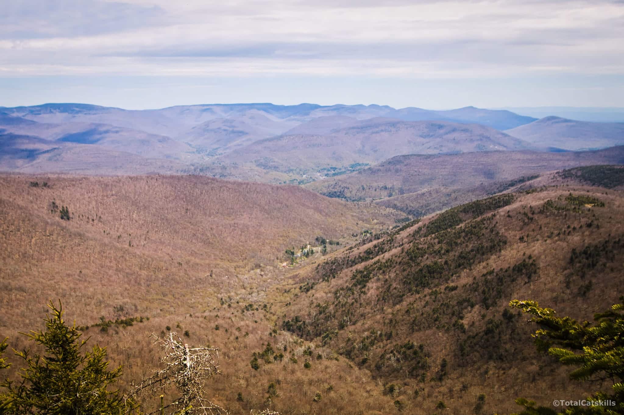
From there, the trail winds around a knob until you come up to an open flat area guarded by two small boulders.
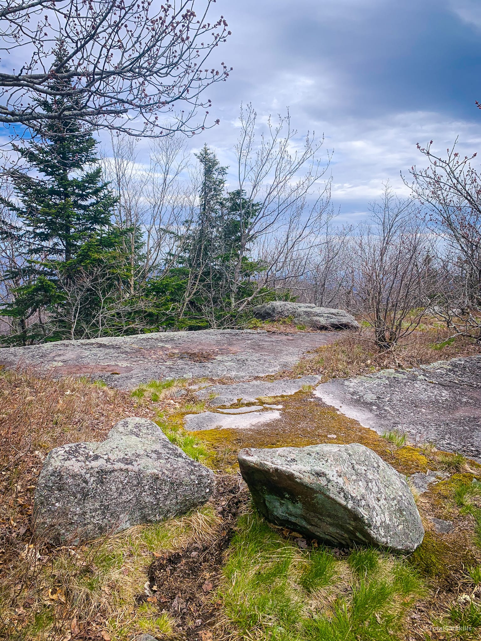
Through the trees to the left, Sherrill and North Dome are once again visible.
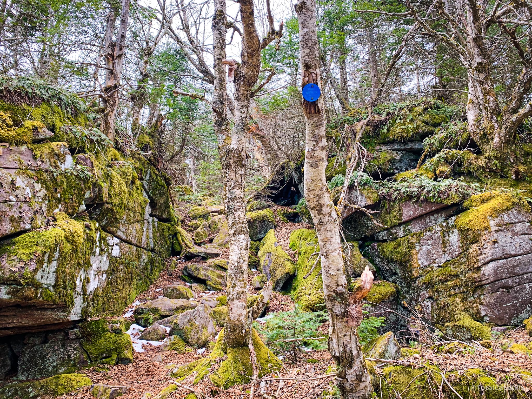
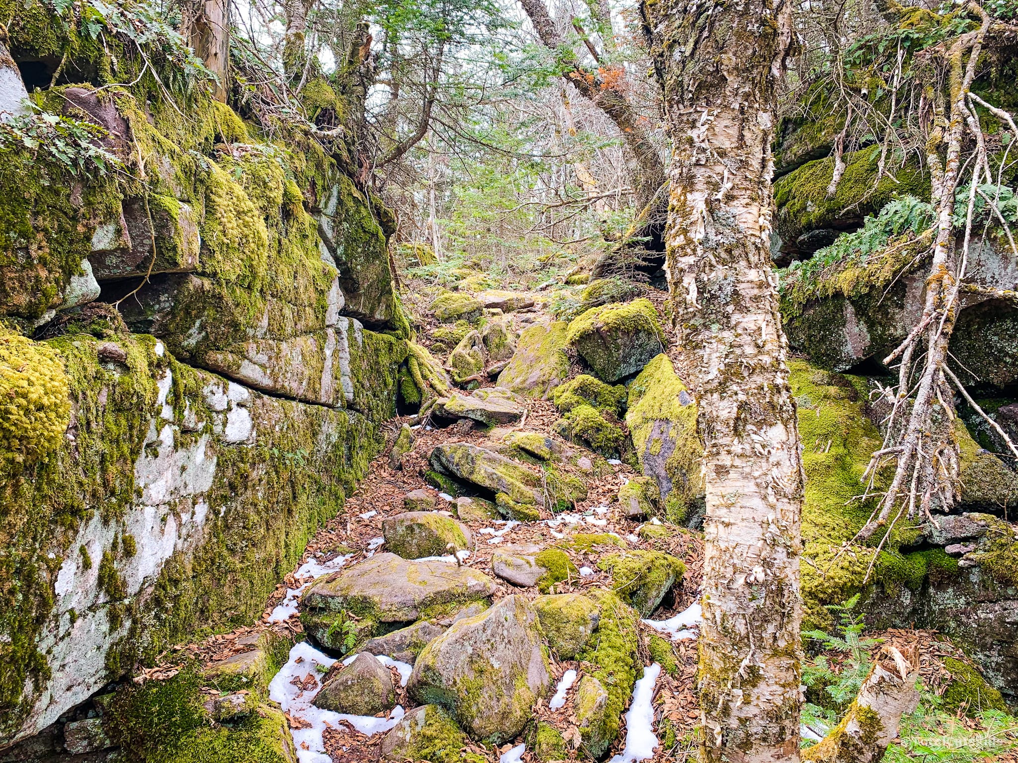
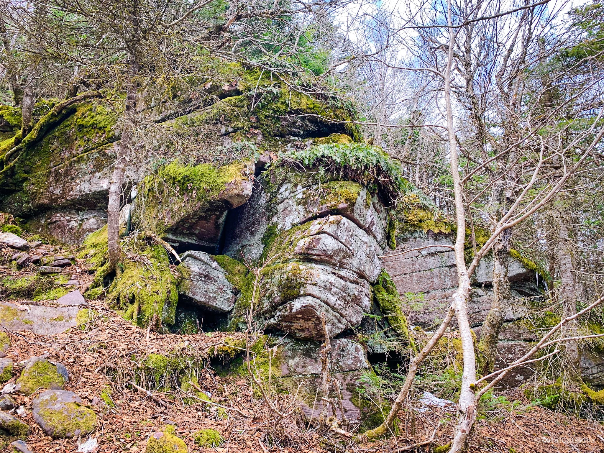
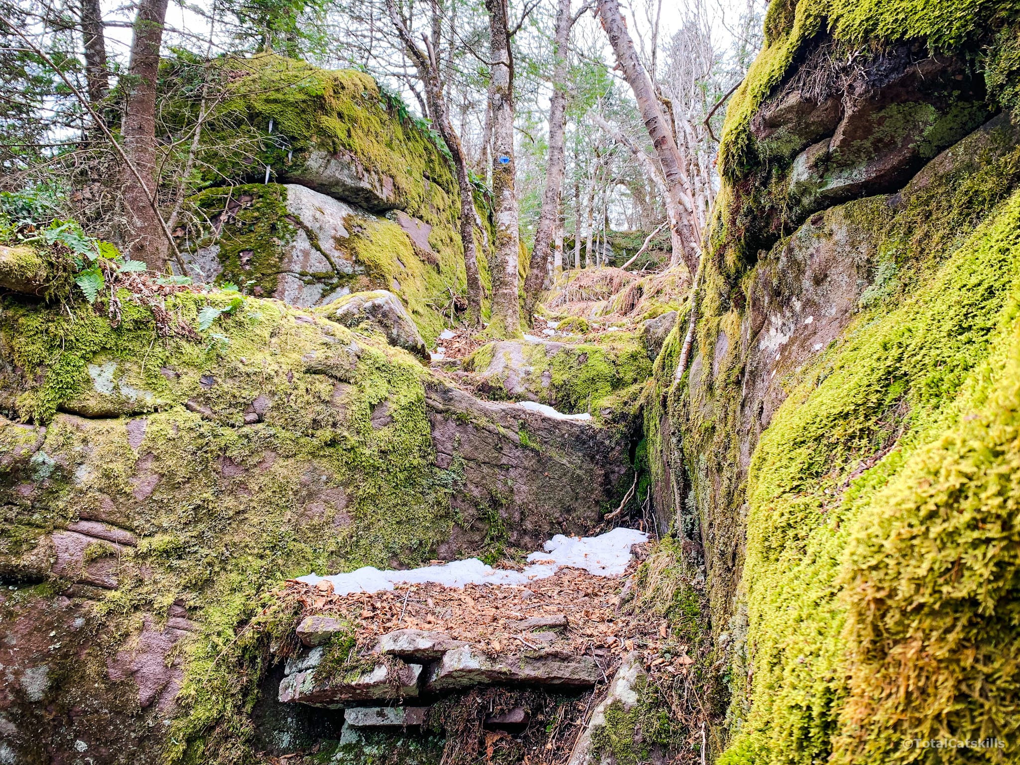
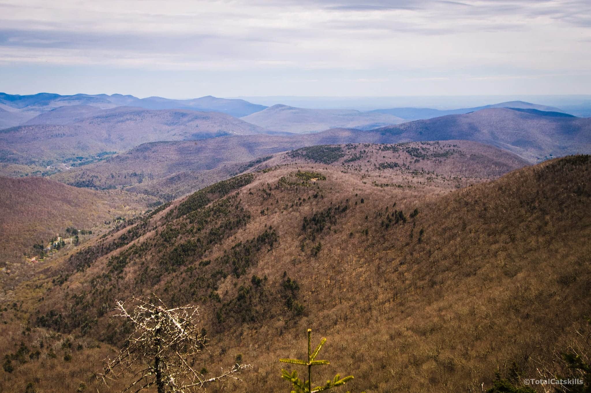
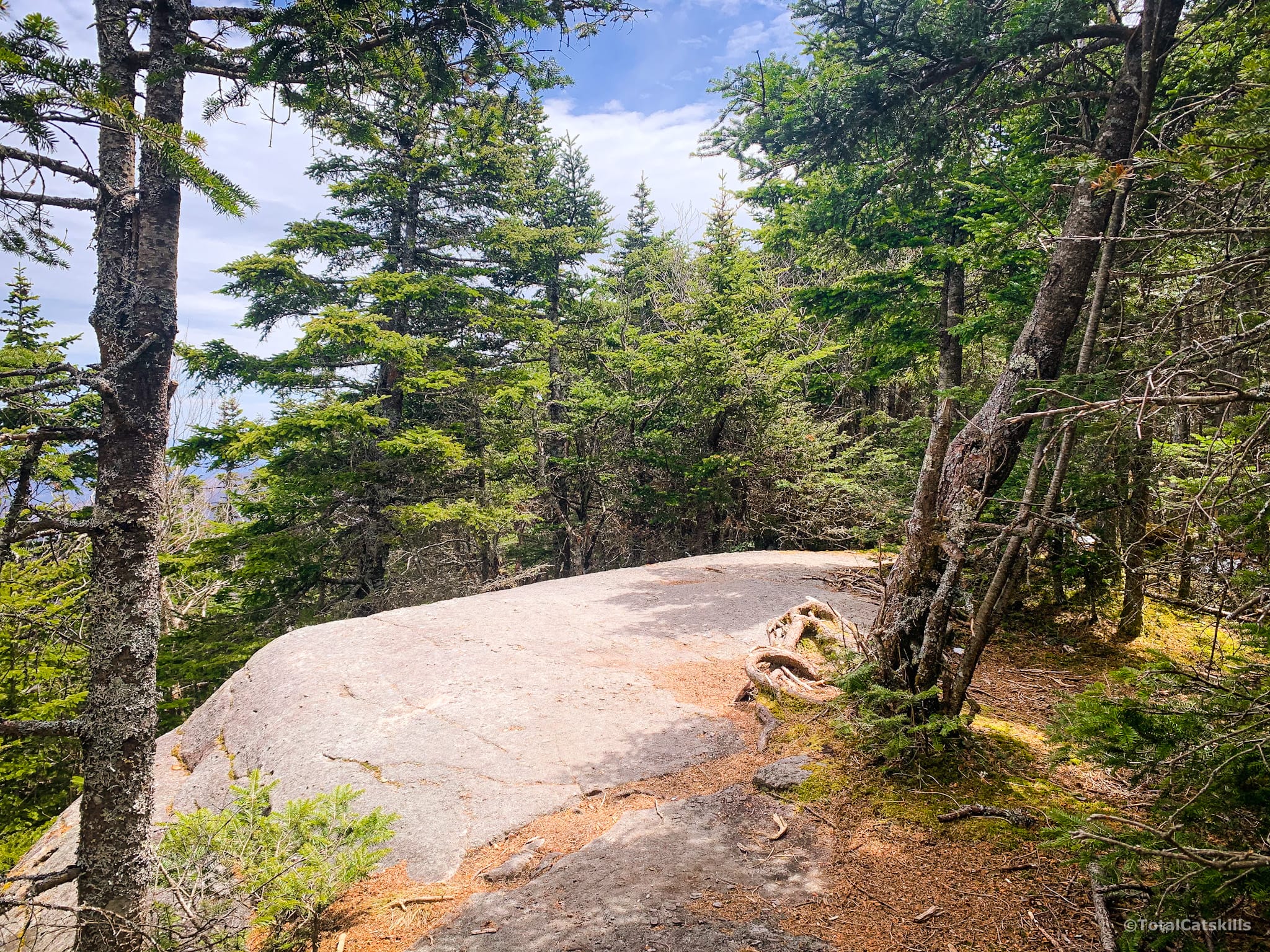
The trail continues south and descends briefly through some dramatic rock formations…
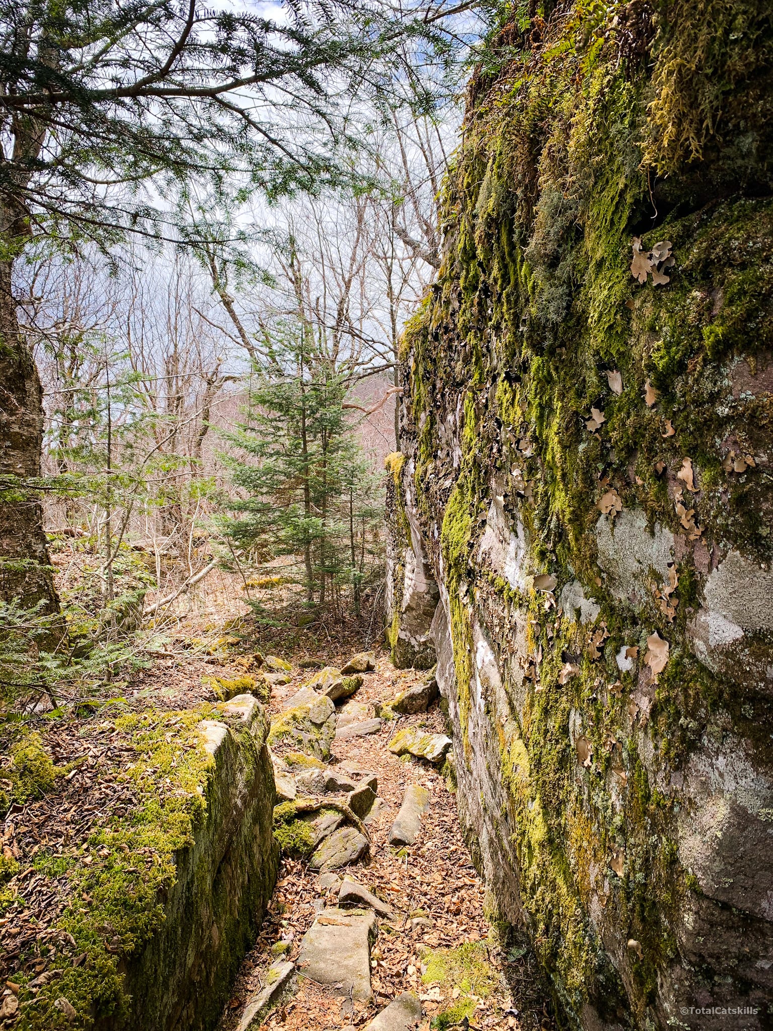
There are some nice easy flat sections too…
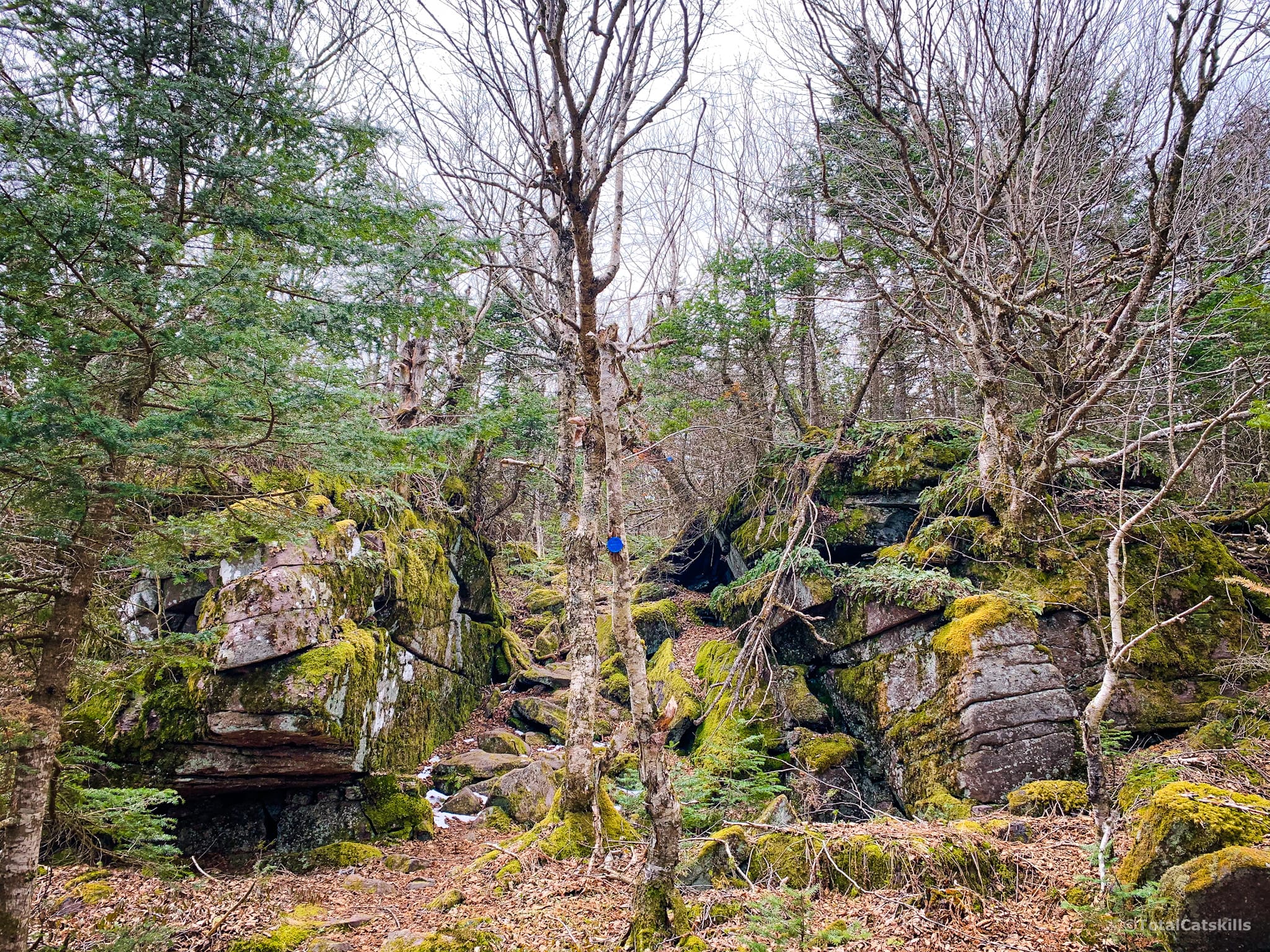
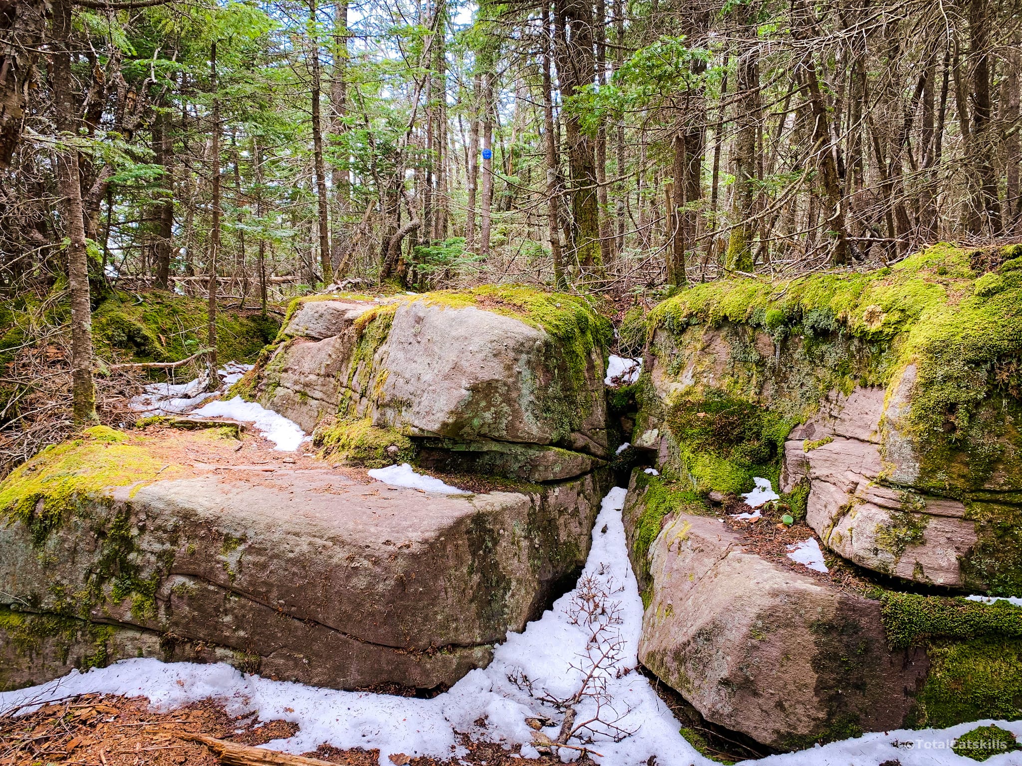
Rock Scrambles
Pass over another minor summit and you’ll finally arrive at the base of the main summit knob. From here, the hike really kicks off with several enormous rock channels to climb through and consistently interesting hiking terrain…
BTW, on this side of the mountain there is a gravity anomaly. Panther sits on top of an ancient asteroid impact crater, which struck the area from the south. You can read about it in this fascinating post about the geological history of Panther Mountain.
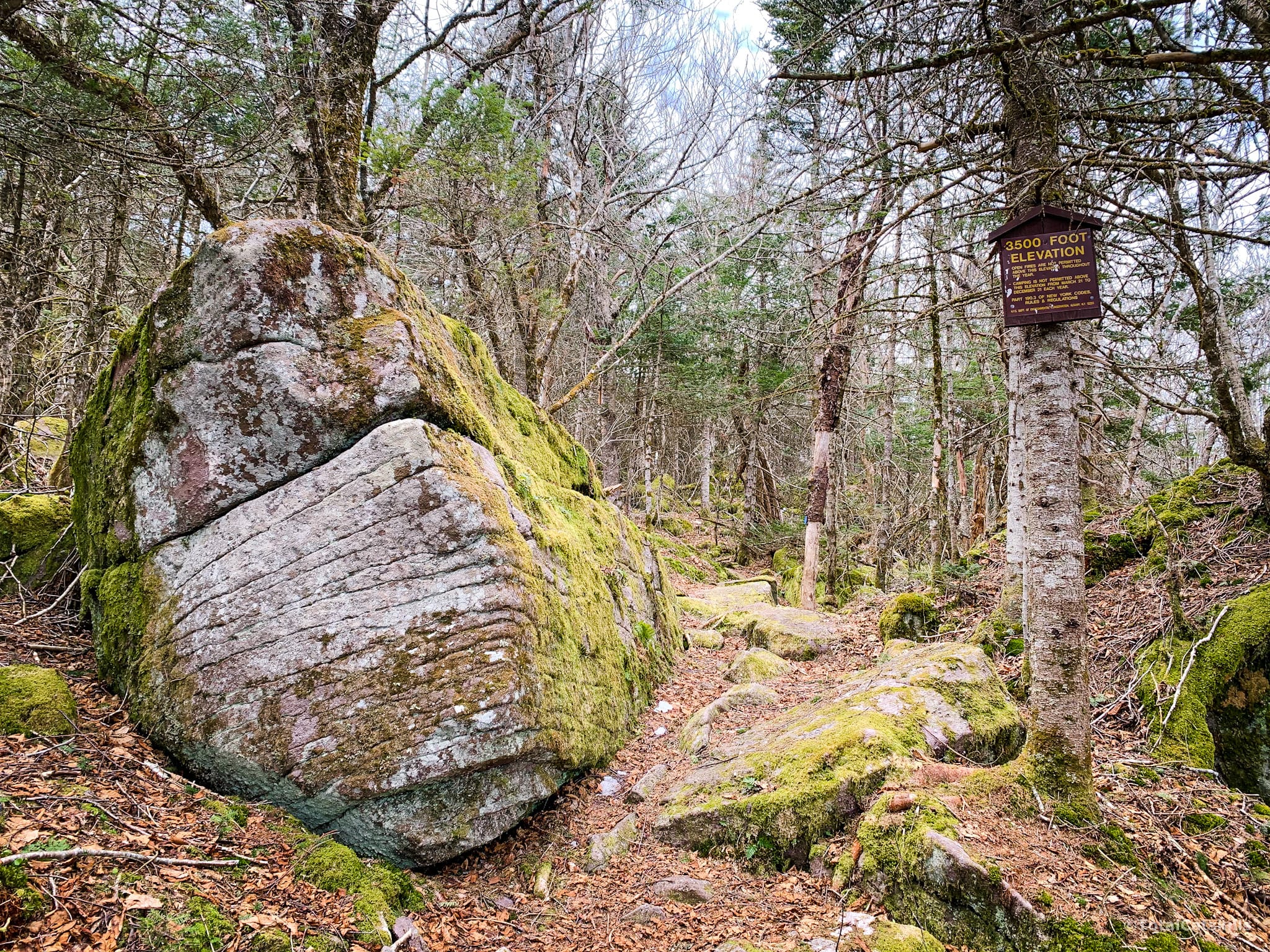
Past the 3500’ elevation sign the trail gets steep for the last push to the summit…
Panther’s Summit
Once you get to 3600’ the going is much easier. Panther’s summit ridge is huge, and is packed with pine trees that smell amazing all year long.
The few remaining rock ledges are small and easy to scramble over…
Panther’s Scenic Ledge
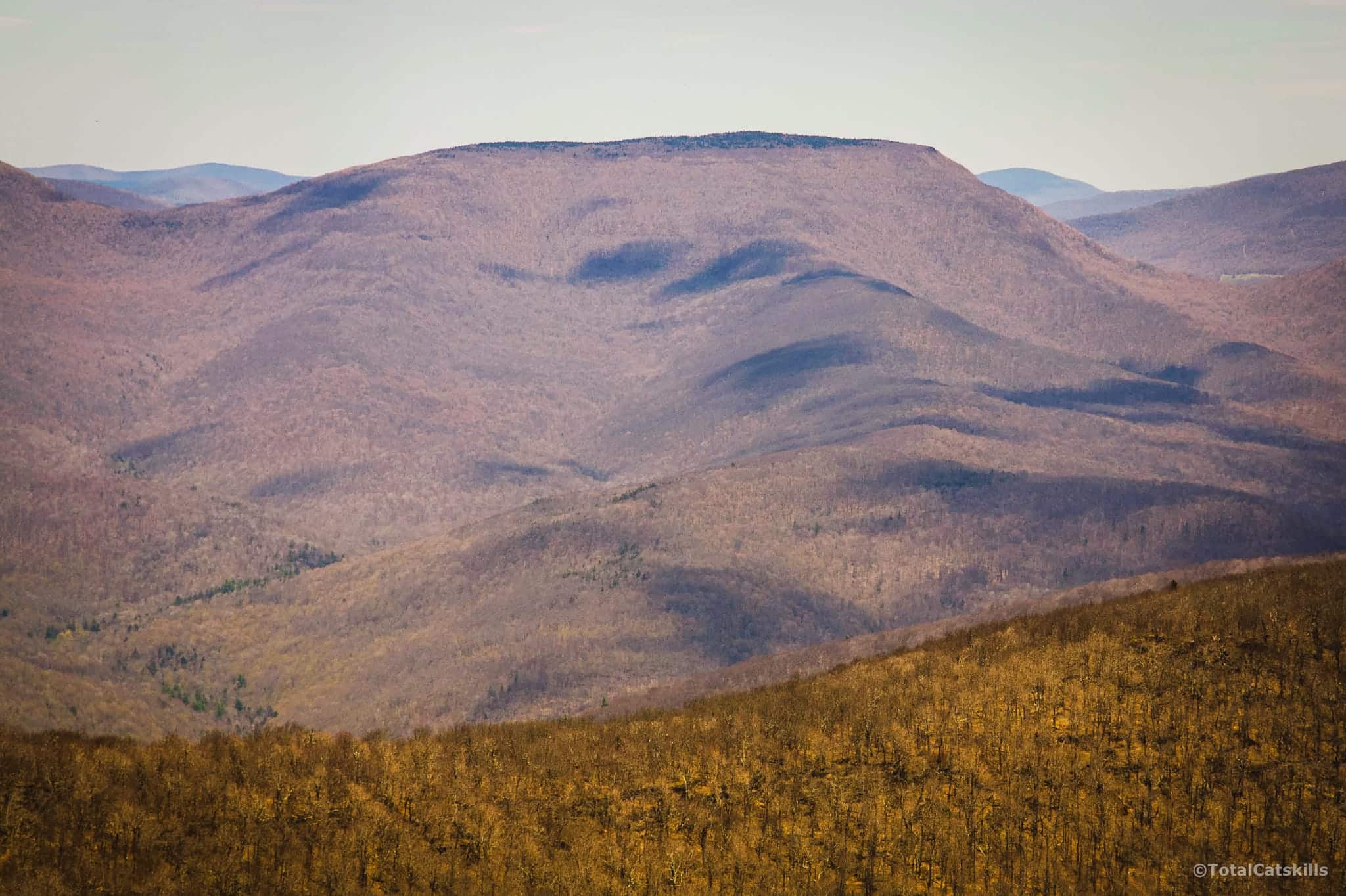
About 800’ before the actual summit, you’ll come to an open ledge with an excellent view east. You can see the entire Devil’s Path, Plattekill and Overlook Mountain.
Carefully lean out and look to the right to see the Ashokan Reservoir guarded by Ticetonyk Mountain.
Looking back to the left…
Panther’s Summit
A few minutes further on from the Scenic Ledge you’ll come to the summit, which is marked by a smaller ledge and a tree with gnarly, looped roots.
From here, I headed back immediately to the scenic ledge to admire the amazing view…
Then I stepped into the woods where a short herd path leads to a very peaceful place to sit in a moss-carpeted open area. It’s a great place to eat lunch if you don’t want to sit out in the blasting sun.
Similar Hikes
This is a very underrated and underused route. If you’re up for a longer hike, don’t mind some steep work, and enjoy solitude, this is a wonderful route to tackle. It’s rugged and very scenic.
Read More
Get full access…
Get instant access to the full version of this site and enjoy great supporter benefits: full galleries, full trail notes, early access to the latest content, and more.
Hot on the website right now…
Follow for more…
Follow my @TotalCatskills content on Instagram for regular hiking inspo and safe, inclusive community.

Panther Mountain from Fox Hollow Trailhead
Medium-sized lot. Not a popular route, so usually less busy than many lots.
Google Maps Location: 42.096999, -74.391620
The map below shows the exact topographic location of the trailhead
Cell Service
Once you get some elevation, you’ll have service for much of the hike. Only a few dead spots once you’re up on the ridge, above the first great look-out/ledge. My network is Verizon. YMMV.
3 responses to “Panther Mountain from Fox Hollow”
Your comments are welcome here…
The parent mountain for this hike is Panther.

Can’t wait to do this way up Panther! I have done the other side, but this sounds fantastic and the pictures correspond beautifully!
It’s so nice. Steep at first but then that side of Panther is so quiet and rugged. And some great views on the way!
Wonderful description, you’ve sold me!