Disclosure: This content may contain affiliate links. Read my disclosure policy.
One of the most popular trails in The Catskills: wide, accessible, scenic.
Trailhead info at bottom of this post.
Hiking Trail Description
Beloved by locals and visitors alike, the Ashokan Rail Trail is one of the most successful Catskills projects in living memory.
Nestled in the heart of the scenic Catskill Mountains in upstate New York, the Ashokan Rail Trail weaves a story of historical significance, natural splendor, and unparalleled recreational opportunities. This picturesque trail, once a vital rail corridor, has been thoughtfully transformed into a meandering path that beckons both seasoned adventurers and leisurely strollers alike.
Stretching approximately 11.5 miles through the serene landscapes of Ulster County, the Ashokan Rail Trail embarks on a journey alongside the Ashokan Reservoir, one of New York’s primary sources of pure drinking water. As you tread this path, you’ll be treated to an ever-changing panorama of woodlands, wetlands, and waterways—a symphony of colors and sounds that shift with the seasons.
The Ashokan Rail Trail is more than just a trail; it’s a connection to the past and a gateway to the region’s natural beauty. It invites you to step back in time to an era when locomotives chugged along these very tracks, transporting goods and passengers across this rugged terrain. Today, these same tracks carry you on a voyage of discovery through a landscape that has been meticulously preserved for your enjoyment.
BTW, you might also enjoy…
- UPDATED › Best Bug Spray & Bug Repellent for Hikers
- CATSKILLS › Peakbagging The Catskills High Peaks (Ultimate Guide)
- STAY › Find Your Perfect Catskills Stay
- ADIRONDACKS › Wright, Algonquin & Iroquois Peaks
- LEARN › Teach Yourself How to Use a Compass
- ENTERTAINMENT › Best & Worst Hiking Movies
- Follow › My Instagram @TotalCatskills
- Follow › My Substack @TotalCatskills
- Follow › My writing for Times Union
Whether you’re an avid cyclist, a dedicated hiker, or simply seeking a leisurely stroll with family and friends, the Ashokan Rail Trail offers an experience that resonates with both history buffs and nature enthusiasts. Join us as we explore this remarkable trail, uncovering its hidden gems, captivating vistas, and the profound sense of serenity that can only be found in the embrace of the Catskills.
Ashokan Rail Trail Info
The trail was developed by the DEC and DEP and opened in late 2019 to an ecstatic public reception. Since then, all trailheads have been consistently busy — every day of the week.
Getting There & Parking
From New York State Thruway Exit 19 in Kingston, take Route 28 West for 5.3 miles to the Woodstock Dike Trailhead.
There are two other trailheads with substantial parking. Ashokan Station Trailhead is roughly half way along the length of the the trail. The third lot at the Boiceville Bridge Trailhead marks the western end of the Ashokan Rail Trail.
Parking at all trailheads for the Ashokan Rail Trail is always free.
How Long is the Ashokan Rail Trail?
End to end, the Ashokan Rail Trail is 11½ miles (18.5 km) long. It’s 12 feet wide the whole way, and is also extremely level. (There’s one small rise over a hump on the western side but it’s not anything that will present difficulty.)
Is the Ashokan Rail Trail Open?
The Ashokan Rail Trail is open from sunrise to sunset year-round.
In winter, the trail itself is not plowed so, after heavy snowfall, you will need snowshoes.
Are Dogs Allowed on The Ashokan Rail Trail?
Yes, but please carry out your pooch’s poop — don’t leave it by the side of the trail to “pick up later”. Ewww.
Get access to hyper-detailed trail guides, insider tips, and expert advice. Join a vibrant community of like-minded hikers, receive exclusive content, and embark on unforgettable outdoor adventures. Whether you’re a seasoned outdoor enthusiast or just starting out on your hiking journey, this website provides invaluable resources to help you explore the best trails in the Catskills, Adirondacks, Hudson Highlands, Berkshires, and beyond. Get access now to all content on this website instantly and enjoy unique supporter benefits.
Where is the Ashokan Rail Trail?
The trail is located on the north side of the Ashokan Reservoir in New York’s Catskills region.
It runs parallel to Route 28 which travels east / west.
The nearest interstate exit is Exit 19/Kingston on I-87. From the exit, take Route 28 heading west.
Ashokan Rail Trail Guide
If you have two cars, you can walk, run or cycle the Trail as a one way affair. On this day, I cycled it as an out-and-back for a total of 23 miles (37 km).
This video takes you along the full length of the trail in less than two minutes…
Where to Start?
I started at the eastern end of the Ashokan Rail Trail — the end nearest Woodstock and Kingston. It’s lovely — but you should note that this is the slightly-less-scenic end.
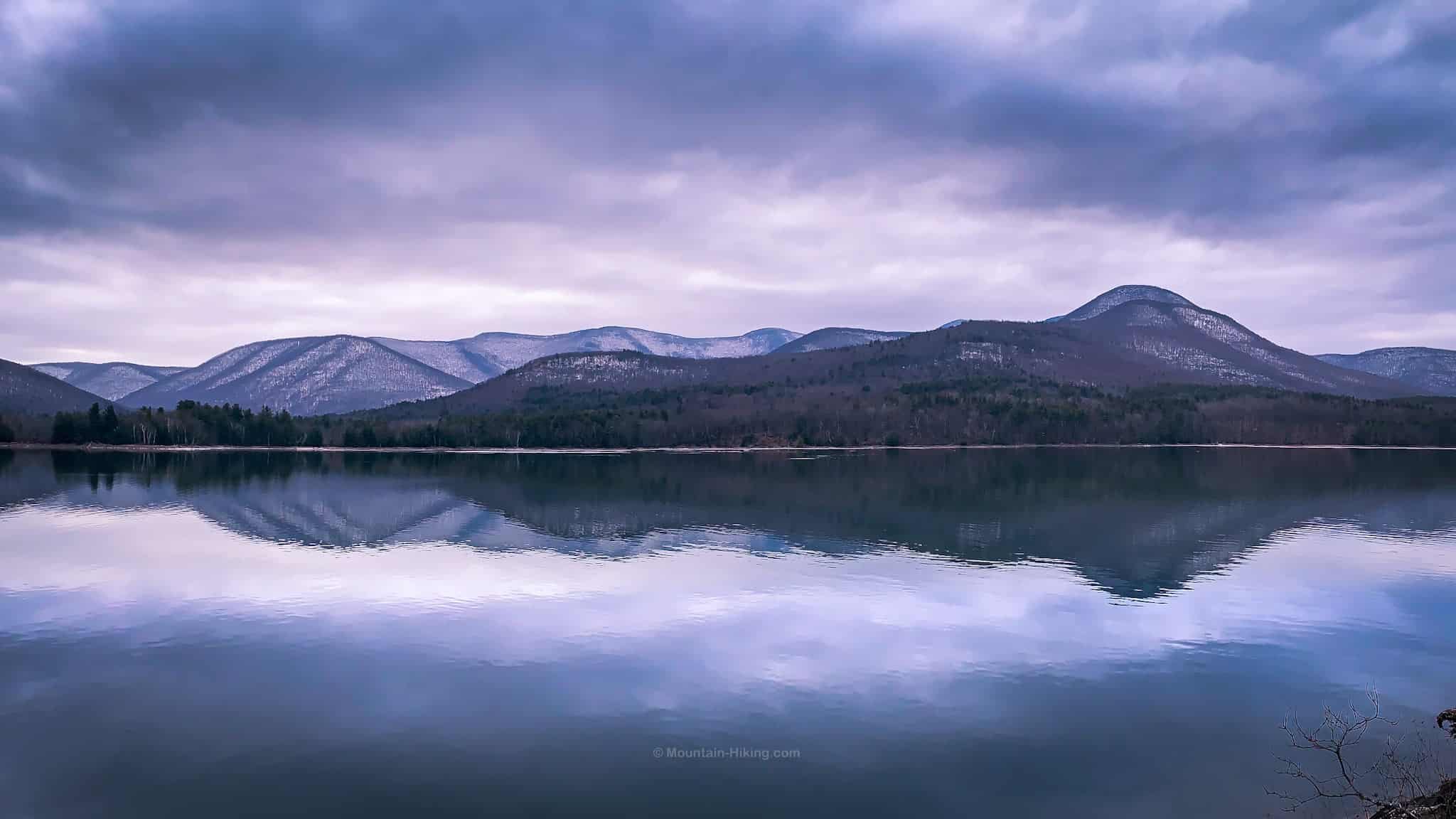
If you can only do one end of the trail, and want some wow-level scenery, start at the western end in Boiceville where, just 1½-2 miles from the trailhead, there are great views of the Burroughs Range and Ashokan High Point.
Ashokan Rail Trail: East Side
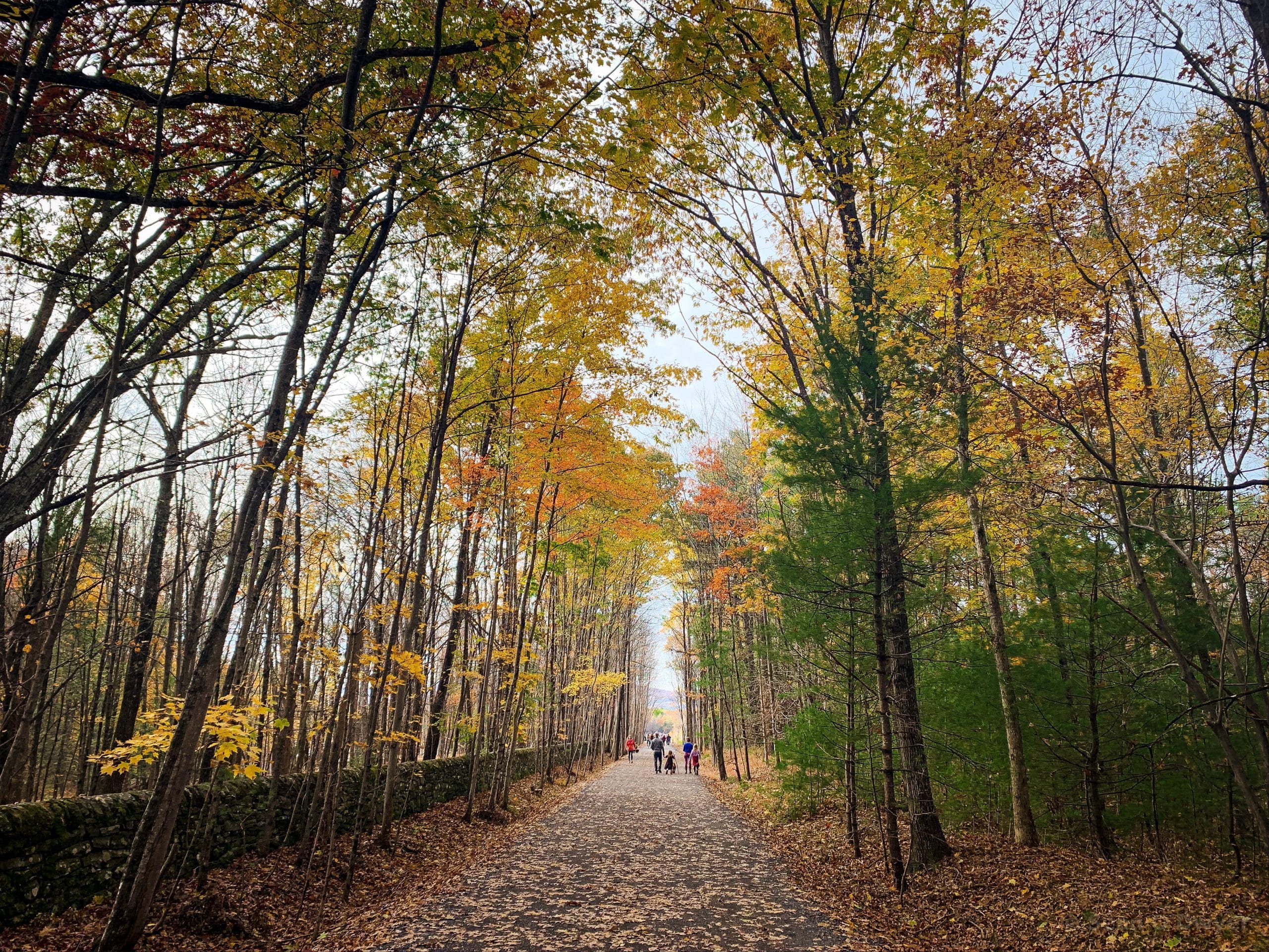
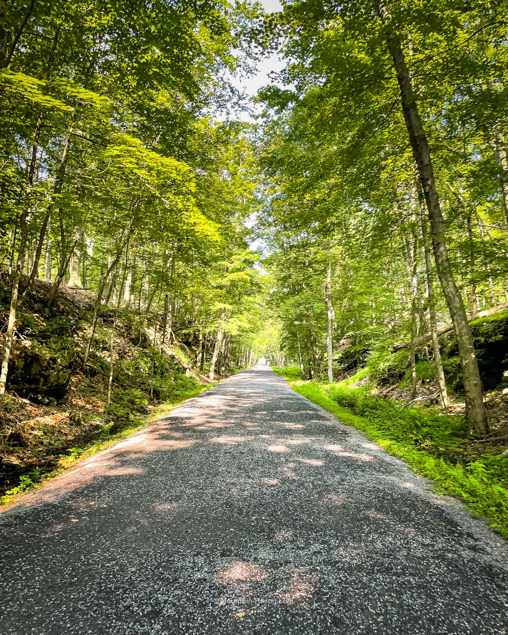
From the eastern trailhead, where I started, the wide flat trail first passes through a beautiful woods.
This is what it looks like in the fall…
In the summer months, of course, it’s lush with greenery…
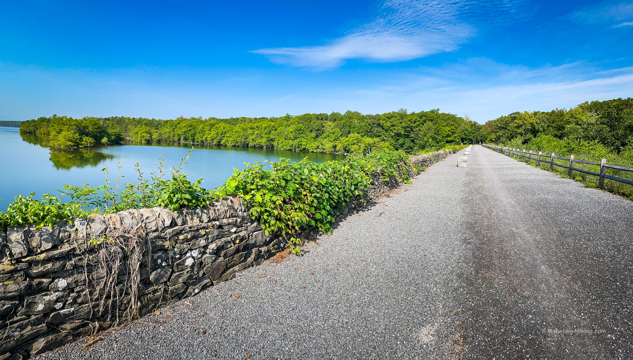
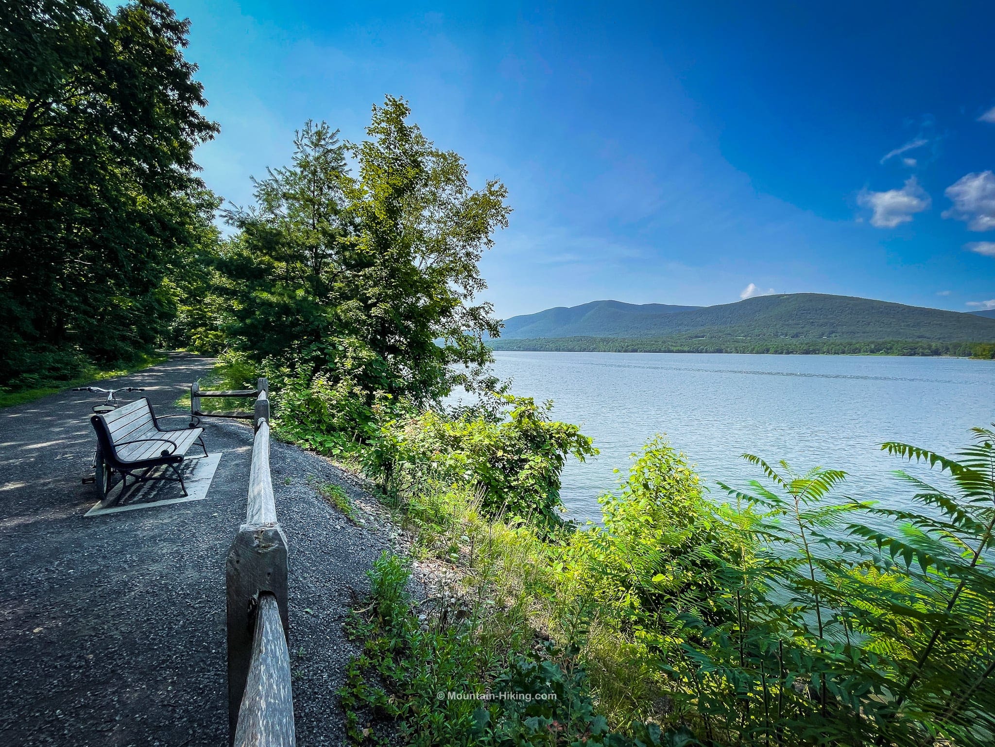
You soon come out into an open area called Glenford Dike which offers watery views toward the mountains at the western end of the reservoir.
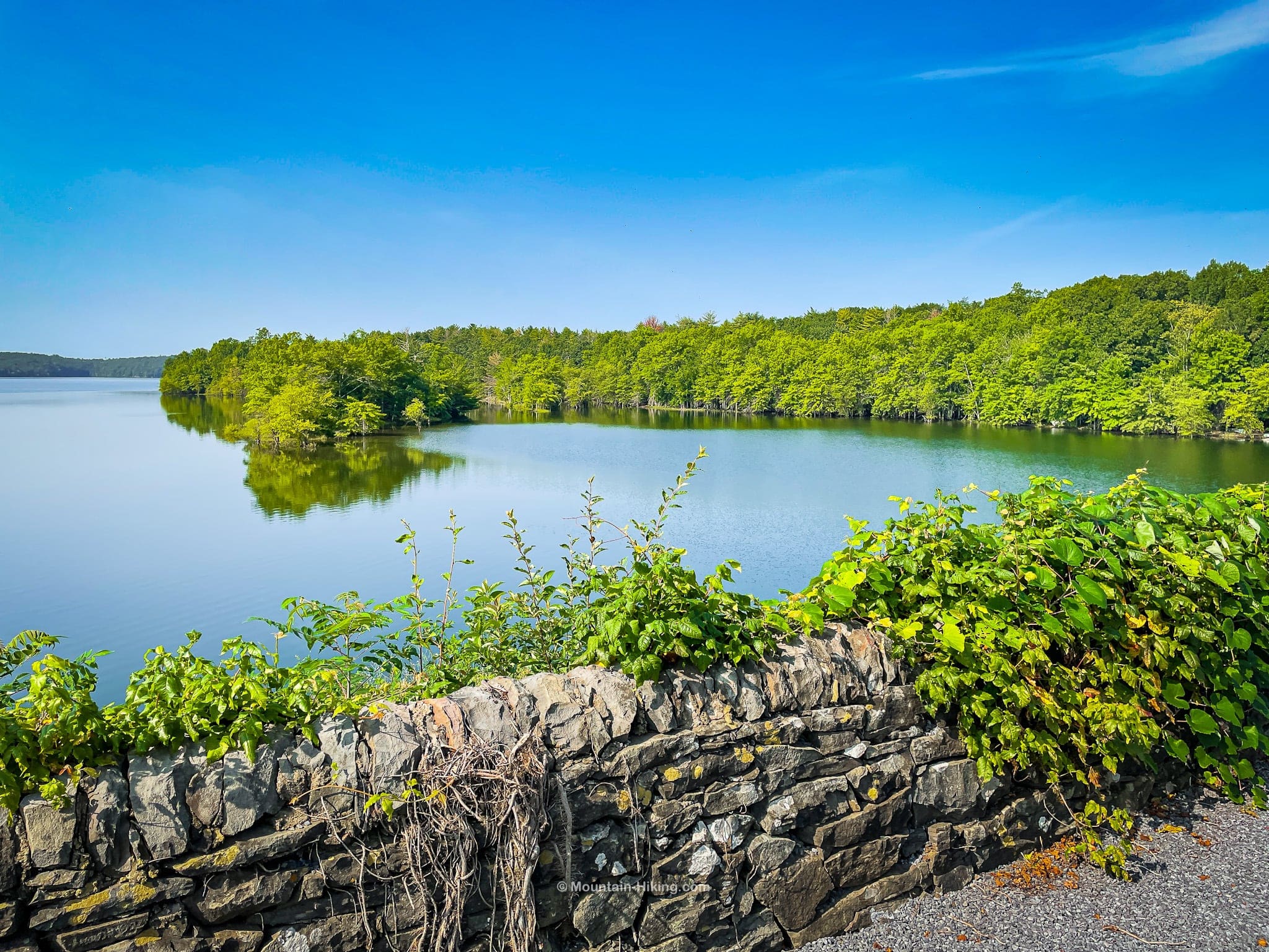
Because there’s no tree cover along Glenford Dike, this is also the most exposed and sunniest spot on the trail. (But it’s less than half a mile long.)
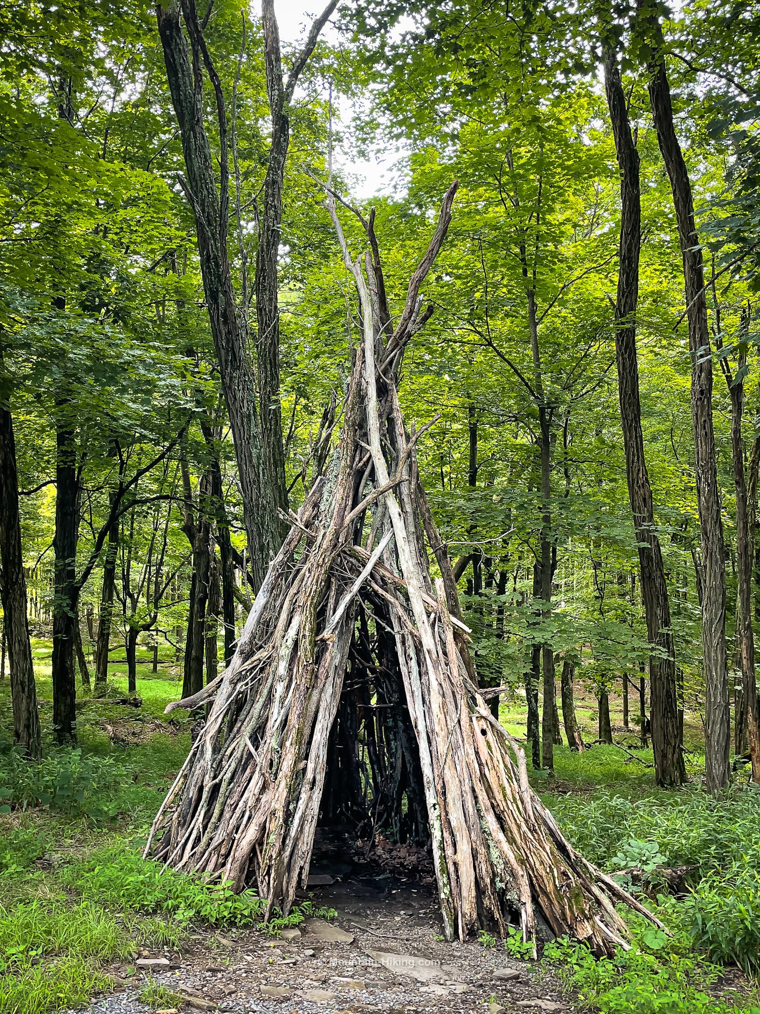
After re-entering the woods, you’ll soon pass a wigwam on the left side of the trail…
Midway Point & More Parking
At roughly the half way mark, you’ll come to Ashokan Station Trailhead.
In fact, there are many more smaller roadside parking and connector trails along the length of Route 28, so there are multiple ways to get onto the trail besides the three main lots.
BTW, at the Ashokan Station Trailhead, there’s a small portable restroom.
Ashokan Rail Trail: West Side
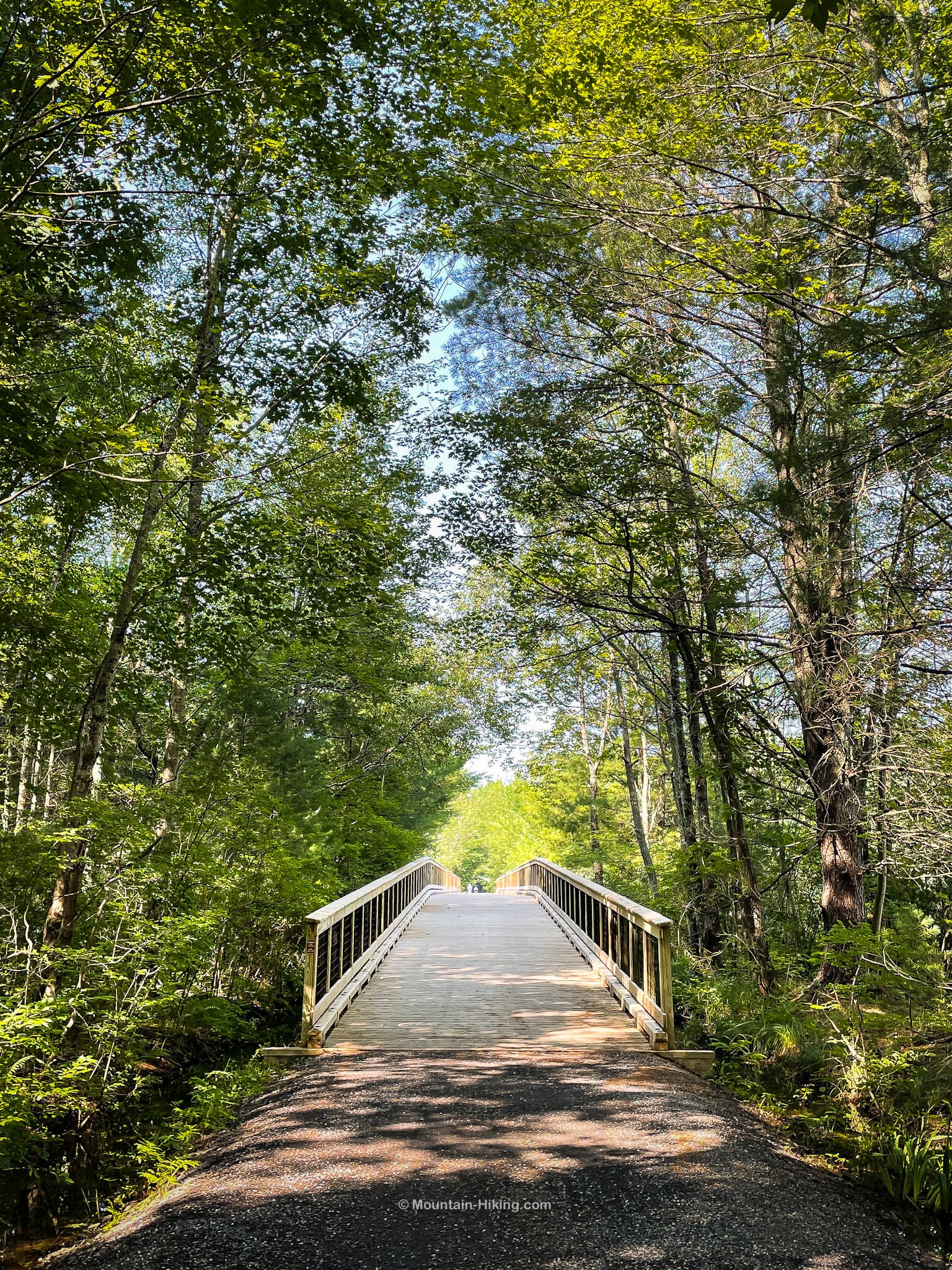
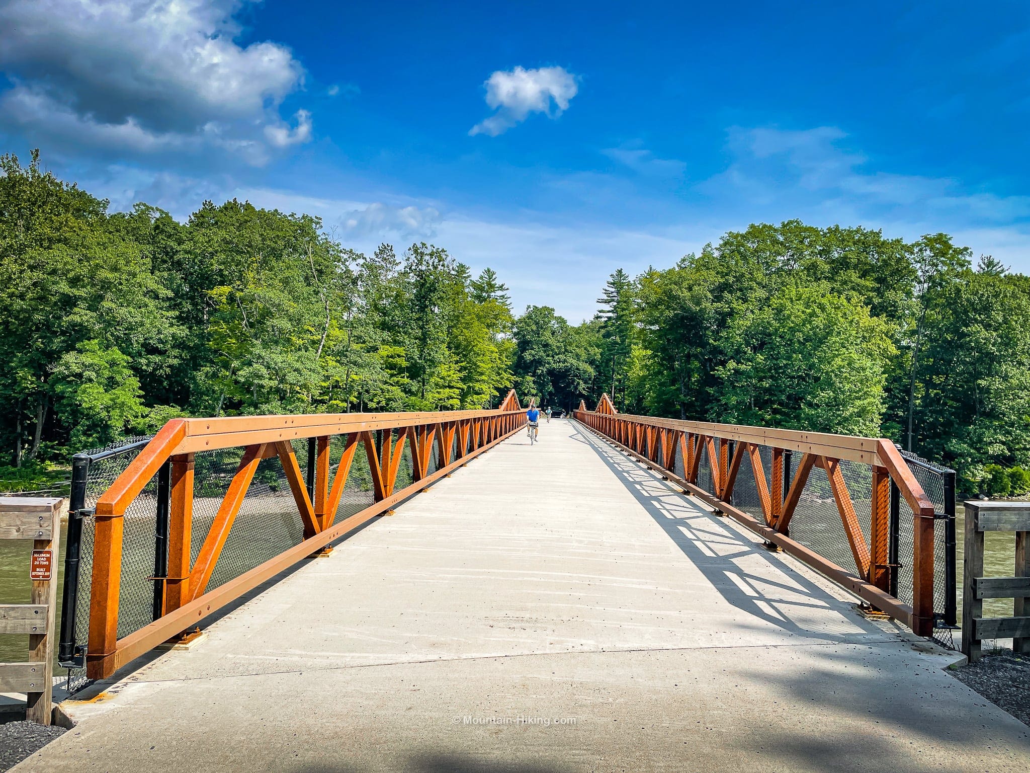
There are several excellent footbridges along the length of the Ashokan Rail Trail; they’re so lovely to walk or cycle across.
And this tunnel which flows under Reservoir Road is a lot of fun to pass through…
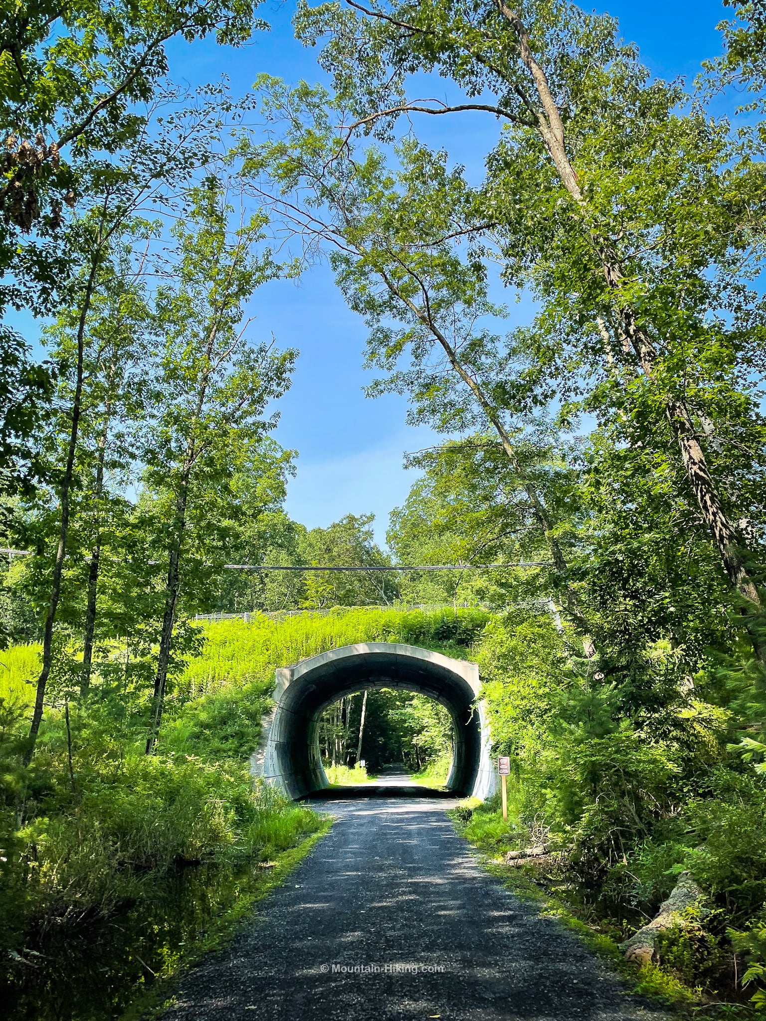
After a curve, you’ll pass over the a modest hump — the only hump in the otherwise perfectly level 11.5 miles of trail — and this spot marks the start of the scenic western section.
There are also a good number of benches along the trail, and many helpful information panels give context for each location and view.
The view from here in winter is equally stunning…
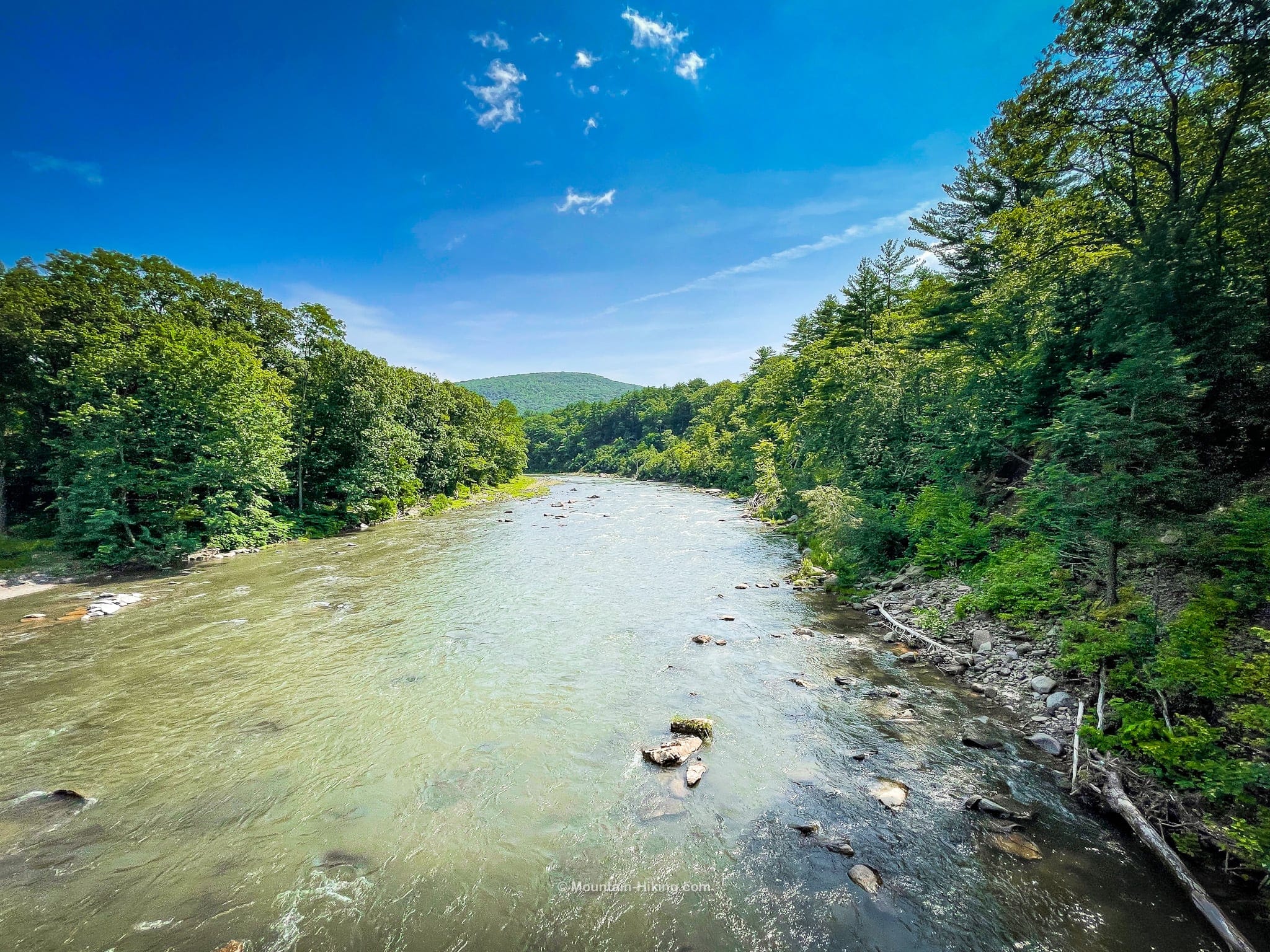
Near the end of the trail you’ll pass over the stunning Boiceville Bridge which crosses the Esopus Creek.
From here, the Boiceville trailhead / terminus is just a few minutes away.
Cycling, Walking, Running, Snowshoeing
The Ashokan Rail Trail is such an incredible promenade. It’s beautifully designed and implemented — and, most importantly, it’s accessible to everyone.
It’s the perfect spot for sunshine, cycling, walking, running, forest bathing, and classic Catskills scenery.
My old bike has been sitting outside under my deck for years, exposed to the elements and growing a very interesting layer of grime.
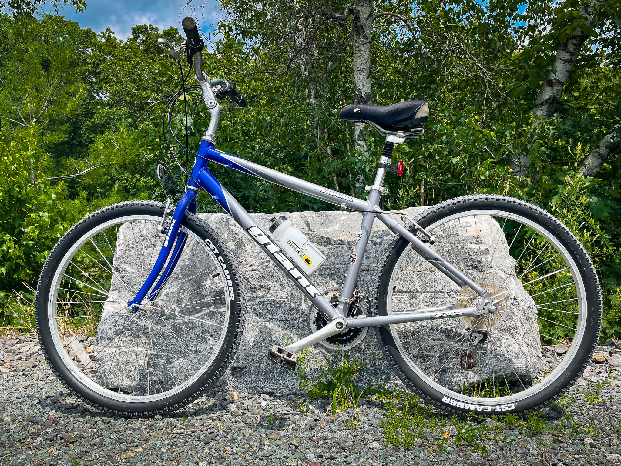
I had it refurbished locally and I’m so glad I did. Don’t have a bike? Reach out to Overlook Bicycles about renting from their store which is right next to the Ashokan Station Trailhead in Shokan. The Ashokan Rail Trail was the perfect way to get back into cycling.
More Ashokan Hikes
On the other side of the reservoir, there’s a short but exceptional nature trail called the Ashokan Quarry Trail. I’ve hiked there so many times, but it never gets old.
You can also hike Ashokan High Point and Little Ashokan.
Read More
You can get more source information at the official Ashokan Rail Trail website.
Get full access…
Get instant access to the full version of this site and enjoy great supporter benefits: full galleries, full trail notes, early access to the latest content, and more.
Hot on the website right now…
Follow for more…
Follow my @TotalCatskills content on Instagram for regular hiking inspo and safe, inclusive community.

Ashokan Rail Trail Trailhead
Very large double-lot but this is one of the most popular nature destinations in The Catskills — so get there early, especially on weekends and holidays
Google Maps Location: 41.994601, -74.092245
The map below shows the exact topographic location of the trailhead
Cell Service
Good throughout. There may be patches where signal is weak but I had a solid signal for most of the length of this trail. My network is Verizon. YMMV.
The parent mountain for this hike is Ashokan High Point.
