Disclosure: This content may contain affiliate links. Read my disclosure policy.
This track includes an off-trail section which is why the total length shown here differs from the advertised length, which is what most hikers would do.
Trailhead info at bottom of this post.
Hiking Trail Description
The Ashokan Quarry Trail is a short, highly entertaining hike most people will be able to do in under an hour.
It’s so varied in terms of terrain, flora, views and ruins, it’s a hit with everyone who hikes it. I really can’t recommend this hiking trail enough.
This trail was built by the Catskill Mountain Club and NYC DEP, with support from the Ashokan Watershed Stream Management Program. More info on the Catskill Mountain Club’s page.
Hiking the Ashokan Quarry Trail
Allow 1 hour for this delightful hike.
Trailhead
The trailhead for the Ashokan Quarry Trail is on the south side of the Ashokan Reservoir. It’s just a minute or two west of the Lemon Squeeze on 28A.
The entrance to the trailhead is in the south side of the road — if you’re driving west, away from the Lemon Squeeze, it’ll be on your left.
You can see the exact topographic location of the lot at the bottom of this page.
Get access to hyper-detailed trail guides, insider tips, and expert advice. Join a vibrant community of like-minded hikers, receive exclusive content, and embark on unforgettable outdoor adventures. Whether you’re a seasoned outdoor enthusiast or just starting out on your hiking journey, this website provides invaluable resources to help you explore the best trails in the Catskills, Adirondacks, Hudson Highlands, Berkshires, and beyond. Get access now to all content on this website instantly and enjoy unique supporter benefits.
Video View
Ashokan Quarry Hiking Trail
Enter the trail past the iron gate and begin hiking uphill. No single section of this trail is very long before the terrain and the flora around you change dramatically.
The first notable thing you pass is a small ruin on your left.
Not long after the ruin, you’ll come to the first intersection.
Turn left and head uphill, following the blue blazes.
BTW, you might also enjoy…
- UPDATED › Best Bug Spray & Bug Repellent for Hikers
- CATSKILLS › Peakbagging The Catskills High Peaks (Ultimate Guide)
- STAY › Find Your Perfect Catskills Stay
- ADIRONDACKS › Wright, Algonquin & Iroquois Peaks
- LEARN › Teach Yourself How to Use a Compass
- ENTERTAINMENT › Best & Worst Hiking Movies
- Follow › My Instagram @TotalCatskills
- Follow › My Substack @TotalCatskills
- Follow › My writing for Times Union
After another 1000’ the trail turns abruptly to the right and leads you quickly to this spectacular view, which looks west to Ashokan High Point and Little Ashokan…
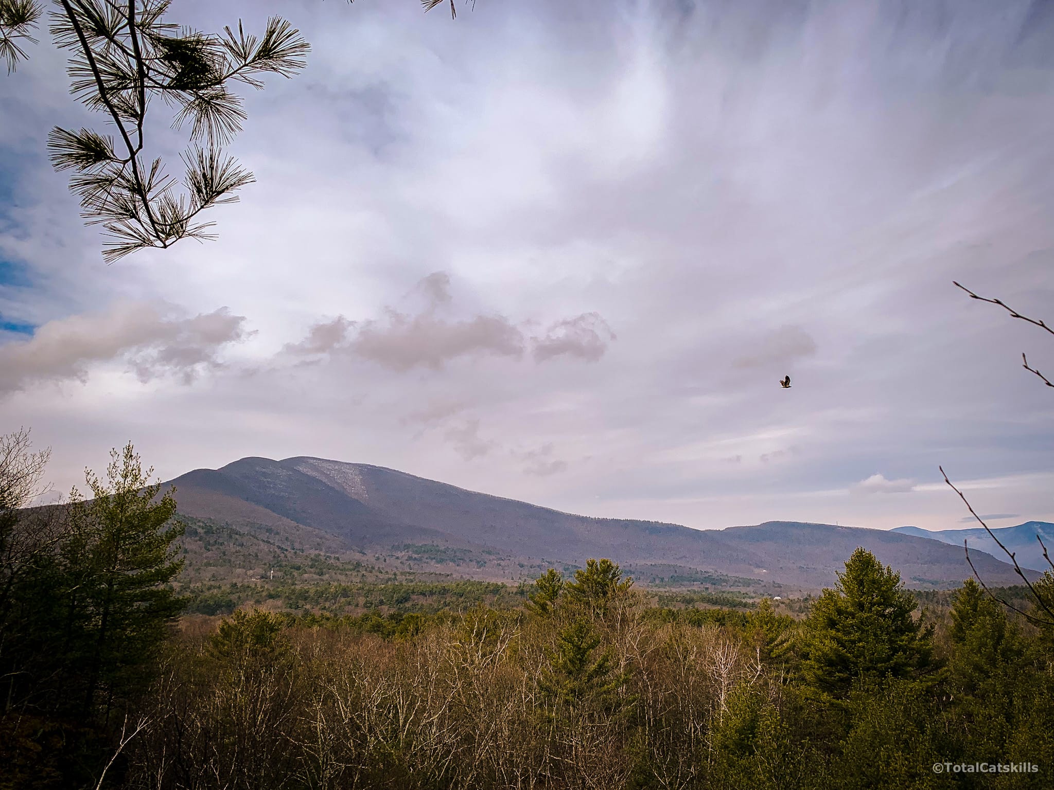
To the right of Ashokan High Point, you can see most the Burroughs Range (Friday, Cornell and Wittenberg) and Samuels Point.
Catskills 3500’ Mountain Club members and aspirants will be delighted to see, on the far right, North Dome…
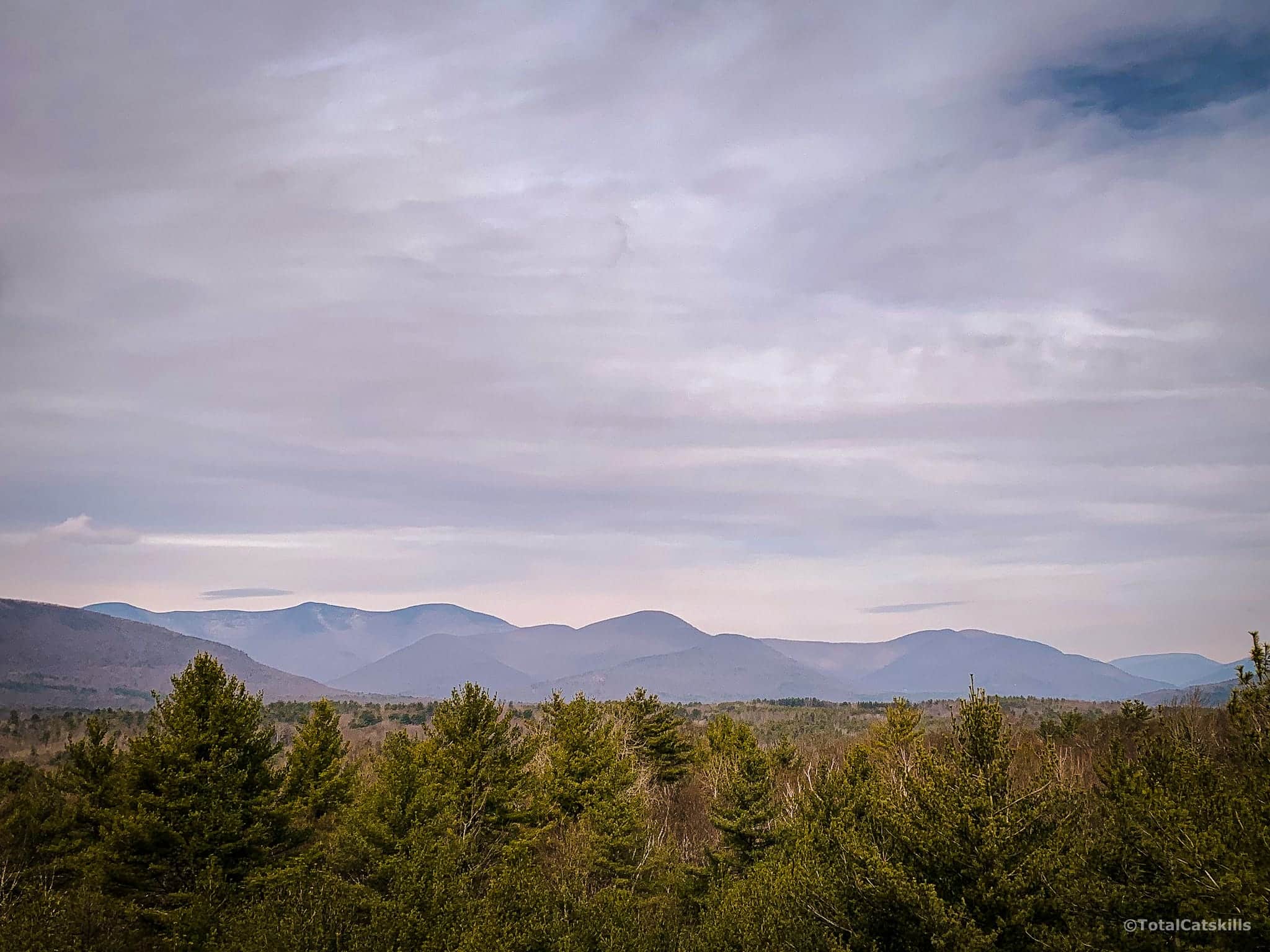
Ashokan Quarry Trail: Quarry Top
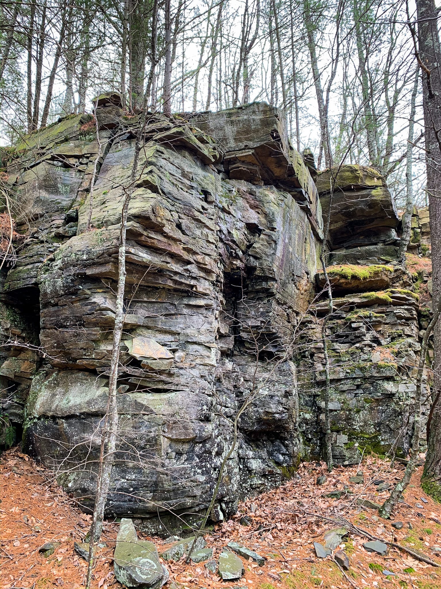
Not far after this panorama you come to the top of the main quarry, where there’s another great view of Ashokan High Point.
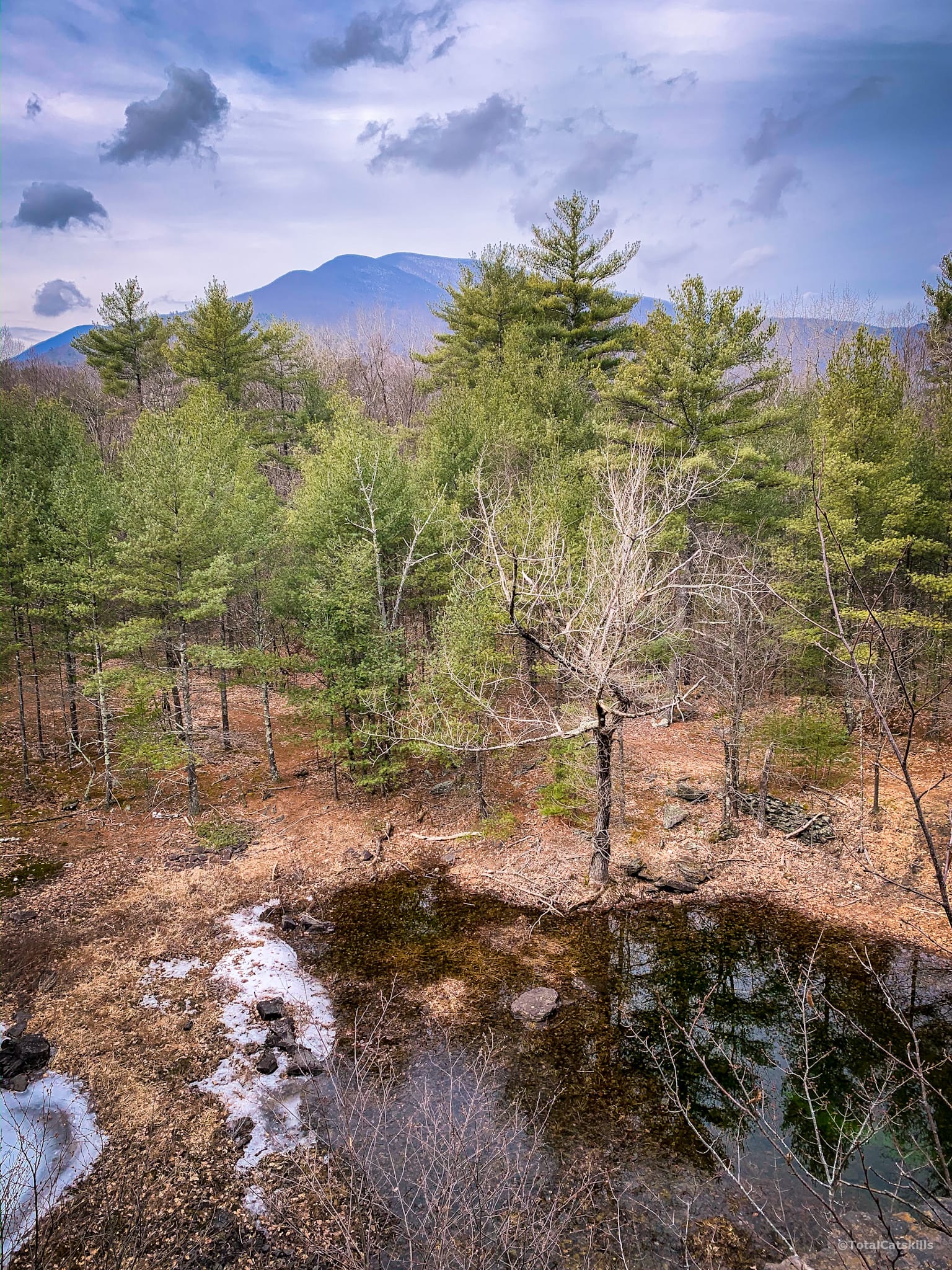
The Ashokan Quarry Trail winds around the top of the cliff, before heading downhill to the right. The blazing here is not always perfectly clear. When you get to the flat trail at the bottom of this section, just turn right and follow it past some dramatic rock bands.
My GPS track shows the exploring I did around here. I went off-trail to follow the old flat rail bed as far as I could (to Samsonville Road) before turning around. Luckily, I decided to take a slightly different route back to the blue trail and discovered the ruins you’ll read about below.
That is, you can ignore the way my GPS track deviates here and just stick to the blue-blazed trail.
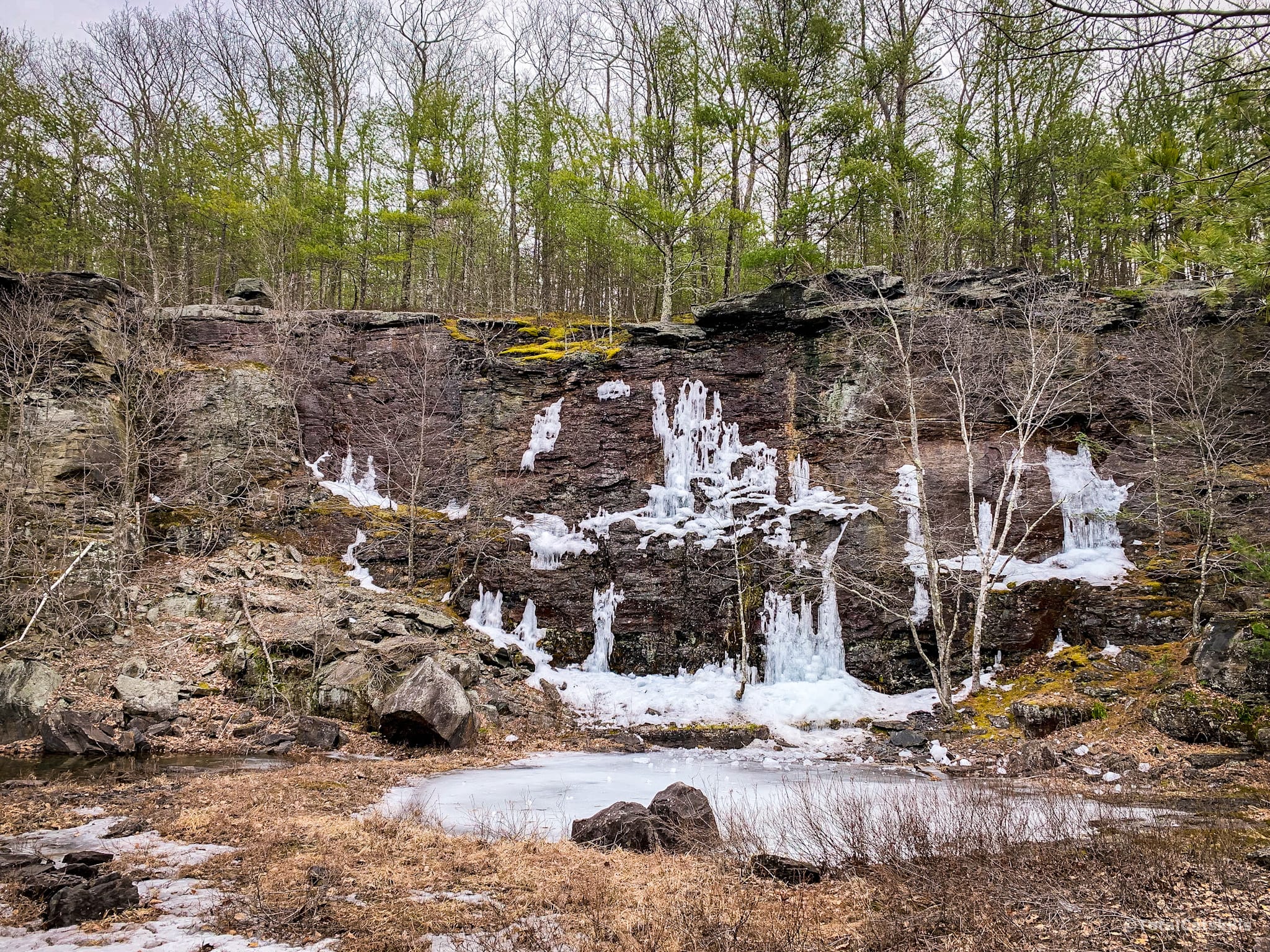
Ashokan Quarry Trail: Quarry Bottom
Back on the blue trail, right after the exposed/quarried rock band, you’ll come to the main quarry. It’s just off-trail, on the right.
From here, the trail leads straight back to the first intersection and, from there, back to the parking lot.
However, if you want to explore a little more before you go…
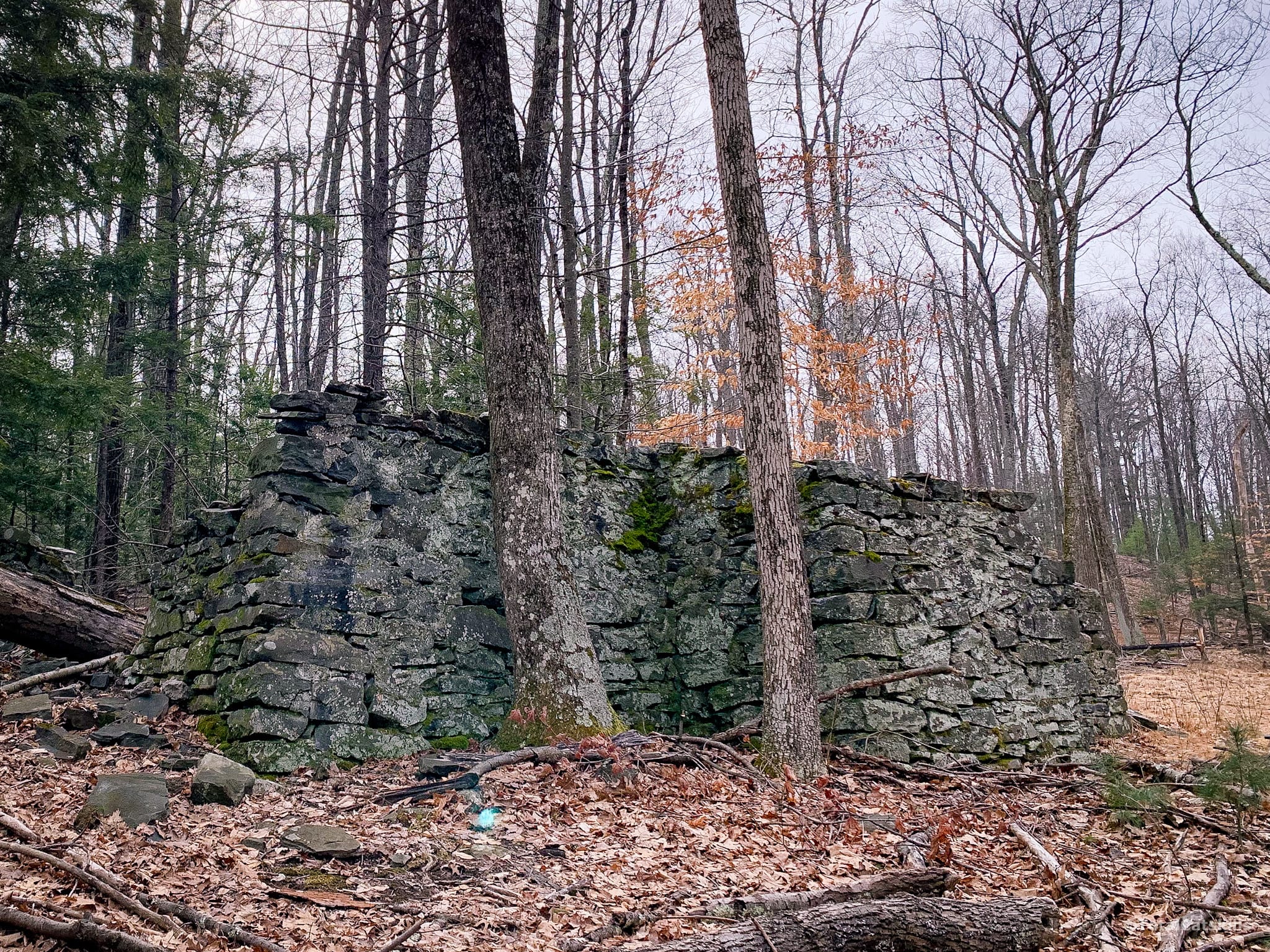
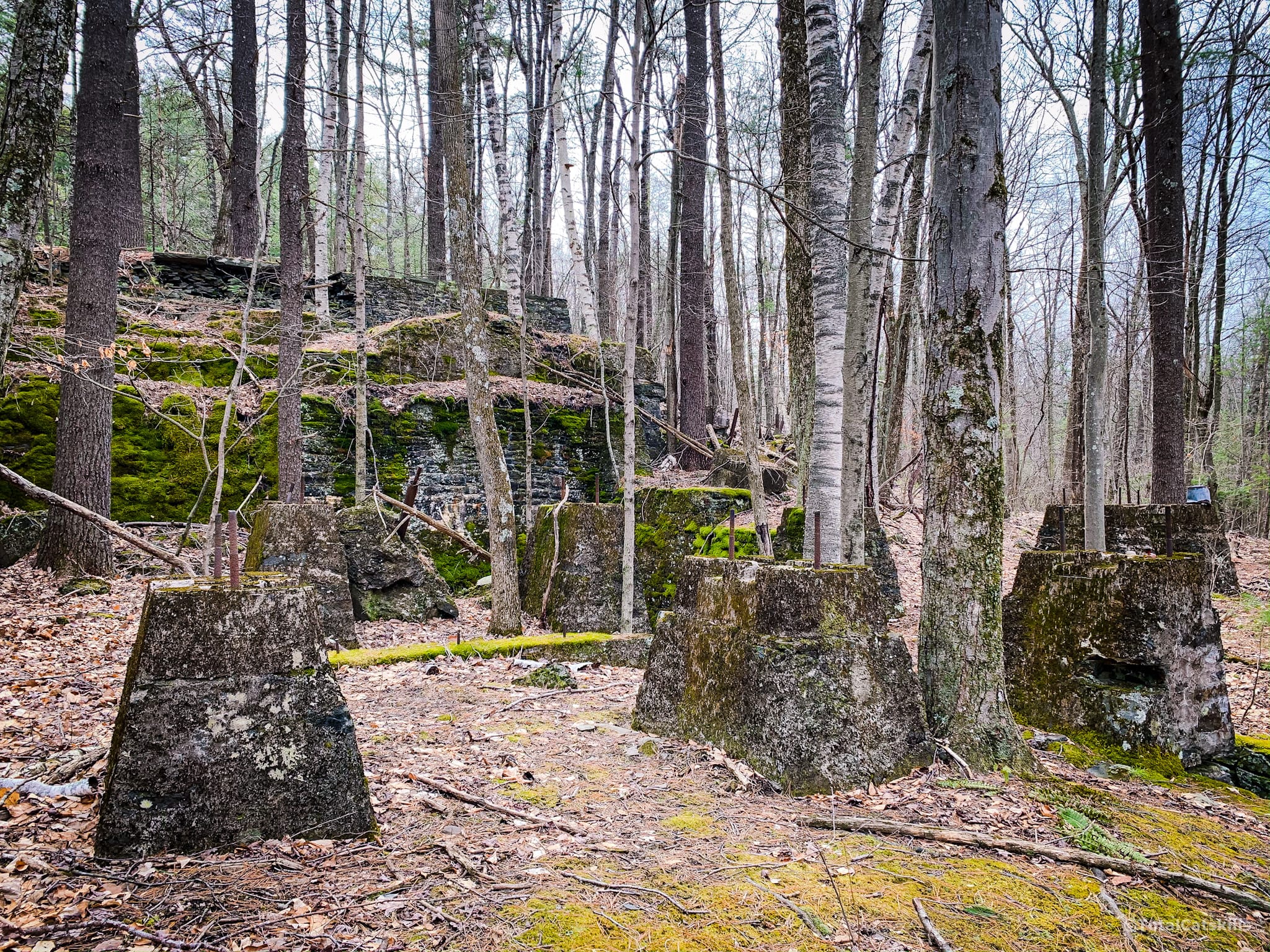
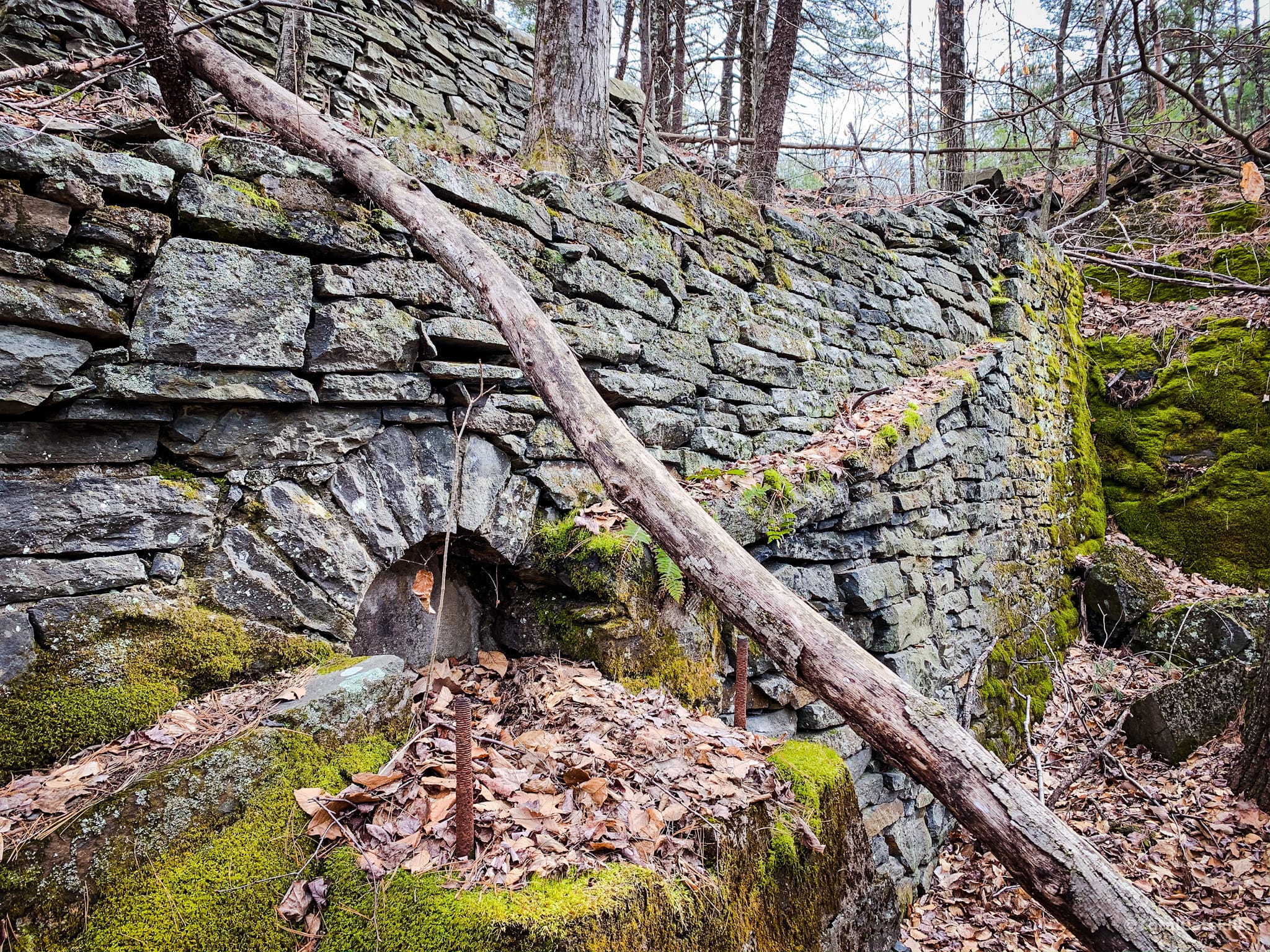
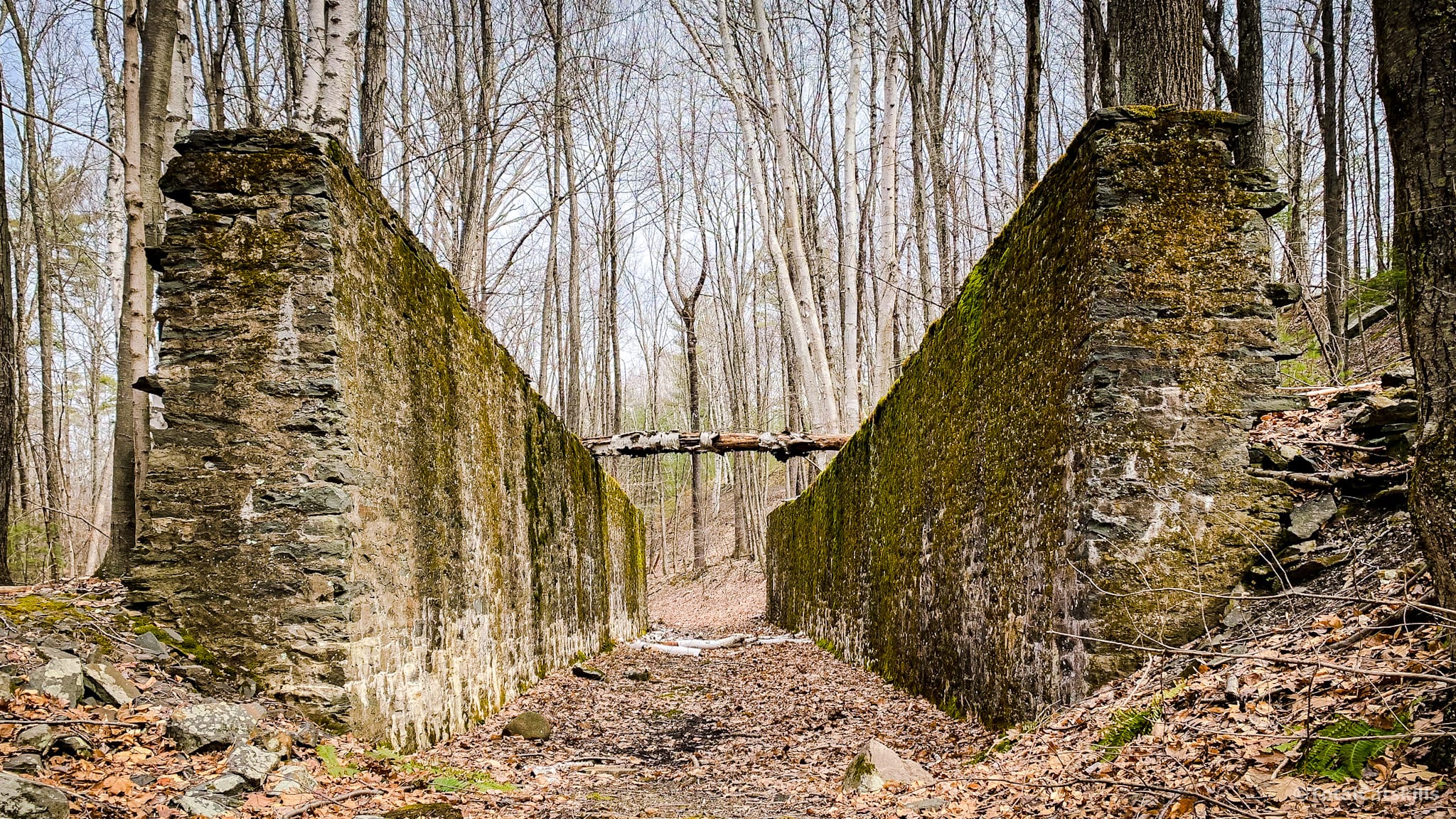
Old Railway Ruins
At the quarry shown above, turn around and look directly across the trail. If you head in a straight line into the woods, about 300’ downhill, you’ll come to this fantastic set of old railway yard ruins.
This section has since been upgraded by the Catskill Mountain Club. No longer a bushwhack. Now, a yellow-blazed spur trail now leads down to the ruins. See comments below.
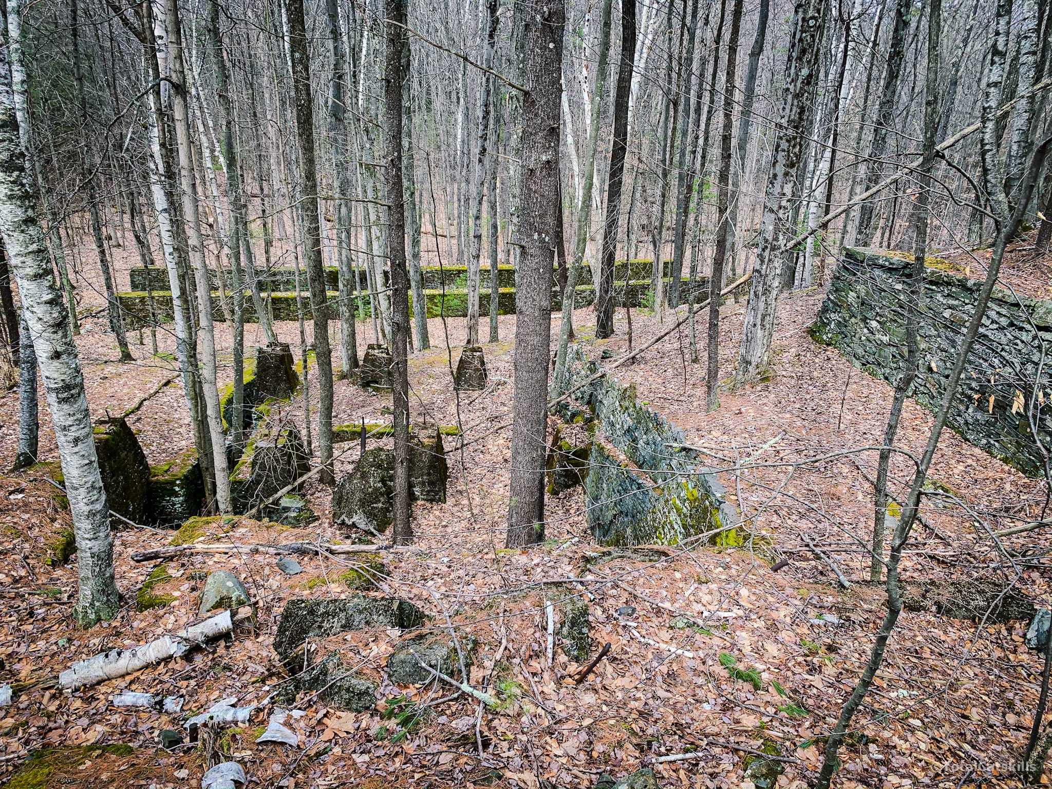
I’d love to know how these old buildings and mechanisms were used…
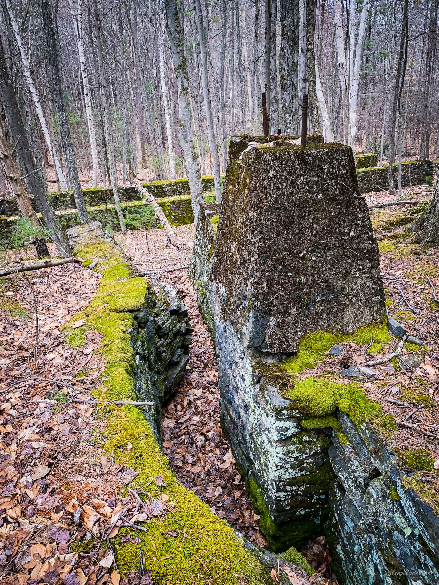
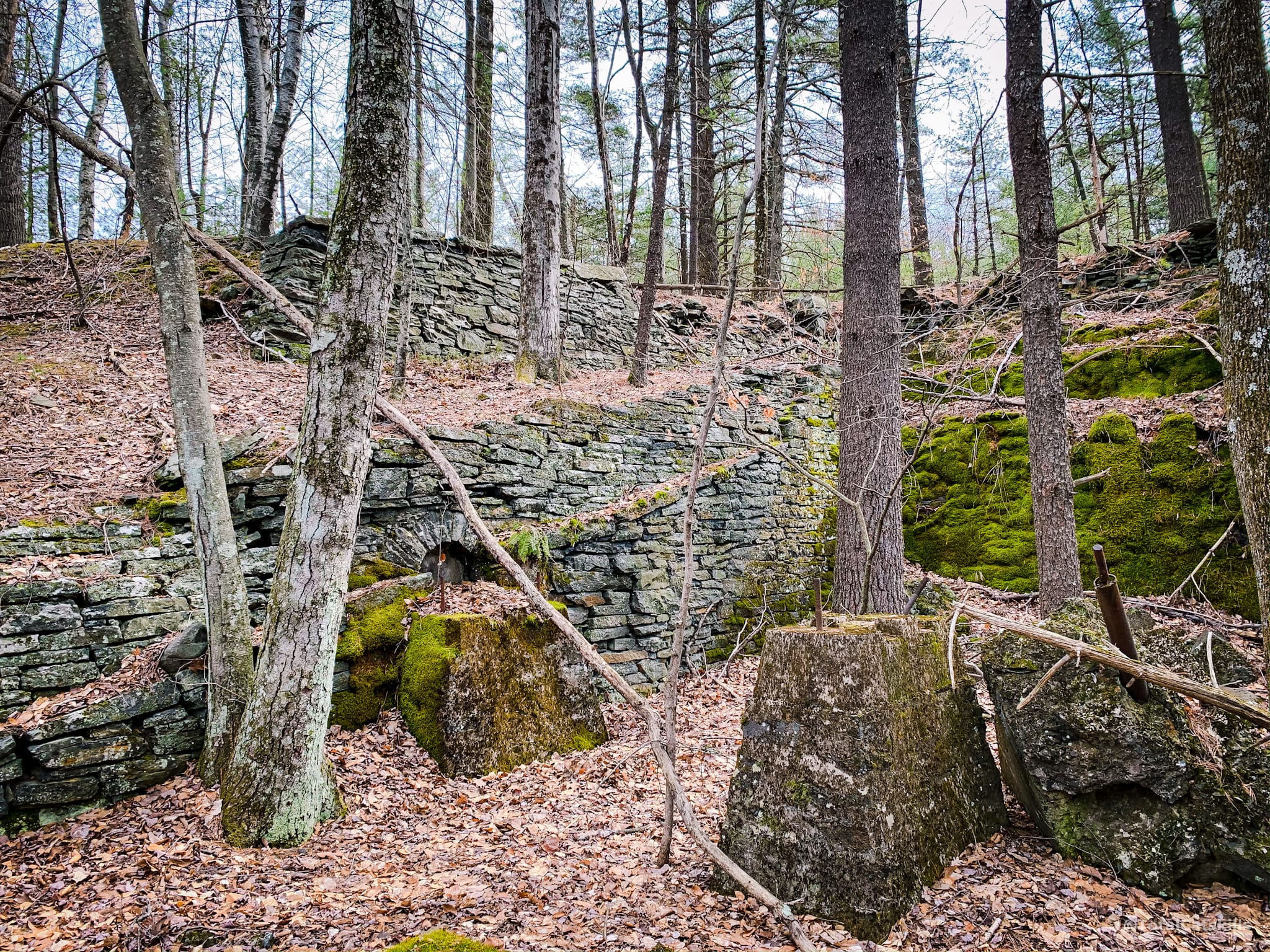
A little farther down, two long, imposing stone walls stand facing each other — between them, I imagine, railroad cars were once parked and loaded with quarried stone from above…
Head back up to the blue trail, and turn left to return to your car.
There are no tricky or steep sections on this hike — tough, obviously, care should be taken near any cliff faces. Very young children should be reigned in near the top of the quarry. Otherwise, this is a super fun and very family-friendly hike.
Similar Hikes
This easy hike is also beautiful and scenic.
And it’s so fun, I’ve added it to the list of best Catskills hikes.
It’s also short and without much elevation gain — so it’s a fantastic Nature Walk.
Read More
Get full access…
Get instant access to the full version of this site and enjoy great supporter benefits: full galleries, full trail notes, early access to the latest content, and more.
Hot on the website right now…
Follow for more…
Follow my @TotalCatskills content on Instagram for regular hiking inspo and safe, inclusive community.
Ashokan Quarry Trail Trailhead
Medium-sized lot just a minute or two west of The Lemon Squeeze lot.
Google Maps Location: 41.93578, -74.22935
The map below shows the exact topographic location of the trailhead
Cell Service
Good throughout. My network is Verizon. YMMV.
10 responses to “Ashokan Quarry Trail”
Your comments are welcome here…
The parent mountain for this hike is Ashokan High Point.

We had a great time! Went with our almost 3 and 7 year old, they loved the rocks and seeing the big mountains. We even saw a large black rat snake (not venomous) we didn’t bother him and he didn’t bother us. Definitely would do as the sign at the gate says and check for ticks, we found one in the kids hair. So great to get into nature for a short hike with amazing views. Can’t wait to explore more of your recommendations!
Excellent! Definitely tick season now, yeah. Sigh. So glad you enjoyed everything else!
What a great hike! We did this on 1/24/21 and had a blast. We followed your directions exactly. Thank you!
Awesome! I’m so glad. It’s such a wonderful place.
Love this little trail! It’s got a lot to offer and many points of interest. The gravel in the beginning, however, is tough on the ankles and is difficult to traverse. Luckily it’s only for the first 10 minutes or so.
There is now a sign near the parking area on 28A.
Woot! Thanks John.
Great pictures and a nice review. Readers might like to know that a spur trail to the railroad ruins is now marked with yellow. The trail was built and is maintained by the Catskill Mountain Club on a NYCDEP parcel. More information can be found on the website.
That’s great! Thanks for the update. You folks did a beautiful job with that trail.