Disclosure: This content may contain affiliate links. Read my disclosure policy.
Lollipop route from Platte Clove.
Trailhead info at bottom of this post.
Hiking Trail Description
I’d wanted to hike Kaaterskill High Peak via Hurricane Ledge for a long time. It absolutely lived up to the hype.
There are two ways to get to the herd path that leads to Hurricane Ledge. From the west, you can hike in via Gillespie Road with a short bushwhack at the start of your hike.
From the southeast, you begin at the popular trailhead for Kaaterskill High Peak and Huckleberry Point in Platte Clove — and this is the route a friend and I hiked for this trail guide.
Both routes are long, and feel longer. I joke that Kaaterskill High Peak is 90% trail and 10% mountain. That’s how it always feels to me. But that 10% is so great!
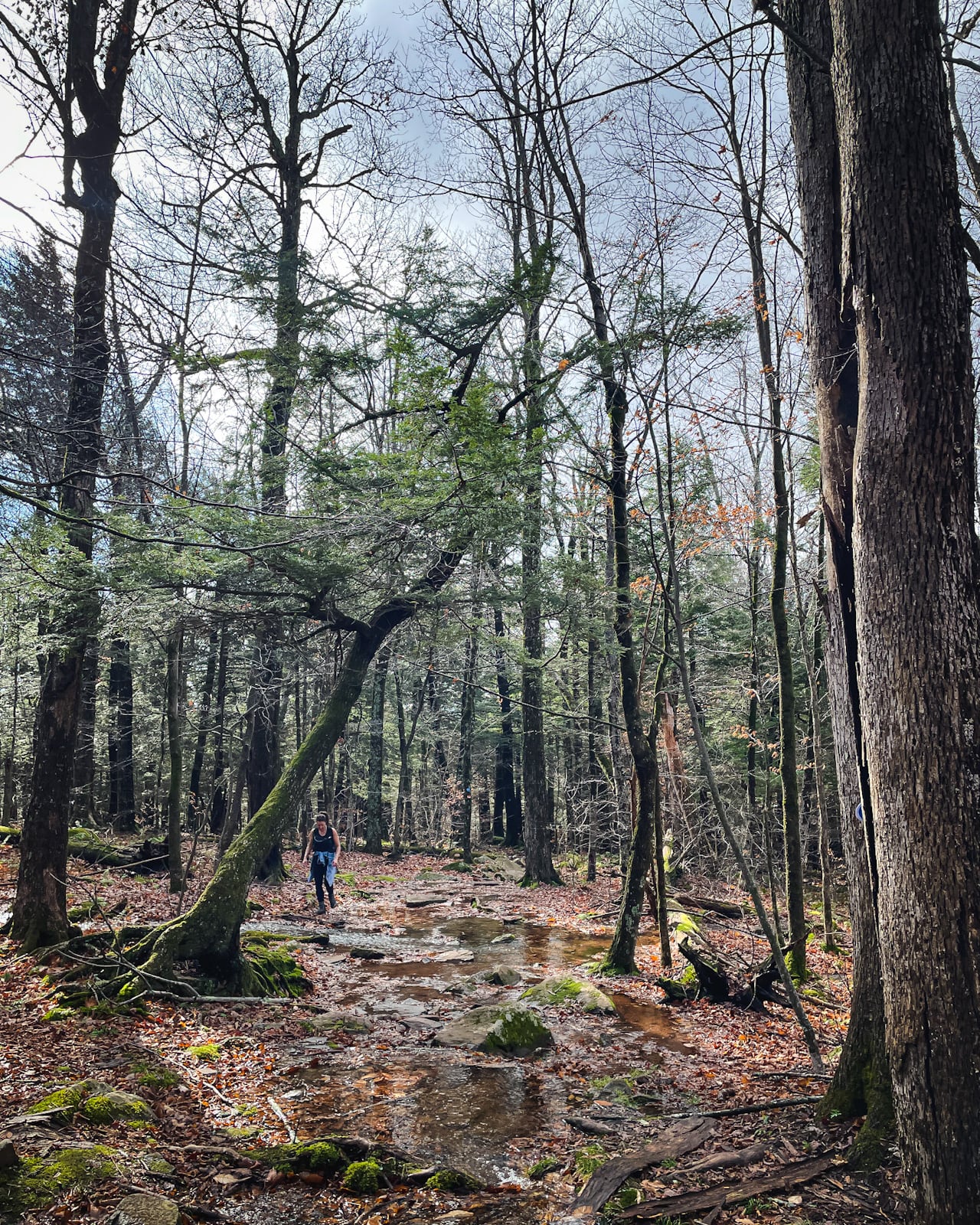
Note: Kaaterskill High Peak is well-known as a wet, muddy mountain, but parts of the snowmobile trail that runs around Round Top and KHP are on the verge of being swampland. I have top-shelf waterproof hiking boots, but even they were no match for the deep suck of Kaaterskill High Peak’s lower slopes.
BTW, you might also enjoy…
- UPDATED › Best Bug Spray & Bug Repellent for Hikers
- CATSKILLS › Peakbagging The Catskills High Peaks (Ultimate Guide)
- STAY › Find Your Perfect Catskills Stay
- ADIRONDACKS › Wright, Algonquin & Iroquois Peaks
- LEARN › Teach Yourself How to Use a Compass
- ENTERTAINMENT › Best & Worst Hiking Movies
- Follow › My Instagram @TotalCatskills
- Follow › My Substack @TotalCatskills
- Follow › My writing for Times Union
Rescues on Kaaterskill High Peak
Summiting Kaaterskill High Peak is technically a bushwhack but the herd paths from the main, blazed trails to the summit are now so well-developed — disastrously so, in fact, with major trail erosion as a result — that the bushwhack portions of this hike are bushwhacks in name only.
However, away from any trail, strong backcountry navigation skills are crucial. On KHP, just staying on the trails is difficult enough…
Very soon after we did this hike, there were several rescues of inexperienced and unprepared hikers on Kaaterskill High Peak. Some were caught off guard by the end of Daylight Savings Time, which meant sunset was an hour earlier. Others simply got lost.
In fact, as we finished this hike, we came across a rescue in progress. A small group of hikers had wandered off trail, not far from the trailhead, and become disoriented in the forest. Easy to do, here, as the trail is not well marked and there are several intersecting woods roads that run through the area.
At the very least, make sure you have a navigation app on your phone such as AllTrails — though a map and compass will never let you down the way a phone’s battery can.
Warning! Attempting a climb of Hurricane Ledge in winter conditions is foolhardy for anyone but experienced winter mountaineers who have both the gear and the skills to meet the challenge. The ledge sits atop a cliff. The margin for error is zero. You are a long long way from help. I was unnerved doing it in the fall when it was merely dripping wet, not covered in thick ice. Consider doing this hike in warmer months only.
Kaaterskill High Peak via Hurricane Ledge Hike
The hiking trail and herd path to Hurricane Ledge includes…
- Old woods roads
- Constant wet trails and, often, deep mud
- A few sweet boardwalks
- Old Mohawk camp
- Swampy snowmobile trails
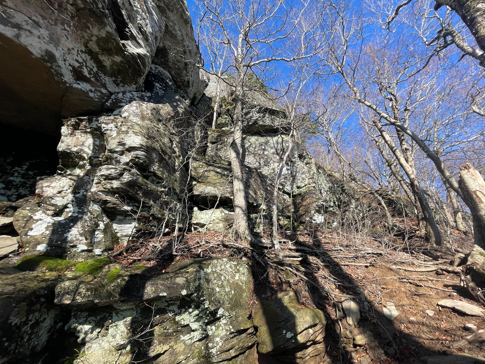
- A very steep climb to the very tricky Hurricane Ledge
- A second ledge that’s a little tricky too
- Two plane wrecks
- Bushwhack routes up and down the summit
- A long, wet walk out
Kaaterskill High Peak via Hurricane Ledge Hike Notes & Gallery
Start at the parking area in Platte Clove, sign the register, and hike up the old woods road. There are several junctions with other woods roads and signage is sparse, so keep an eye for the few helpful blazes and unofficial signposts.
The wetness begins immediately…
Mohawk Camp & 1987 Plane Wreck
You can read a detailed description of how to find the Mohawk Indian Camp and both plane wrecks in Kaaterskill high Peak & 2 Plane Wrecks, but the GPS track attached to this blog post will bring you to each of those locations too, as you’ll soon see…
 You’ve got the basic details, but there’s so much more…
Unlock this site now to get complete intel on every route, including my full photo galleries, personal insights and tips. Elevate your next hike with deep trail beta. Experience hundreds of amazing routes at their absolute finest. With Mountain-Hiking.com, you’re not just skimming the surface.
Sean

Similar Hikes
Kaaterskill High Peak is always a blast. If you like very scenic hikes, it’s a great hike.
If you like visiting wrecks, it certainly has you covered on that score too.
Read More
Get full access…
Get instant access to the full version of this site and enjoy great supporter benefits: full galleries, full trail notes, early access to the latest content, and more.
Hot on the website right now…
Follow for more…
Follow my @TotalCatskills content on Instagram for regular hiking inspo and safe, inclusive community.

Kaaterskill High Peak via Hurricane Ledge Trailhead
Large lot, very popular.
Google Maps Location: 42.133700, -74.082171
The map below shows the exact topographic location of the trailhead
Cell Service
Sketchy at trailhead. Patchy throughout. Best service up very high. My network is Verizon. YMMV.
The parent mountain for this hike is Kaaterskill High Peak.