Disclosure: This content may contain affiliate links. Read my disclosure policy.
A direct out-and-back to Hunter’s fire tower from Spruceton
Trailhead info at bottom of this post.
Hiking Trail Description
This moderate hike can be completed in 4-5 hrs. This is the easiest route to climb Hunter Mountain. It’s also the most scenic route.
This route follows an old road, so the trail is wide and even the whole way up. There are no technical sections, no rock scrambles, and there are switchbacks to ease the steepest sections. It’s just a straightforward uphill hike.
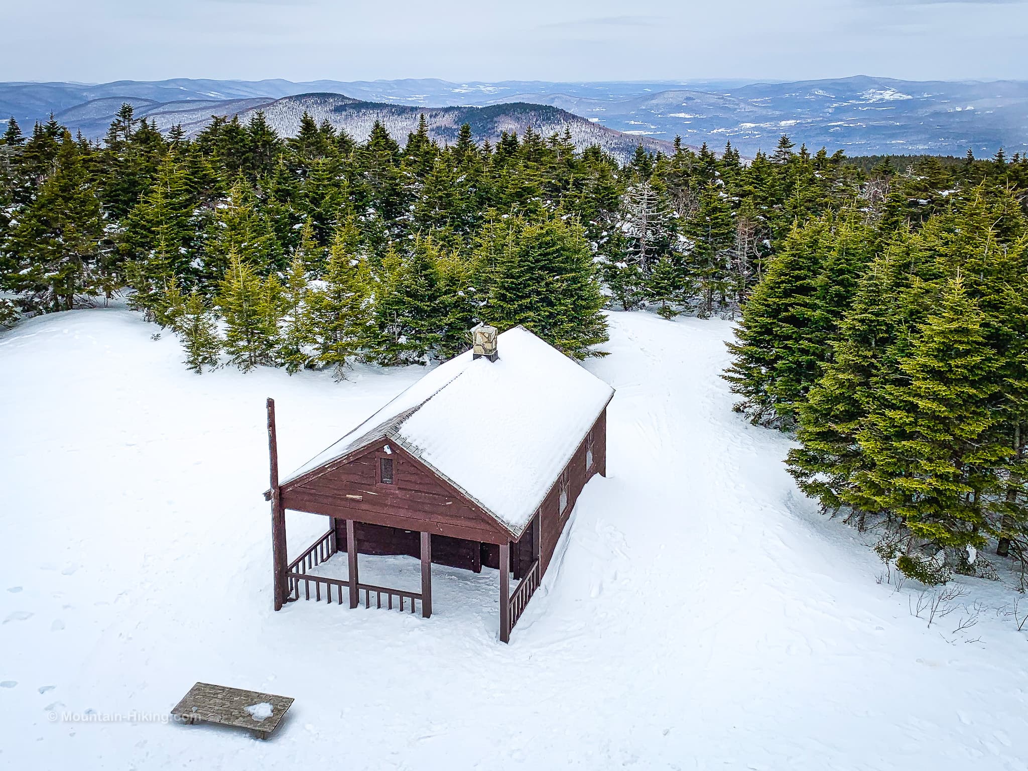
The 360° view from the fire tower is spectacular, and the view from John Robb Lean-To is equally exceptional.
Trailhead Parking
There are two lots at the of Spruceton Road. The lot for this hike is the first one you’ll come to, on the left.
If that lot is full, you can try the lot for West Kill which is about 1000 ft further down the road, on the right.
Both lots serve very popular destinations, even in winter. Arrive as early as you can, especially on busy weekends or public holidays.
Hunter Mountain Hiking Trail
Start at the parking area and head north, following the blue blazes. This is also a horse trail, so there are two blue blazes: one for humans, one for horses.
Sign in at the register, a very important safety protocol.
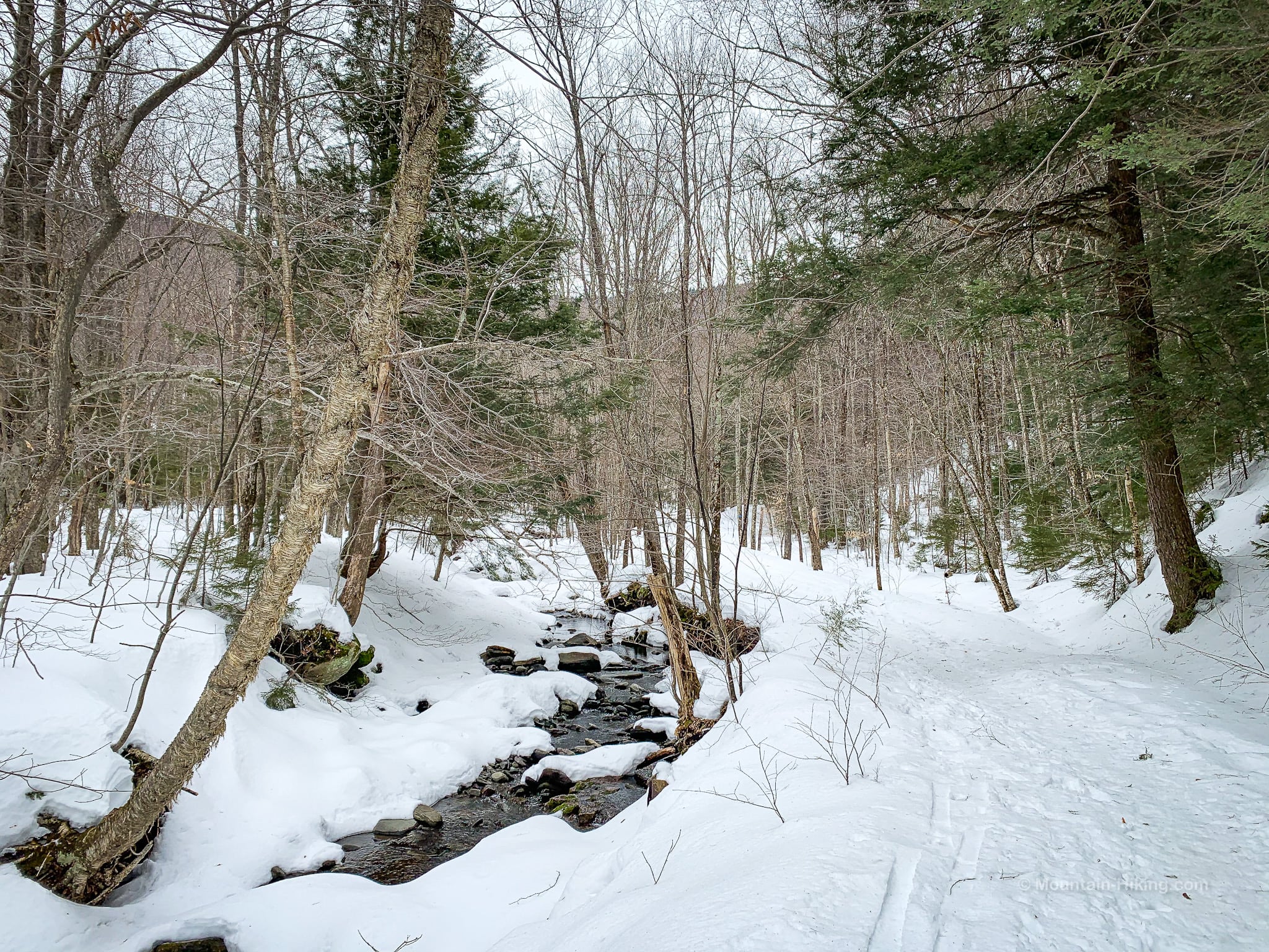
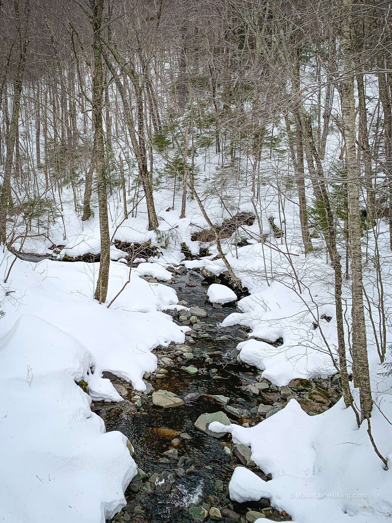
The trail runs alongside Hunter Brook. Follow the blue blazes.
This bridge crosses Hunter Brook and affords delightful views on both sides at any time of year — but especially in fall and in the snow.
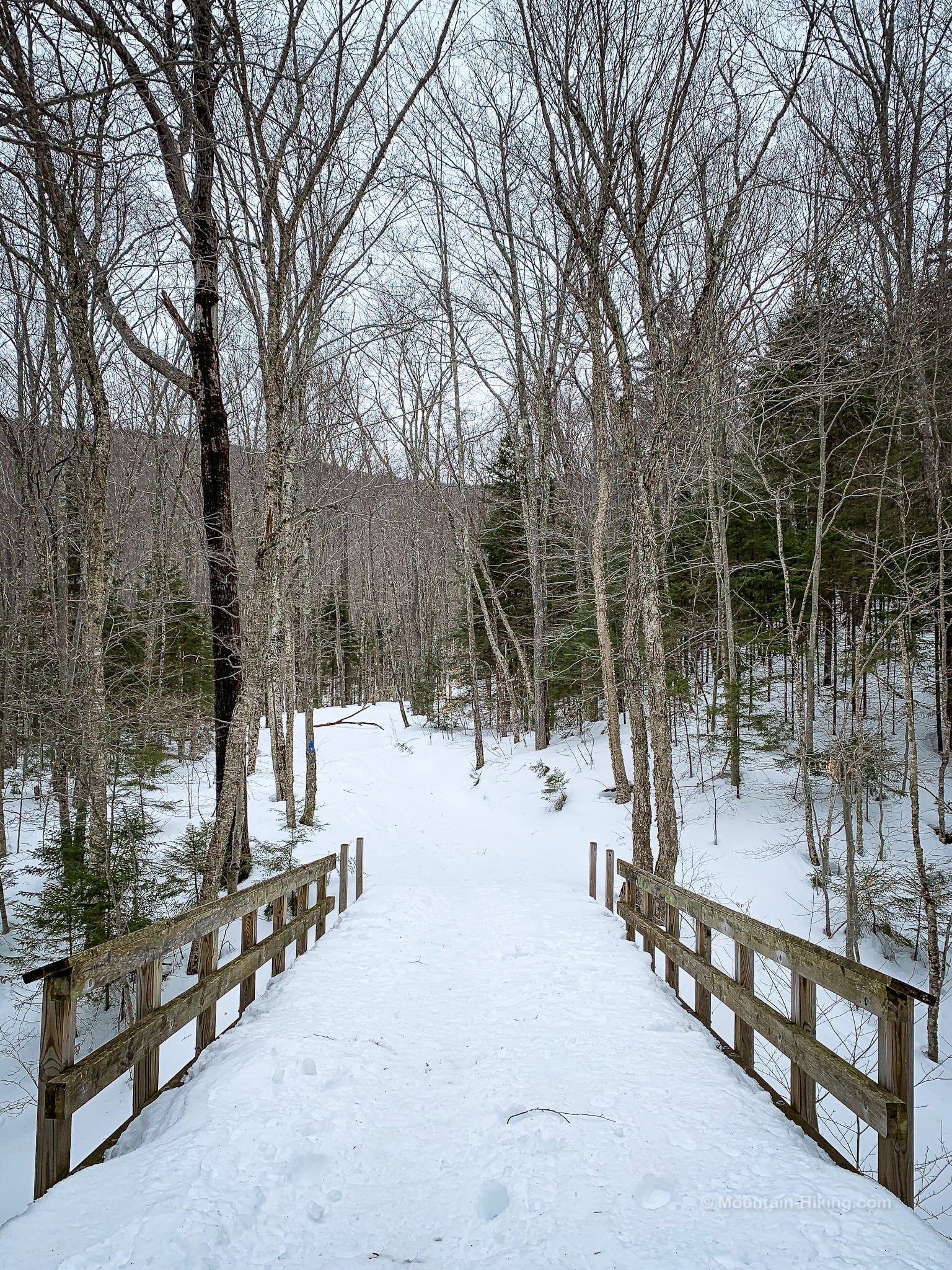
Looking upstream from the bridge…
Climb the switchback, pass over a smaller footbridge and, after 1.7 miles, you’ll come to the first junction which is in Jones Gap.
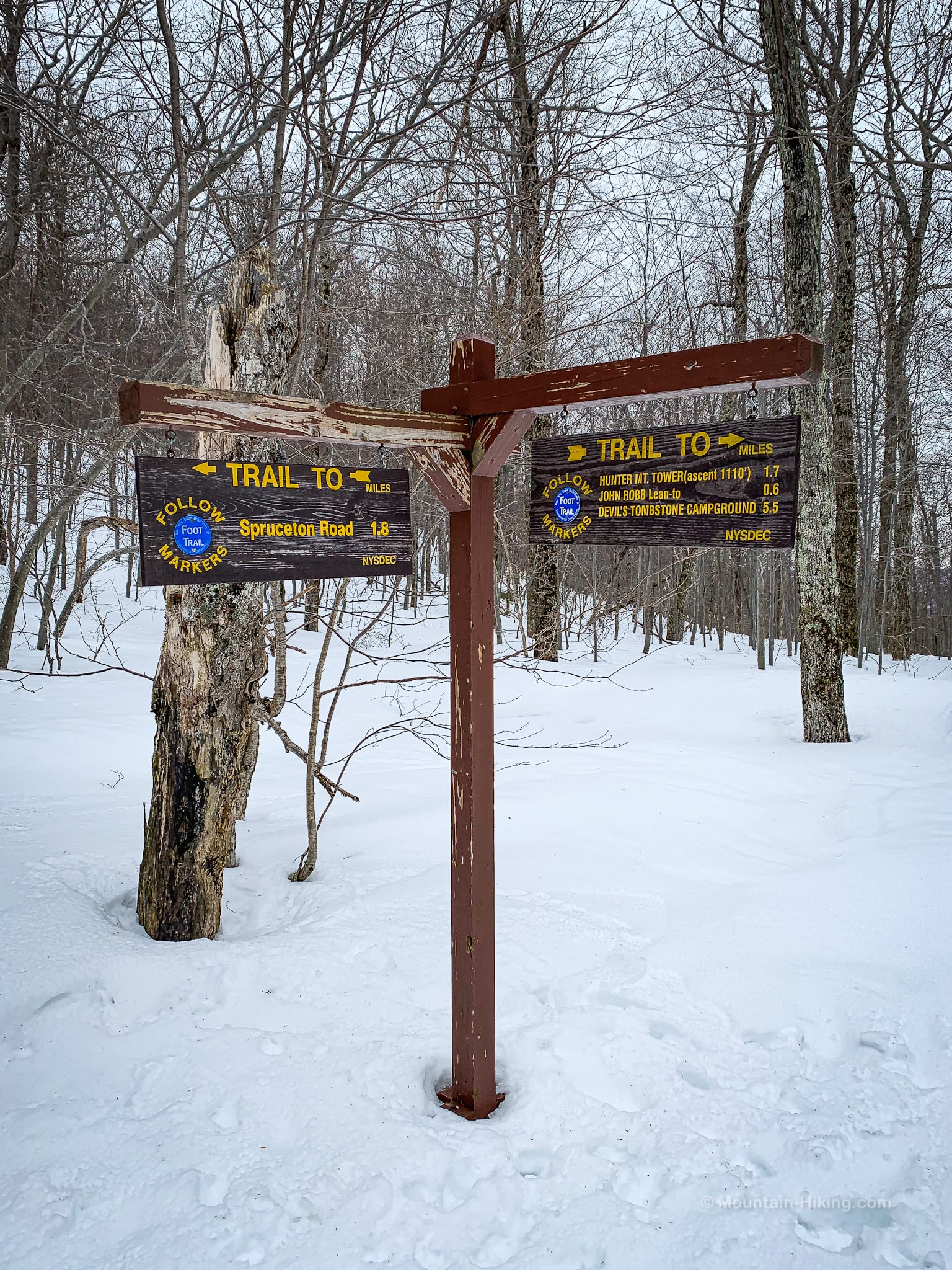
The old road also continues straight ahead but, here, you will turn right and begin your climb up Hunter’s northwestern ridge. (Thus far, you’ve been hiking along the lower slopes of Rusk and East Rusk.)
Posthole PSA
Below is a posthole. It was at least a foot deep. I saw dozens like it on this hike. They are dangerous.
Postholes stay in place until the snowpack melts. If it snows again, the very top will fill in but not the hole, turning it into a booby trap for someone’s ankle.
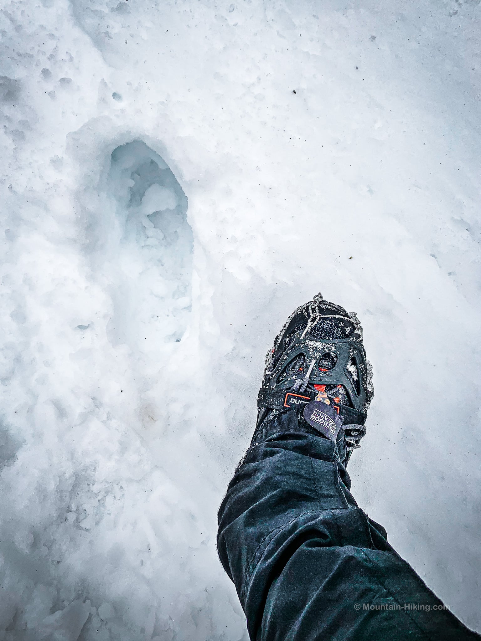
Don’t be a posthole. When the snow is fresh and deeper than 8″, or not packed down hard, always wear snowshoes. (The Snowshoe Basics post includes a list of places to buy or rent snowshoes.)
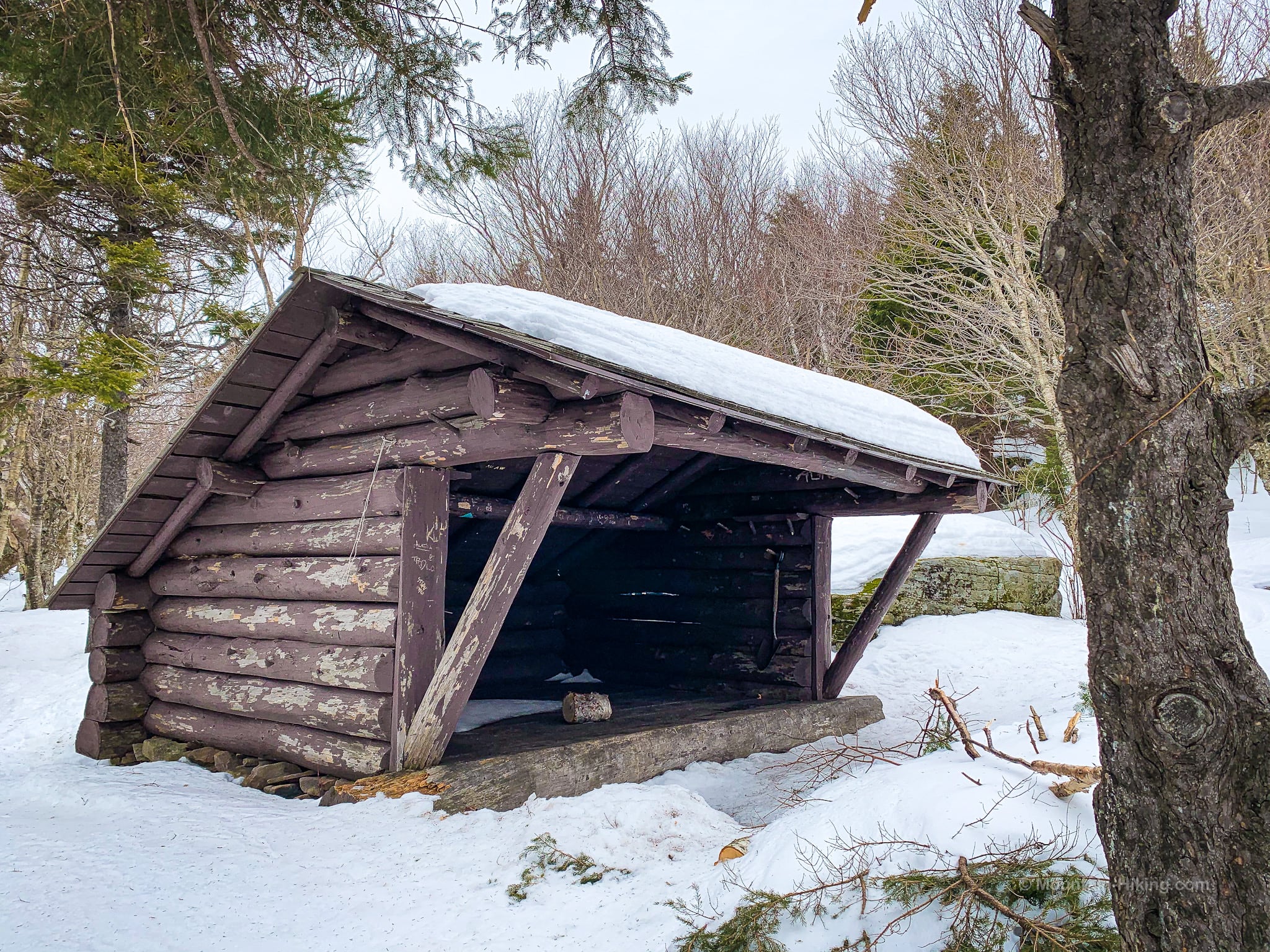
John Robb Lean-To
Just below 3500’ keep an eye on the right side of the trail. You’ll pass through an obvious stand of birch trees, and then you’ll pass a spring on your right — and then a small spur trail will appear, also on the right.
Coming from this direction, the wooden sign that says LEAN-TO is a little hard to spot, so keep your eyes peeled.
Follow the yellow-blazed spur trail into the woods.
It’s a little steep, and there is a small rock channel to pass through, but the lean-to is obvious and easy to find…
An open ledge just past the lean-to offers a stunning view of Southwest Hunter, West Kill, North Dome, Mount Sherrill, Sleeping Lion, and the hamlet of Spruceton down in Spruceton Valley.

Similar Hikes
Alternatively, at the junction you can turn left and head down via the full Hunter Mountain Loop which takes in some beautiful terrain and views, as well as Southwest Hunter which can also be approached via Stony Clove Notch.
The hike from Diamond Notch up West Kill is similarly lovely and offers the amazing view from Buck Ridge Lookout.
Get full access…
Get instant access to the full version of this site and enjoy great supporter benefits: full galleries, full trail notes, early access to the latest content, and more.
Hot on the website right now…
Follow for more…
Follow my @TotalCatskills content on Instagram for regular hiking inspo and safe, inclusive community.

Hunter Mountain Fire Tower (Best Route) Trailhead
Medium-sized lot, very popular location. Fills up early on busy days.
Google Maps Location: 42.184894, -74.271164
The map below shows the exact topographic location of the trailhead
Cell Service
No service at the trailhead. Once you start to climb above the surrounding ridges, service starts to come online. Strong signal at the summit. My network is Verizon. YMMV.
The parent mountain for this hike is Hunter.
