Disclosure: This content may contain affiliate links. Read my disclosure policy.
This full loop has an easy start, then a steep climb, then a moderate descent back to the junction that includes two or three sections of steep trail.
Trailhead info at bottom of this post.
Hiking Trail Description
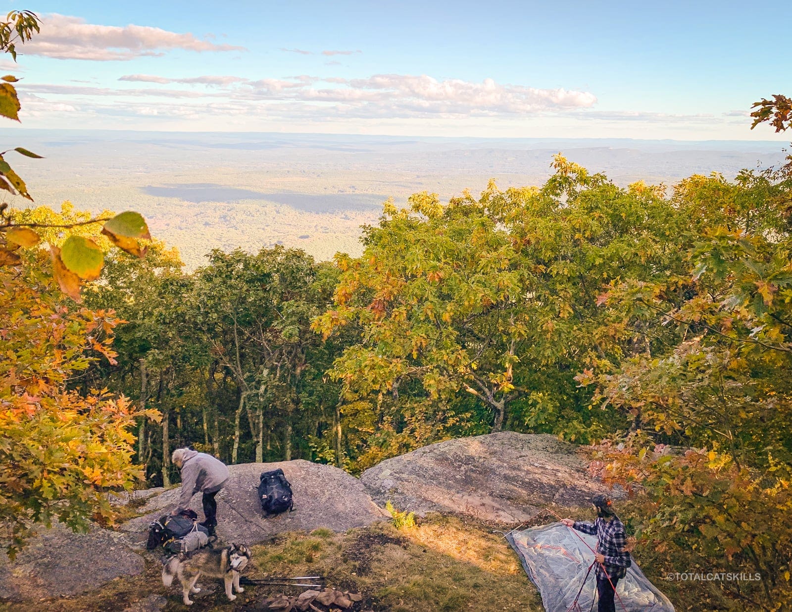
The Ashokan High Point trail is a very popular route for both casual hikers and overnight campers
You can expect this mountain to be busy year round, particularly the two trail sections that lead directly to the summit.
The trails here have a unique mix of ease and difficulty, beauty and ruggedness, views and geology, and other elements that keep this route pleasant and rewarding the whole way through.
BTW, you might also enjoy…
- UPDATED › Best Bug Spray & Bug Repellent for Hikers
- CATSKILLS › Peakbagging The Catskills High Peaks (Ultimate Guide)
- STAY › Find Your Perfect Catskills Stay
- ADIRONDACKS › Wright, Algonquin & Iroquois Peaks
- LEARN › Teach Yourself How to Use a Compass
- ENTERTAINMENT › Best & Worst Hiking Movies
- Follow › My Instagram @TotalCatskills
- Follow › My Substack @TotalCatskills
- Follow › My writing for Times Union
I usually avoid popular spots at weekends so I tried to mitigate the likelihood of running into too many people by planning this Saturday outing as a sunset-summit-hike. I started hiking around 3:30 pm with sunset due around 6:30 pm. Even so, the trail proved to be quite busy with people finishing up their day hikes.
Later, while walking out in the dark, it was super fun to see so many active campsites with campfires and small groups of friends having a great time.
A full breakdown is provided in the hike notes below, with 21 outstanding photos.
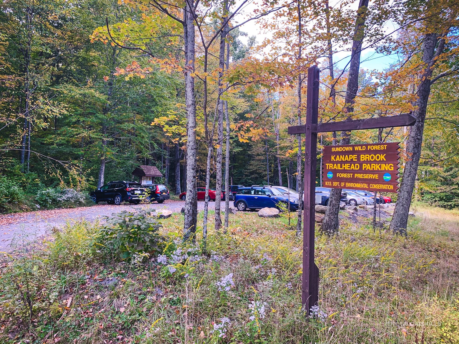
Kanape Trailhead Parking
The newly-expanded parking lot is large and level, with space for many cars — necessary because this destination is popular with both day hikers in search of beautiful hiking trail and campers looking to camp out in one of the sweetest and most accessible locations in the Catskills.
Ashokan High Point Trail Notes & Gallery
If you’re coming from Route 28, the lot is on the right side of the road, on a bit of a curve. Pull in and park. The information board is at the back of the lot, and the trail also begins at the back of the lot — which is not immediately clear, so that’s where to head.
Walk to the back of the lot, and look toward the road. You’ll see an arrow sign with a red blaze pointing down and across the road…
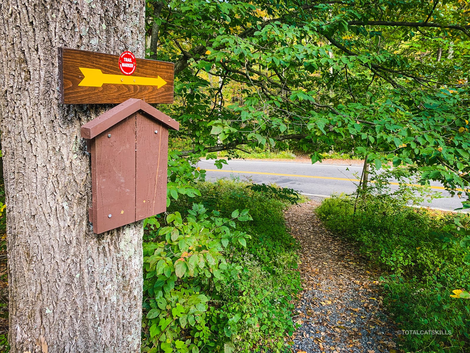
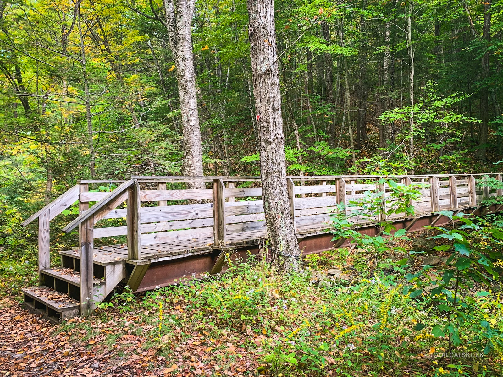
Cross the road, and continue over the footbridge.
Not long after, you’ll come to the Ashokan High Point trail register. As a precaution in these COVID days, disinfect your hands before signing in, then disinfect your hands again when you’re finished.
The trail follows Kanape Brook. It’s really lovely the whole way to the junction in the col between Ashokan High Point and Mombaccus Mountain at the back of the hollow.
John Canape was one of the first settler-farmers in the area. You’ll pass the remnants of hillside farms, and there are many great spots on both sides of the brook to camp out.
 You’ve got the basic details, but there’s so much more…
Unlock this site now to get complete intel on every route, including my full photo galleries, personal insights and tips. Elevate your next hike with deep trail beta. Experience hundreds of amazing routes at their absolute finest. With Mountain-Hiking.com, you’re not just skimming the surface.
Sean

Similar Hikes
Through the hollow, with its mix of beautiful stream and early settler history, the first part of this hike reminded me of Rochester Hollow.
The steepness and thick stands of mountain laurel reminded me of the new trail up Ticetonyk Mountain.
The blueberry heaths reminded me of hikes at Minnewaska. And the small plane wreck reminded me of the two small plane wrecks on Kaaterskill High Peak.
Read More
Get full access…
Get instant access to the full version of this site and enjoy great supporter benefits: full galleries, full trail notes, early access to the latest content, and more.
Hot on the website right now…
Follow for more…
Follow my @TotalCatskills content on Instagram for regular hiking inspo and safe, inclusive community.

Ashokan High Point (with Plane Wreck) Trailhead
Large lot for popular destination. Good LTE signal.
Google Maps Location: 41.935832, -74.327768
The map below shows the exact topographic location of the trailhead
Cell Service
This is rare hike in the Catskills that has pretty good cell reception almost the entire way. A few patches without. Otherwise surprisingly good! My network is Verizon. YMMV.
4 responses to “Ashokan High Point (with Plane Wreck)”
Your comments are welcome here…
The parent mountain for this hike is Ashokan High Point.
You may have gotten some of the history accounts from a NY State site that is incorrect. The Kanape is not named after anyone named Kanape. There was no John Kanape. Kanape is thought to be a Dutch word or possible a corruption of a native American word meaning sofa or settee. One of the foundations still standing with the spring belonged to John Jones. Other farms belonged to Orson Every. My great-aunt was married to Sylvester Jones, son of John.
I love it. Thank you for this info. And any other details you care to share!
Did this exact route today including Little Ashokan thanks entirely to your detailed report and beautiful photos. We had an amazing time! We set out around 1:30 and were back to our car by 7:30, with breaks at the summits and to explore the plane wreck.The fall colors have set in even more over the past week, but those beautiful red blueberry patches will be gone soon, I’m guessing. So glad we were able to see them, it’s one of the most memorable views I’ve seen of all my years of hiking in the Catskills and Adirondacks! We did spot some more bear scat on Little Ashokan — good to be aware of. There is a nice, wide ledge on the eastern side that has a 180 (maybe closer to 160) degree view of the valley below. We checked out the new herd path you mentioned, but if it leads to anything interesting, we couldn’t tell — it just dead ends in the woods. Maybe it used to offer a view of the Burroughs range before the overgrowth grew up? Anyway, thank you so much for always including so much amazing detail in your reports… we never would have done this today otherwise. Can’t wait to get back out and do more!
Wow, that’s just so great. What a lovely reply. I’m so glad you did that and had a great time! Thanks for the notes. I’m looking forward to doing it again, maybe in the snow… anyway 🙌