Disclosure: This content may contain affiliate links. Read my disclosure policy.
An easy out-and-back.
Hiking Trail Description
Diamond Notch Falls is a very popular destination for nature lovers seeking to immerse themselves in the deep beauty of The Catskills.
Surrounded by lush forests and beautiful hiking trails, the double-falls sit at a trail junction that connects Hunter, Southwest Hunter and West Kill mountains.
The falls are only about 15 feet high, but so beautiful — in spring, summer and fall, of course, but especially in winter.
This short easy route continues into the notch for an epic view. It’s short enough and easy enough that it qualifies as a Nature Trail.
Plan on 1½ to 2 hours to get the most from this extremely enjoyable hike.
- You might also enjoy this alternate route to Diamond Notch Falls via Diamond Notch Road
This trail guide is free to all readers thanks to my subscribers. Get full access to this website instantly and enjoy great supporter benefits!
You might also enjoy…
- Updated › Wittenberg & Cornell
- Updated › How to Winter Hike: The Essential Roundup
- Follow › Sean’s content on Instagram
- Identify › Bobcat/Coyote Tracks and Bear Prints
- Explore › Easy Hikes
- Hike More › Catskills, Adirondacks, Hudson Highlands, Gunks
Diamond Notch Falls Trail
The Diamond Notch hiking trail from Spruceton includes…
- A short, easy hike in to the falls
- A wonderful footbridge over the falls
- A quick uphill section to an excellent scenic view
Trail Notes & Gallery
Park in the medium-sized parking area on Spruceton Road — but make sure to not park in the turnaround at the end of the road, near the trailhead. It’s a very short road walk from the official parking lot to the trailhead.
The walk in, along the West Kill, is a lovely start to this hike. Follow the blue trail blazes…
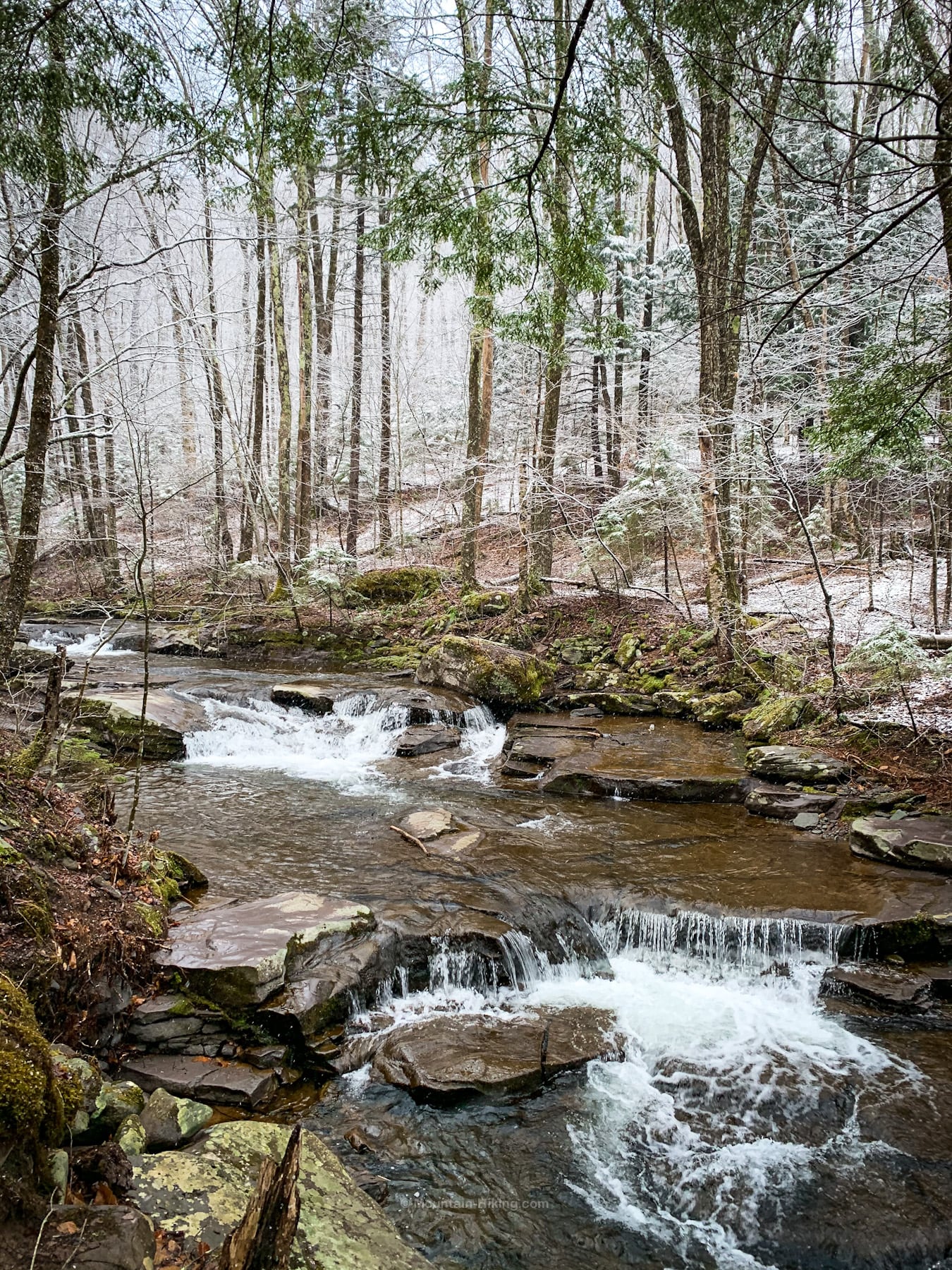
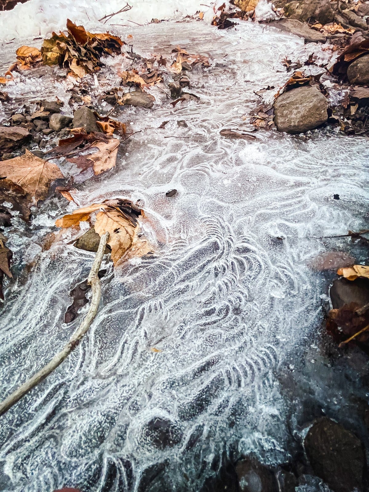
In cold weather on any mountain hike, you’ll definitely need microspikes. The trail often looks like this…
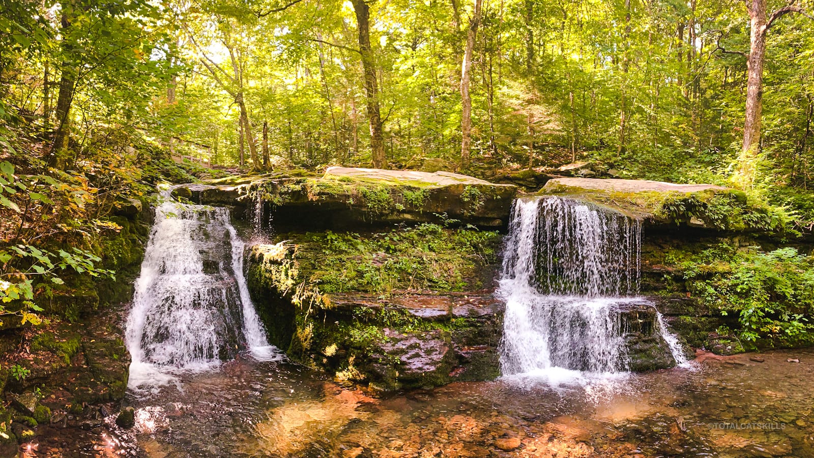
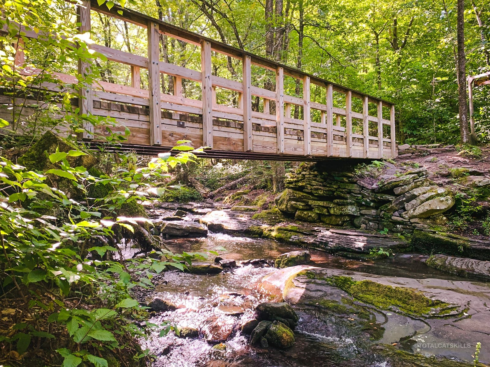
In summer, the footbridge across the top of the waterfalls looks like this…
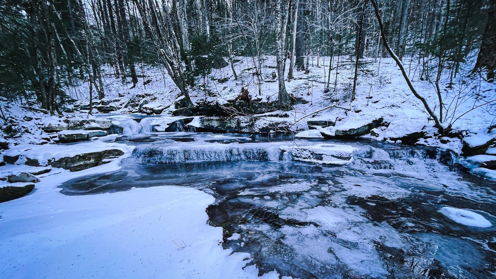
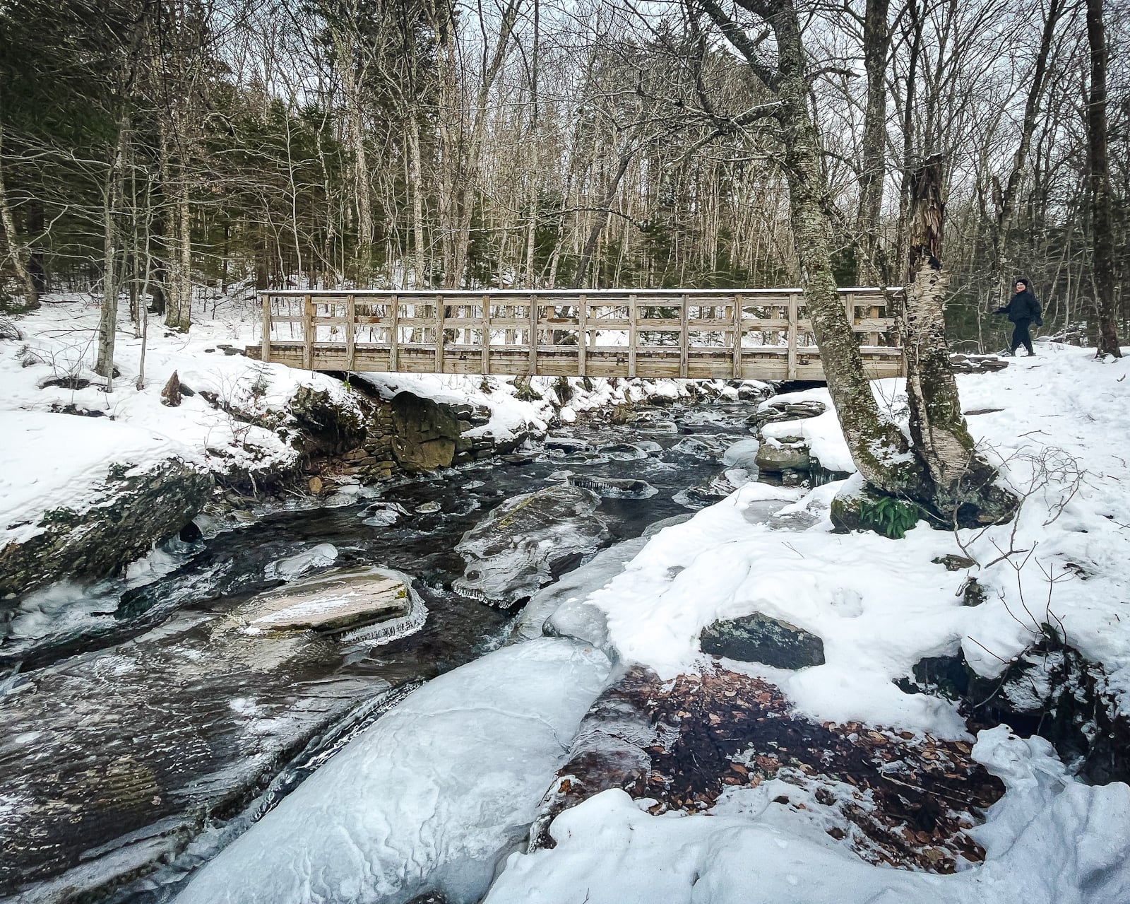
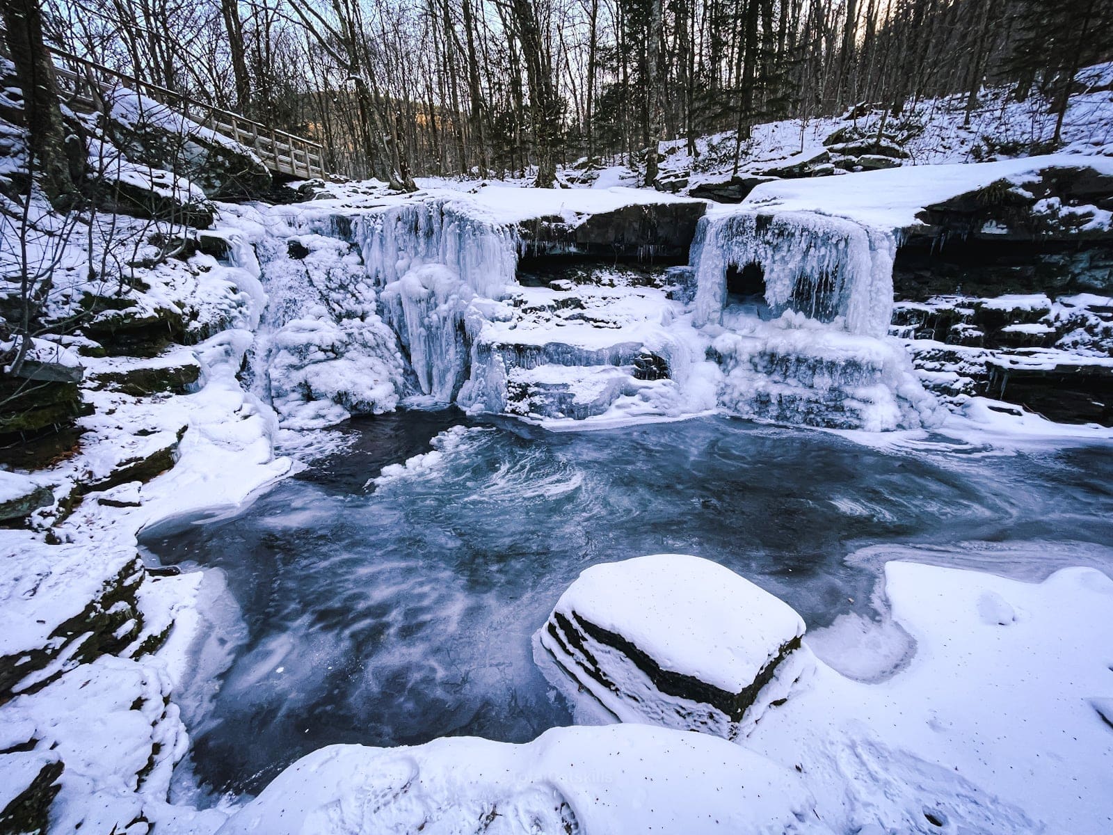
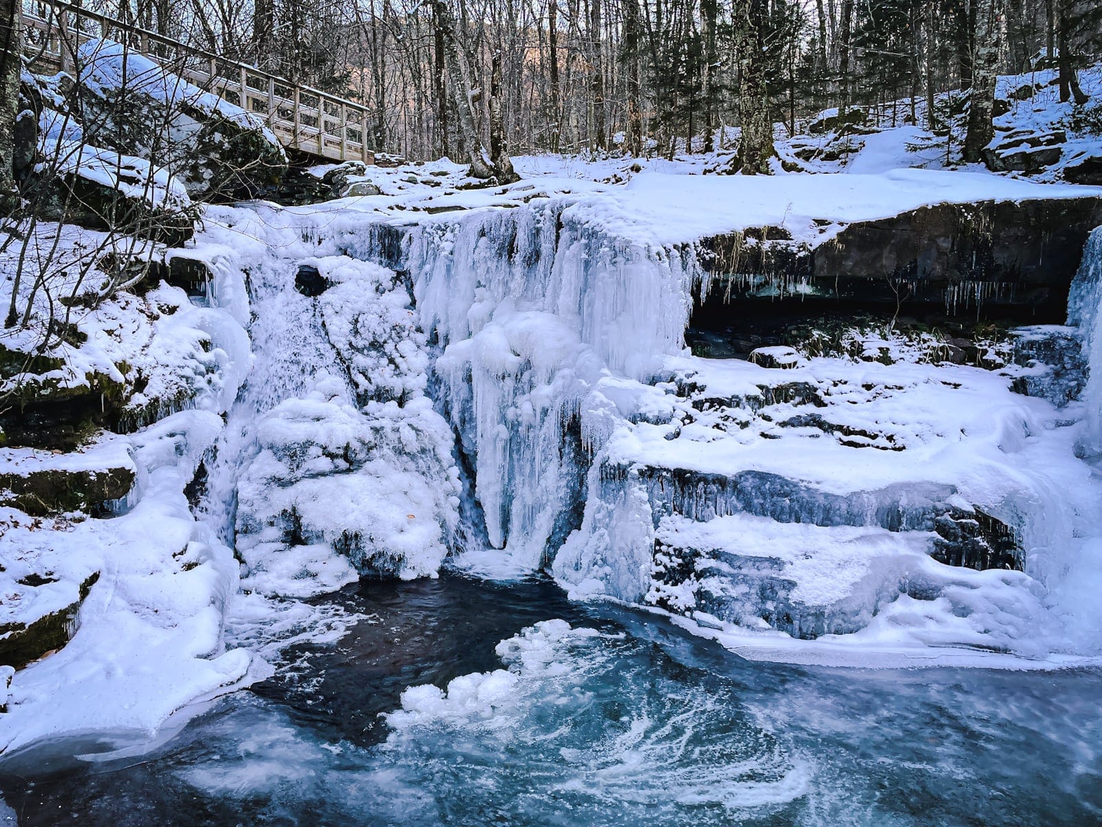
In winter, it looks so…
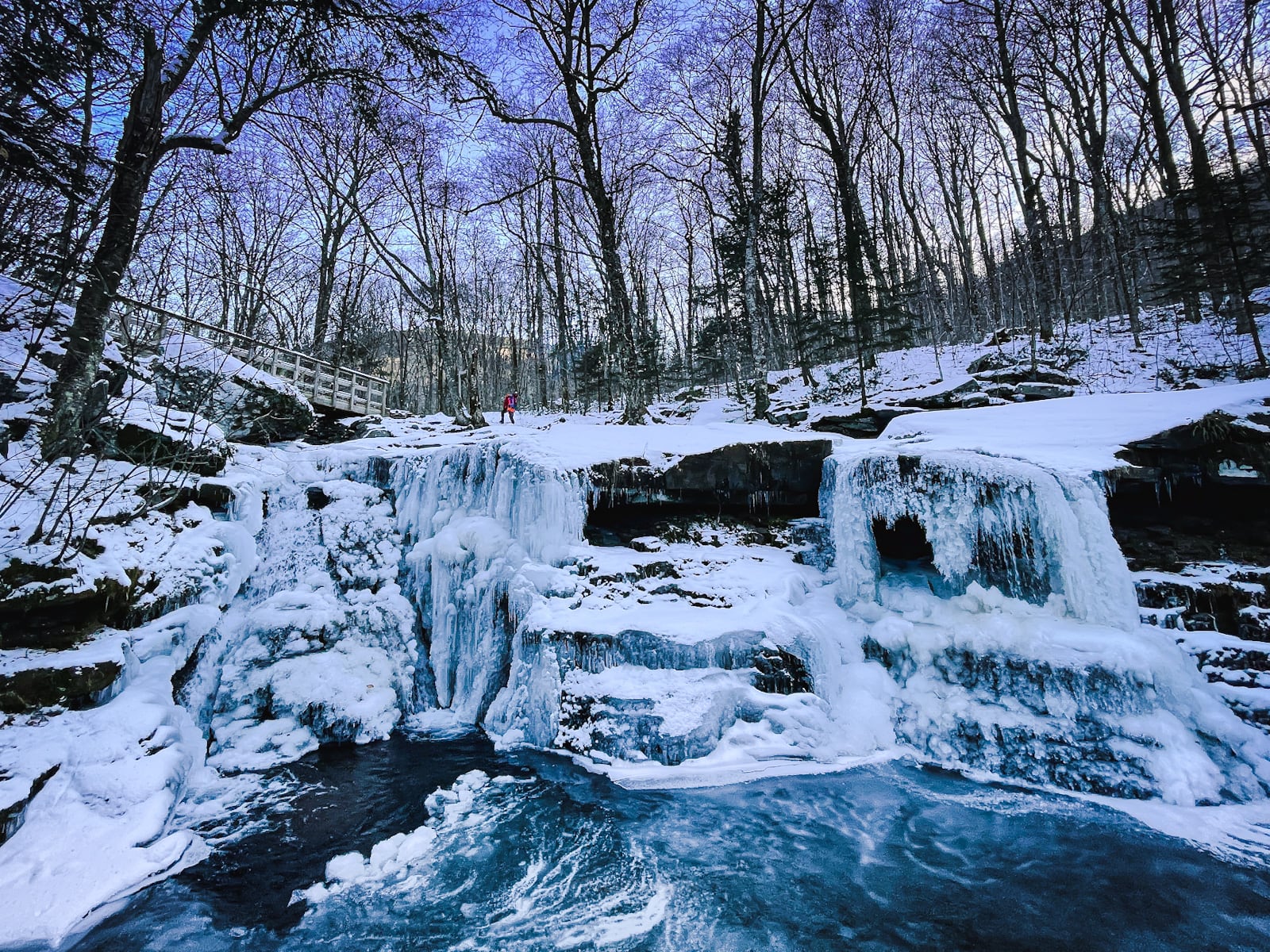
Diamond Notch Falls
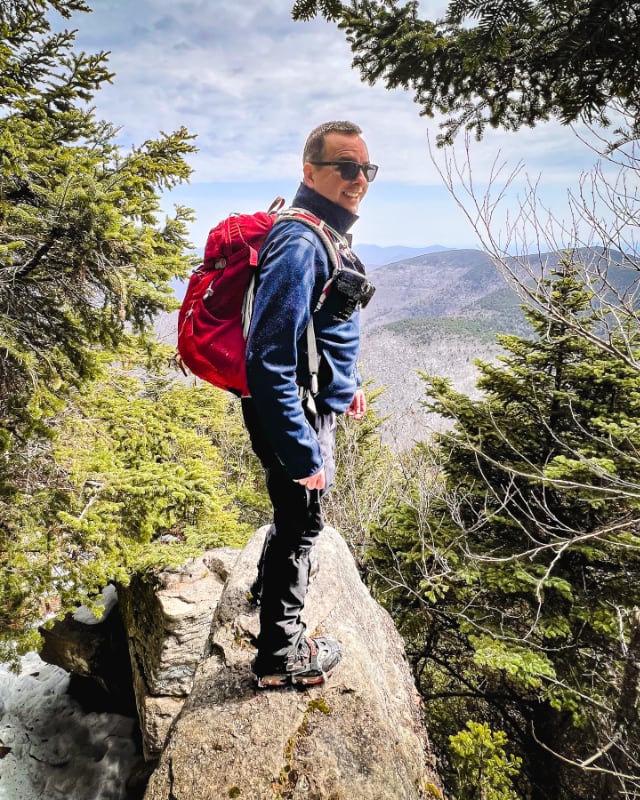
Winter is my favorite time to visit any waterfall. Spot the hiker…
Diamond Notch Scenic View
Cross over the footbridge and continue to follow the blue blazes uphill, to your left.
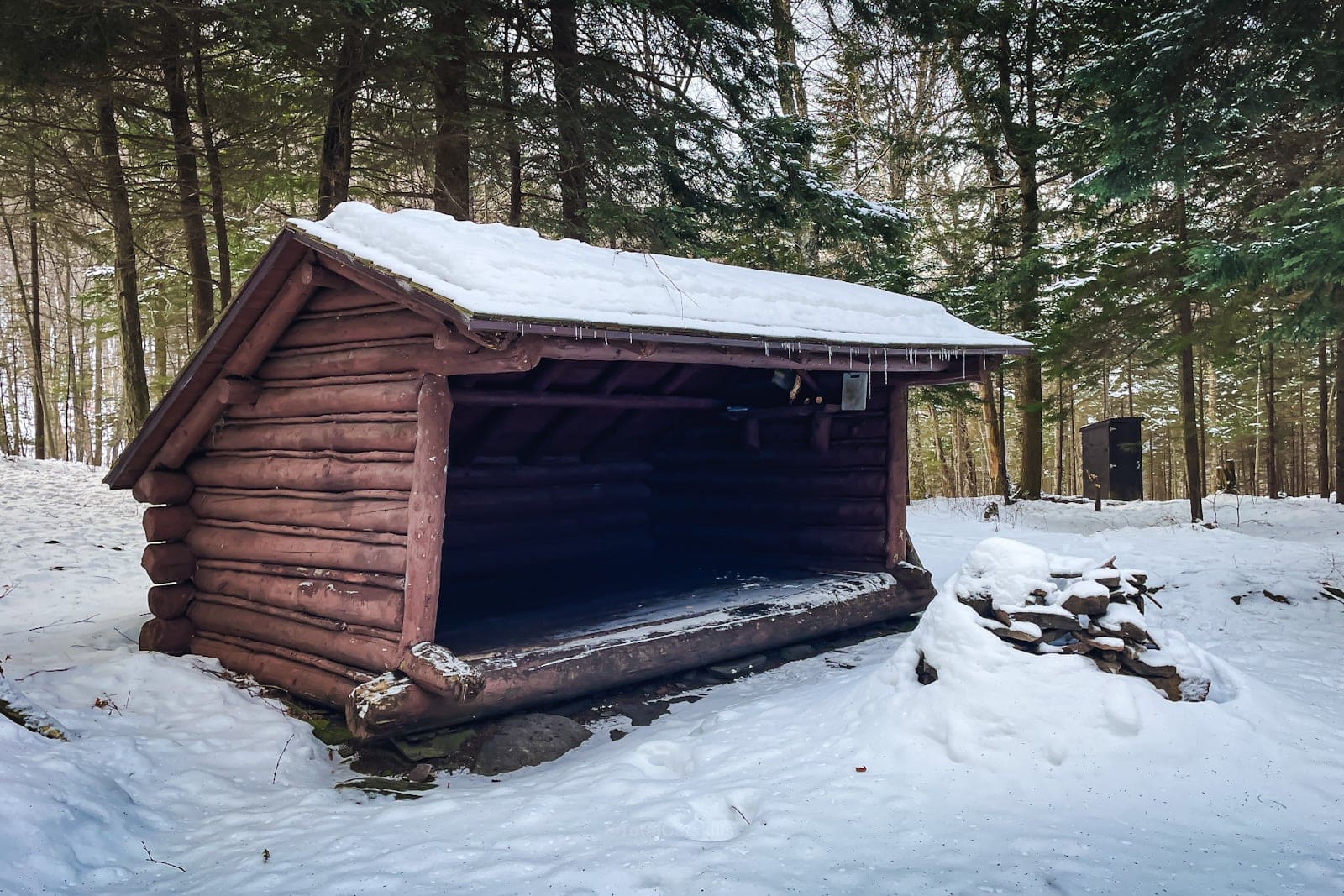
Before half a mile, you’ll see a lean-to shelter on your left, just off trail…
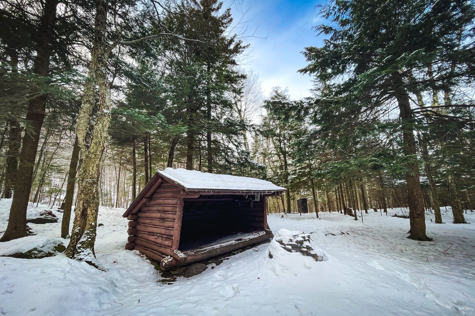
It’s really beautifully situated. There’s also a privy.
From here, make your way further uphill on the trail until you enter the very narrowest part of the wind gap — where it’s possible to put one foot on Southwest Hunter and the other on West Kill mountain.
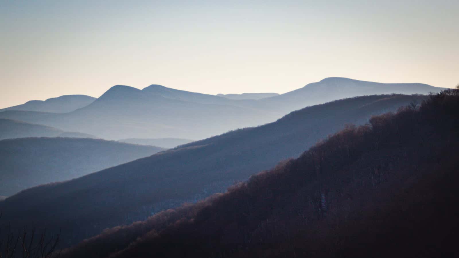
At half-a-mile from the footbridge, you’ll come to an obvious boulder. From this spot, there’s a terrific view of the Burroughs Range: Wittenberg, Cornell, the col, and Slide Mountain.
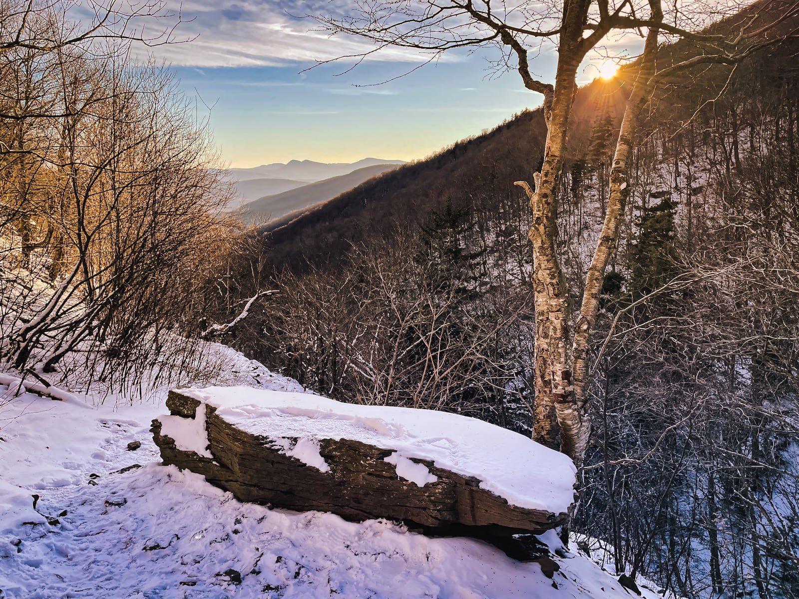
Behind the Burroughs Range, you can see Table and Peekamoose mountains.
From here, it’s roughly 1.5 miles back to your car on Spruceton Road.
Similar Hikes
Check the alternate route to Diamond Notch via Diamond Notch Road.
If you love waterfalls, you’ll love this list of waterfall hikes.
If you’re looking for short, easy hikes, here’s a list of Nature Trails on the website.
Read More
Get full access…
Get instant access to the full version of this site and enjoy great supporter benefits: full galleries, full trail notes, early access to the latest content, and more.
Hot on the website right now…
Follow for more…
Follow my @TotalCatskills content on Instagram for regular hiking inspo and safe, inclusive community.
The parent mountain for this hike is West Kill.
If you do this hike, LMK how it went…
Trailhead Info for this Hike
Medium-sized lot. Very popular. Do not park in the turn-around.
Google Maps Location: 42.182596, -74.269579
The map below shows the exact topographic location of the trailhead
Cell Service
No cell service until you get up into the wind gap near the scenic view. My network is Verizon. YMMV.